Bluff City Nw Topo Map Kansas
To zoom in, hover over the map of Bluff City Nw
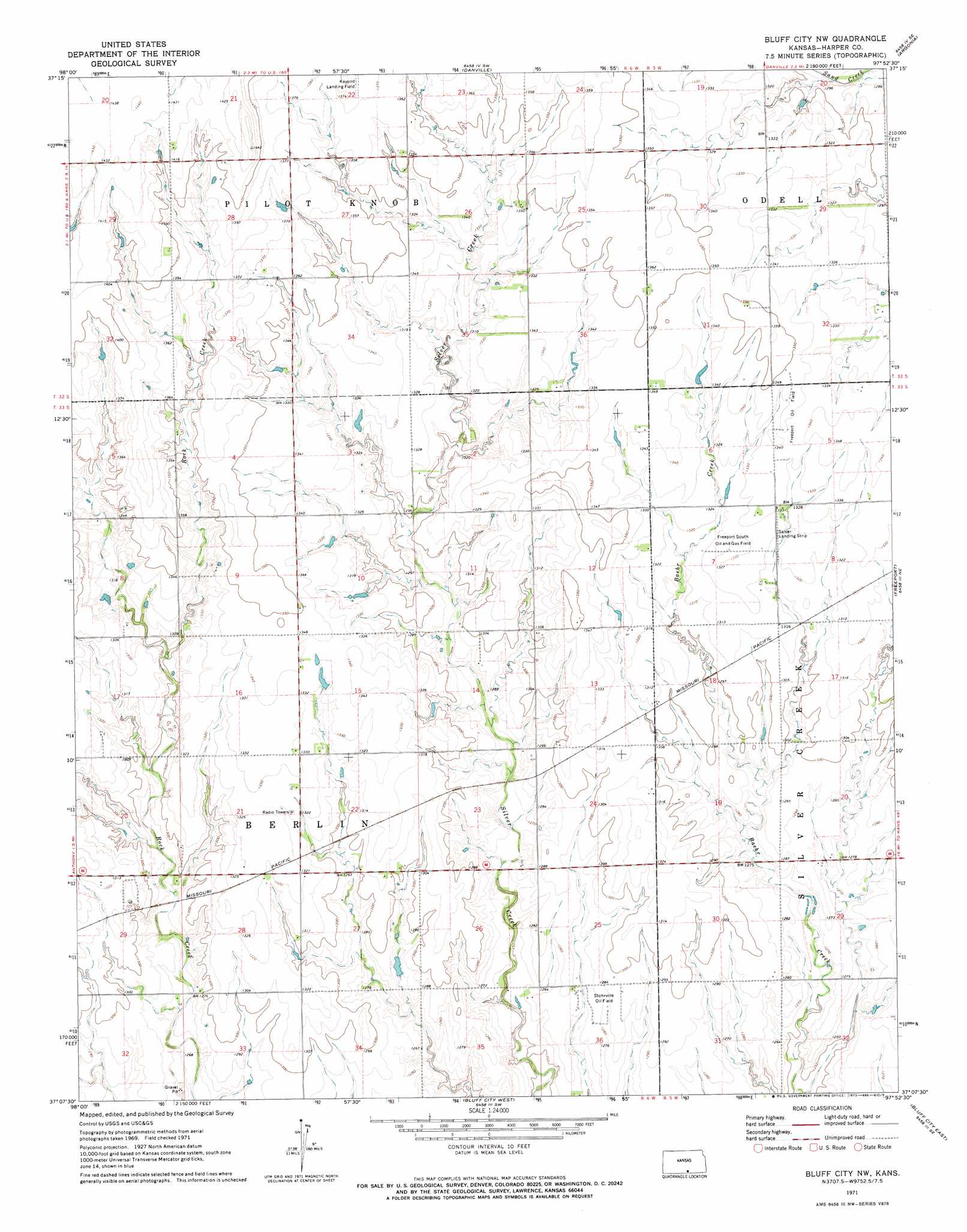
USGS Topo Quad 37097b8 - 1:24,000 scale
| Topo Map Name: | Bluff City Nw |
| USGS Topo Quad ID: | 37097b8 |
| Print Size: | ca. 21 1/4" wide x 27" high |
| Southeast Coordinates: | 37.125° N latitude / 97.875° W longitude |
| Map Center Coordinates: | 37.1875° N latitude / 97.9375° W longitude |
| U.S. State: | KS |
| Filename: | o37097b8.jpg |
| Download Map JPG Image: | Bluff City Nw topo map 1:24,000 scale |
| Map Type: | Topographic |
| Topo Series: | 7.5´ |
| Map Scale: | 1:24,000 |
| Source of Map Images: | United States Geological Survey (USGS) |
| Alternate Map Versions: |
Bluff City NW KS 1971, updated 1973 Download PDF Buy paper map Bluff City NW KS 2010 Download PDF Buy paper map Bluff City NW KS 2012 Download PDF Buy paper map Bluff City NW KS 2015 Download PDF Buy paper map |
1:24,000 Topo Quads surrounding Bluff City Nw
Spivey |
Rago |
Adams |
Norwich |
Conway Springs |
Crystal Springs |
Harper |
Danville |
Argonia |
Milan |
Attica |
Anthony |
Bluff City Nw |
Freeport |
Caldwell Nw |
Waldron |
Spring |
Bluff City West |
Bluff City East |
Doster |
Manchester Nw |
Manchester |
Wakita |
Wakita Ne |
Renfrow |
> Back to 37097a1 at 1:100,000 scale
> Back to 37096a1 at 1:250,000 scale
> Back to U.S. Topo Maps home
Bluff City Nw topo map: Gazetteer
Bluff City Nw: Airports
Salser Landing Strip elevation 406m 1332′Bluff City Nw: Oilfields
Freeport Oil Field elevation 409m 1341′Freeport South Oil and Gas Field elevation 405m 1328′
Stohrville Oil Field elevation 391m 1282′
Bluff City Nw digital topo map on disk
Buy this Bluff City Nw topo map showing relief, roads, GPS coordinates and other geographical features, as a high-resolution digital map file on DVD: