Akron Topo Map Kansas
To zoom in, hover over the map of Akron
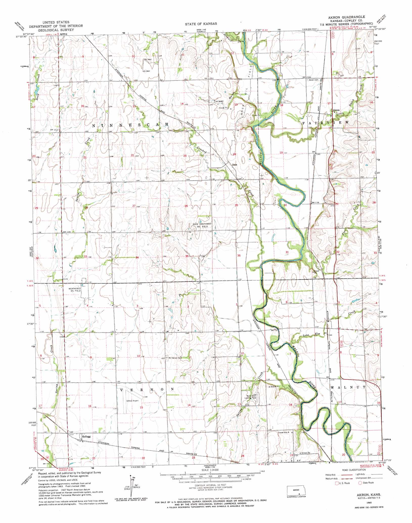
USGS Topo Quad 37097c1 - 1:24,000 scale
| Topo Map Name: | Akron |
| USGS Topo Quad ID: | 37097c1 |
| Print Size: | ca. 21 1/4" wide x 27" high |
| Southeast Coordinates: | 37.25° N latitude / 97° W longitude |
| Map Center Coordinates: | 37.3125° N latitude / 97.0625° W longitude |
| U.S. State: | KS |
| Filename: | o37097c1.jpg |
| Download Map JPG Image: | Akron topo map 1:24,000 scale |
| Map Type: | Topographic |
| Topo Series: | 7.5´ |
| Map Scale: | 1:24,000 |
| Source of Map Images: | United States Geological Survey (USGS) |
| Alternate Map Versions: |
Akron KS 1965, updated 1966 Download PDF Buy paper map Akron KS 2010 Download PDF Buy paper map Akron KS 2012 Download PDF Buy paper map Akron KS 2015 Download PDF Buy paper map |
1:24,000 Topo Quads surrounding Akron
Derby |
Rose Hill |
Douglass |
Gordon |
Augusta Se |
Belle Plaine |
Mulvane |
Udall |
Wilmot |
Atlanta |
Dalton |
Oxford |
Akron |
New Salem |
Burden |
South Haven Ne |
Adamsville |
Hackney |
Winfield |
Eaton |
Portland |
Geuda Springs |
Arkansas City |
Silverdale |
Maple City |
> Back to 37097a1 at 1:100,000 scale
> Back to 37096a1 at 1:250,000 scale
> Back to U.S. Topo Maps home
Akron topo map: Gazetteer
Akron: Airports
Oxford Municipal Airport elevation 360m 1181′Richardson Landing Field elevation 355m 1164′
Akron: Oilfields
Rock Oil Field elevation 349m 1145′Rock Southwest Oil Field elevation 363m 1190′
Weathered Oil Field elevation 363m 1190′
Akron: Populated Places
Akron elevation 354m 1161′Dale elevation 361m 1184′
Kellogg elevation 359m 1177′
Akron: Streams
Crooked Creek elevation 339m 1112′Foos Creek elevation 339m 1112′
Little Dutch Creek elevation 349m 1145′
Lone Elm Creek elevation 338m 1108′
Spring Creek elevation 341m 1118′
Stewart Creek elevation 344m 1128′
Akron: Valleys
Turkey Gulch elevation 343m 1125′Akron digital topo map on disk
Buy this Akron topo map showing relief, roads, GPS coordinates and other geographical features, as a high-resolution digital map file on DVD: