Millerton Topo Map Kansas
To zoom in, hover over the map of Millerton
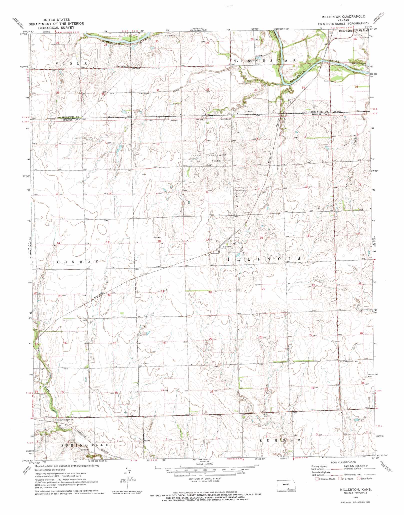
USGS Topo Quad 37097d5 - 1:24,000 scale
| Topo Map Name: | Millerton |
| USGS Topo Quad ID: | 37097d5 |
| Print Size: | ca. 21 1/4" wide x 27" high |
| Southeast Coordinates: | 37.375° N latitude / 97.5° W longitude |
| Map Center Coordinates: | 37.4375° N latitude / 97.5625° W longitude |
| U.S. State: | KS |
| Filename: | o37097d5.jpg |
| Download Map JPG Image: | Millerton topo map 1:24,000 scale |
| Map Type: | Topographic |
| Topo Series: | 7.5´ |
| Map Scale: | 1:24,000 |
| Source of Map Images: | United States Geological Survey (USGS) |
| Alternate Map Versions: |
Millerton KS 1971, updated 1973 Download PDF Buy paper map Millerton KS 2010 Download PDF Buy paper map Millerton KS 2012 Download PDF Buy paper map Millerton KS 2015 Download PDF Buy paper map |
1:24,000 Topo Quads surrounding Millerton
Cheney |
Garden Plain |
Goddard |
Wichita West |
Wichita East |
Cheney Se |
Lake Afton |
Clearwater |
Bayneville |
Derby |
Norwich |
Conway Springs |
Millerton |
Zyba |
Belle Plaine |
Argonia |
Milan |
Mayfield |
Wellington |
Dalton |
Freeport |
Caldwell Nw |
Perth |
Rome |
South Haven Ne |
> Back to 37097a1 at 1:100,000 scale
> Back to 37096a1 at 1:250,000 scale
> Back to U.S. Topo Maps home
Millerton topo map: Gazetteer
Millerton: Oilfields
Latta Northwest Oil Field elevation 403m 1322′Latta Oil Field elevation 410m 1345′
Millerton: Plains
Wichita Prairies elevation 413m 1354′Millerton: Populated Places
Millerton elevation 410m 1345′Millerton digital topo map on disk
Buy this Millerton topo map showing relief, roads, GPS coordinates and other geographical features, as a high-resolution digital map file on DVD: