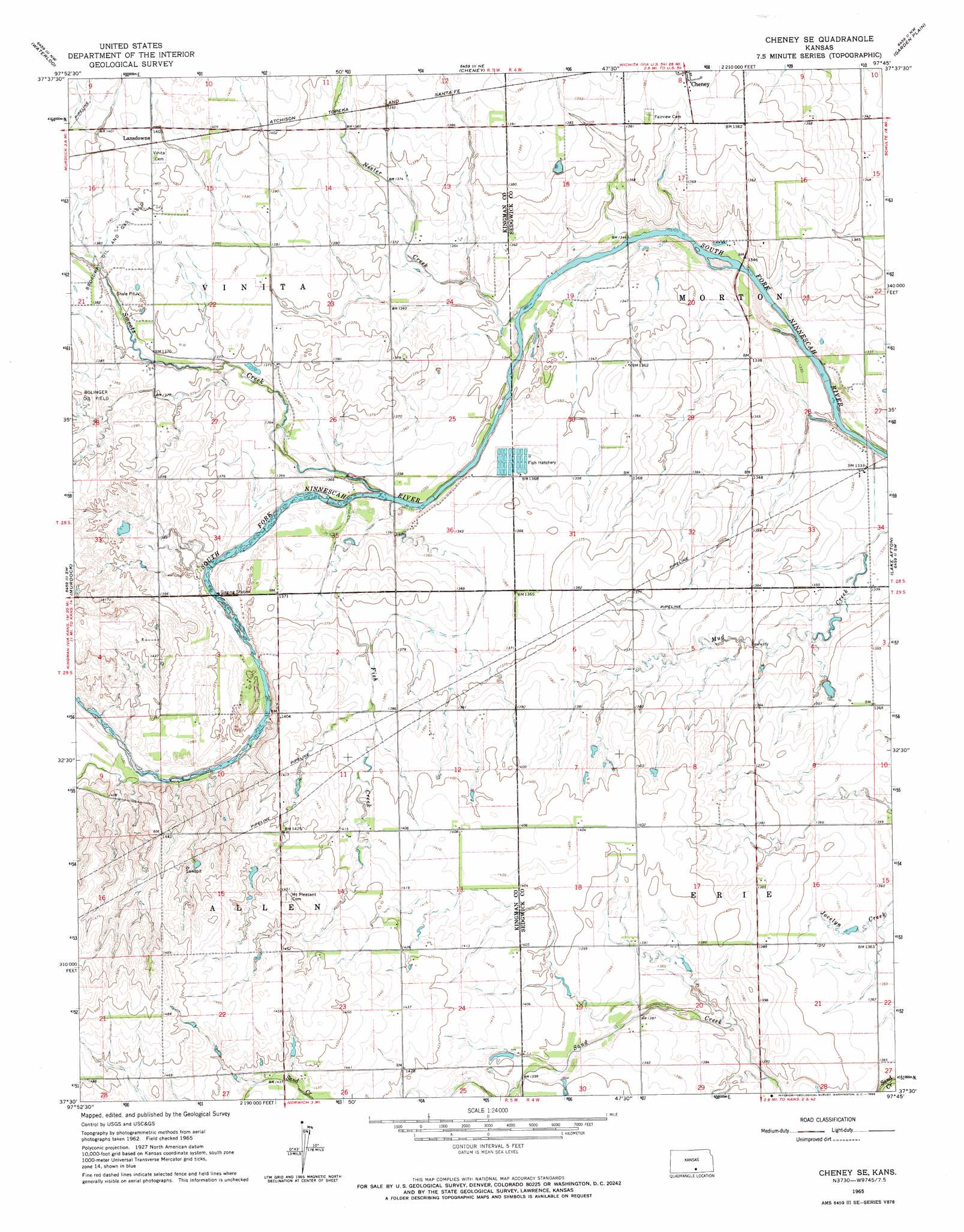
Cheney Se Topo Map Kansas
To zoom in, hover over the map of Cheney Se
USGS Topo Quad 37097e7 - 1:24,000 scale
| Topo Map Name: | Cheney Se |
| USGS Topo Quad ID: | 37097e7 |
| Print Size: | ca. 21 1/4" wide x 27" high |
| Southeast Coordinates: | 37.5° N latitude / 97.75° W longitude |
| Map Center Coordinates: | 37.5625° N latitude / 97.8125° W longitude |
| U.S. State: | KS |
| Filename: | o37097e7.jpg |
| Download Map JPG Image: | Cheney Se topo map 1:24,000 scale |
| Map Type: | Topographic |
| Topo Series: | 7.5´ |
| Map Scale: | 1:24,000 |
| Source of Map Images: | United States Geological Survey (USGS) |
| Alternate Map Versions: |
Cheney SE KS 1965, updated 1966 Download PDF Buy paper map Cheney SE KS 2009 Download PDF Buy paper map Cheney SE KS 2012 Download PDF Buy paper map Cheney SE KS 2015 Download PDF Buy paper map |
1:24,000 Topo Quads surrounding Cheney Se
Pretty Prairie |
Castleton |
Haven Se |
Mount Hope |
Colwich |
Kingman |
Waterloo |
Cheney |
Garden Plain |
Goddard |
Almeda |
Murdock |
Cheney Se |
Lake Afton |
Clearwater |
Rago |
Adams |
Norwich |
Conway Springs |
Millerton |
Harper |
Danville |
Argonia |
Milan |
Mayfield |
> Back to 37097e1 at 1:100,000 scale
> Back to 37096a1 at 1:250,000 scale
> Back to U.S. Topo Maps home
Cheney Se topo map: Gazetteer
Cheney Se: Oilfields
Broadway Oil and Gas Field elevation 424m 1391′Cheney Se: Populated Places
Lansdowne elevation 428m 1404′Suppesville elevation 418m 1371′
Cheney Se: Streams
Fish Creek elevation 411m 1348′Nester Creek elevation 408m 1338′
Smoots Creek elevation 414m 1358′
Cheney Se digital topo map on disk
Buy this Cheney Se topo map showing relief, roads, GPS coordinates and other geographical features, as a high-resolution digital map file on DVD: