Haven Se Topo Map Kansas
To zoom in, hover over the map of Haven Se
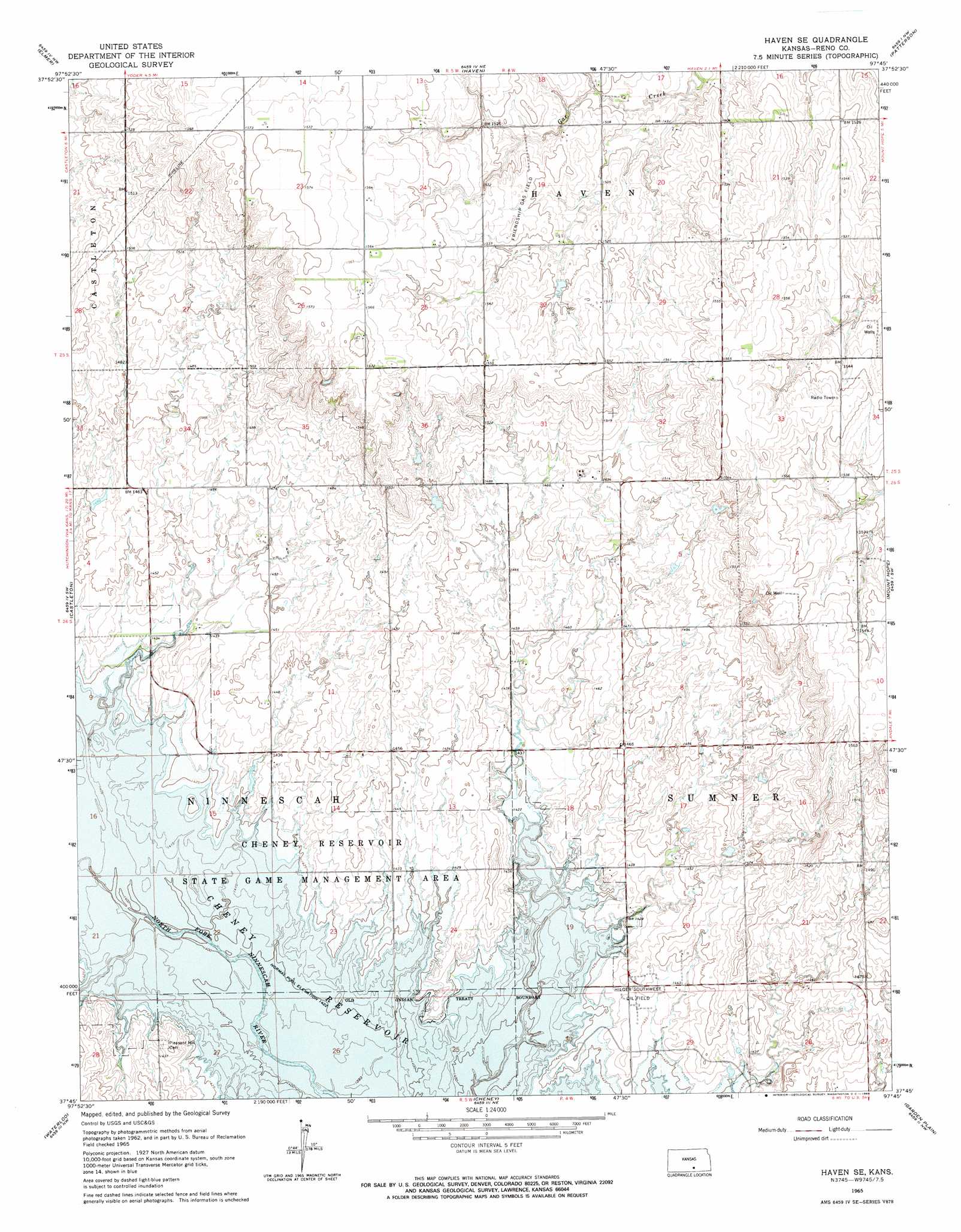
USGS Topo Quad 37097g7 - 1:24,000 scale
| Topo Map Name: | Haven Se |
| USGS Topo Quad ID: | 37097g7 |
| Print Size: | ca. 21 1/4" wide x 27" high |
| Southeast Coordinates: | 37.75° N latitude / 97.75° W longitude |
| Map Center Coordinates: | 37.8125° N latitude / 97.8125° W longitude |
| U.S. State: | KS |
| Filename: | o37097g7.jpg |
| Download Map JPG Image: | Haven Se topo map 1:24,000 scale |
| Map Type: | Topographic |
| Topo Series: | 7.5´ |
| Map Scale: | 1:24,000 |
| Source of Map Images: | United States Geological Survey (USGS) |
| Alternate Map Versions: |
Haven SE KS 1965, updated 1966 Download PDF Buy paper map Haven SE KS 2009 Download PDF Buy paper map Haven SE KS 2012 Download PDF Buy paper map Haven SE KS 2015 Download PDF Buy paper map |
1:24,000 Topo Quads surrounding Haven Se
Yaggy |
Hutchinson |
Hutchinson Se |
Burrton |
Halstead |
Partridge |
Elmer |
Haven |
Patterson |
Bentley |
Pretty Prairie |
Castleton |
Haven Se |
Mount Hope |
Colwich |
Kingman |
Waterloo |
Cheney |
Garden Plain |
Goddard |
Almeda |
Murdock |
Cheney Se |
Lake Afton |
Clearwater |
> Back to 37097e1 at 1:100,000 scale
> Back to 37096a1 at 1:250,000 scale
> Back to U.S. Topo Maps home
Haven Se topo map: Gazetteer
Haven Se: Oilfields
Friendship Gas Field elevation 468m 1535′Hilger Southwest Oil Field elevation 440m 1443′
Haven Se: Parks
Cheney State Park elevation 436m 1430′Cheney Wildlife Area elevation 433m 1420′
Haven Se digital topo map on disk
Buy this Haven Se topo map showing relief, roads, GPS coordinates and other geographical features, as a high-resolution digital map file on DVD: