Bentley Topo Map Kansas
To zoom in, hover over the map of Bentley
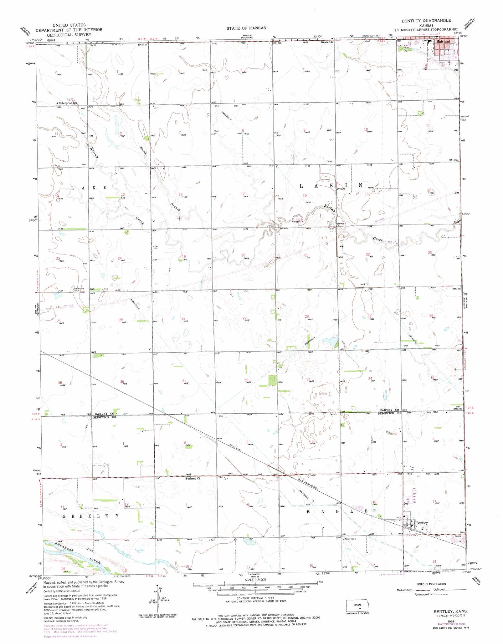
USGS Topo Quad 37097h5 - 1:24,000 scale
| Topo Map Name: | Bentley |
| USGS Topo Quad ID: | 37097h5 |
| Print Size: | ca. 21 1/4" wide x 27" high |
| Southeast Coordinates: | 37.875° N latitude / 97.5° W longitude |
| Map Center Coordinates: | 37.9375° N latitude / 97.5625° W longitude |
| U.S. State: | KS |
| Filename: | o37097h5.jpg |
| Download Map JPG Image: | Bentley topo map 1:24,000 scale |
| Map Type: | Topographic |
| Topo Series: | 7.5´ |
| Map Scale: | 1:24,000 |
| Source of Map Images: | United States Geological Survey (USGS) |
| Alternate Map Versions: |
Bentley KS 1958, updated 1959 Download PDF Buy paper map Bentley KS 1958, updated 1978 Download PDF Buy paper map Bentley KS 2009 Download PDF Buy paper map Bentley KS 2012 Download PDF Buy paper map Bentley KS 2015 Download PDF Buy paper map |
1:24,000 Topo Quads surrounding Bentley
Buhler |
Halstead Nw |
Moundridge |
Hesston |
Goessel |
Hutchinson Se |
Burrton |
Halstead |
Zimmerdale |
Newton |
Haven |
Patterson |
Bentley |
Sedgwick |
Sedgwick Ne |
Haven Se |
Mount Hope |
Colwich |
Maize |
Valley Center |
Cheney |
Garden Plain |
Goddard |
Wichita West |
Wichita East |
> Back to 37097e1 at 1:100,000 scale
> Back to 37096a1 at 1:250,000 scale
> Back to U.S. Topo Maps home
Bentley topo map: Gazetteer
Bentley: Populated Places
Bentley elevation 423m 1387′Bentley: Post Offices
Bentley Post Office elevation 423m 1387′Bentley: Streams
North Branch Kisiwa Creek elevation 426m 1397′Bentley digital topo map on disk
Buy this Bentley topo map showing relief, roads, GPS coordinates and other geographical features, as a high-resolution digital map file on DVD: