Stubbs Topo Map Kansas
To zoom in, hover over the map of Stubbs
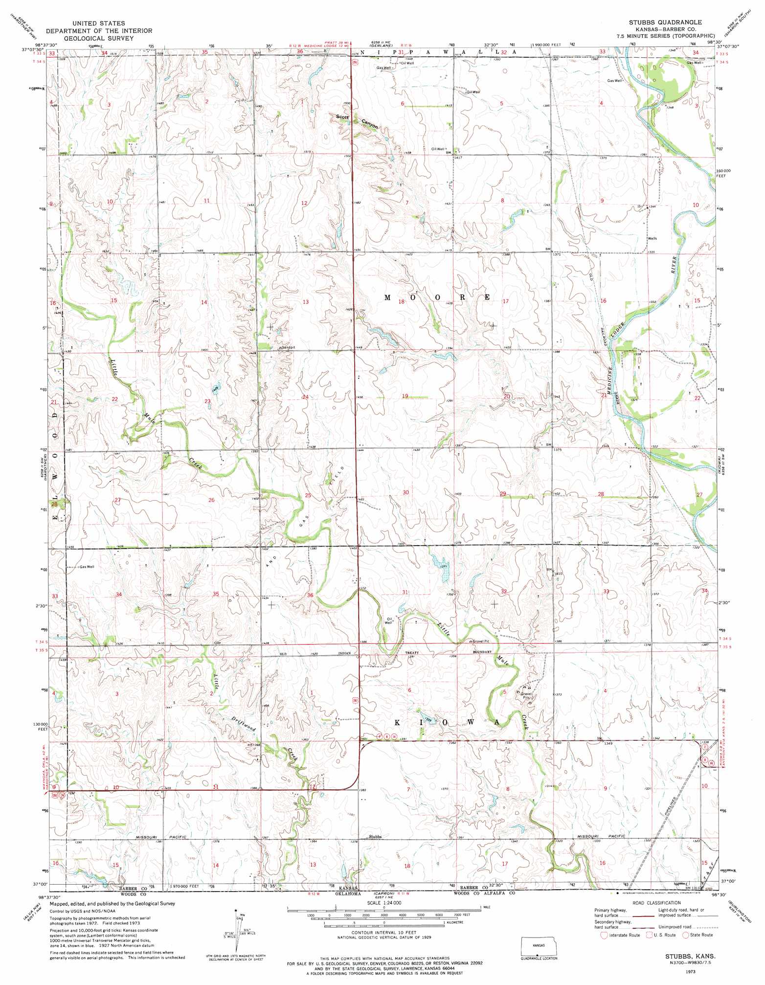
USGS Topo Quad 37098a5 - 1:24,000 scale
| Topo Map Name: | Stubbs |
| USGS Topo Quad ID: | 37098a5 |
| Print Size: | ca. 21 1/4" wide x 27" high |
| Southeast Coordinates: | 37° N latitude / 98.5° W longitude |
| Map Center Coordinates: | 37.0625° N latitude / 98.5625° W longitude |
| U.S. State: | KS |
| Filename: | o37098a5.jpg |
| Download Map JPG Image: | Stubbs topo map 1:24,000 scale |
| Map Type: | Topographic |
| Topo Series: | 7.5´ |
| Map Scale: | 1:24,000 |
| Source of Map Images: | United States Geological Survey (USGS) |
| Alternate Map Versions: |
Stubbs KS 1973, updated 1975 Download PDF Buy paper map Stubbs KS 2009 Download PDF Buy paper map Stubbs KS 2012 Download PDF Buy paper map Stubbs KS 2016 Download PDF Buy paper map |
1:24,000 Topo Quads surrounding Stubbs
Lake City |
Medicine Lodge Sw |
Medicine Lodge |
Sharon North |
Zenda Se |
Pump Creek |
Hardtner Nw |
Gerlane |
Sharon South |
Crisfield |
Hackberry Creek |
Hardtner |
Stubbs |
Kiowa |
Corwin |
Tegarden Ne |
Alva Nw |
Capron |
Burlington |
Amorita |
Tegarden Se |
Alva |
Alva Se |
Ingersoll |
Cherokee North |
> Back to 37098a1 at 1:100,000 scale
> Back to 37098a1 at 1:250,000 scale
> Back to U.S. Topo Maps home
Stubbs topo map: Gazetteer
Stubbs: Populated Places
Stubbs elevation 421m 1381′Stubbs: Valleys
Scott Canyon elevation 435m 1427′Stubbs digital topo map on disk
Buy this Stubbs topo map showing relief, roads, GPS coordinates and other geographical features, as a high-resolution digital map file on DVD: