Lake City Topo Map Kansas
To zoom in, hover over the map of Lake City
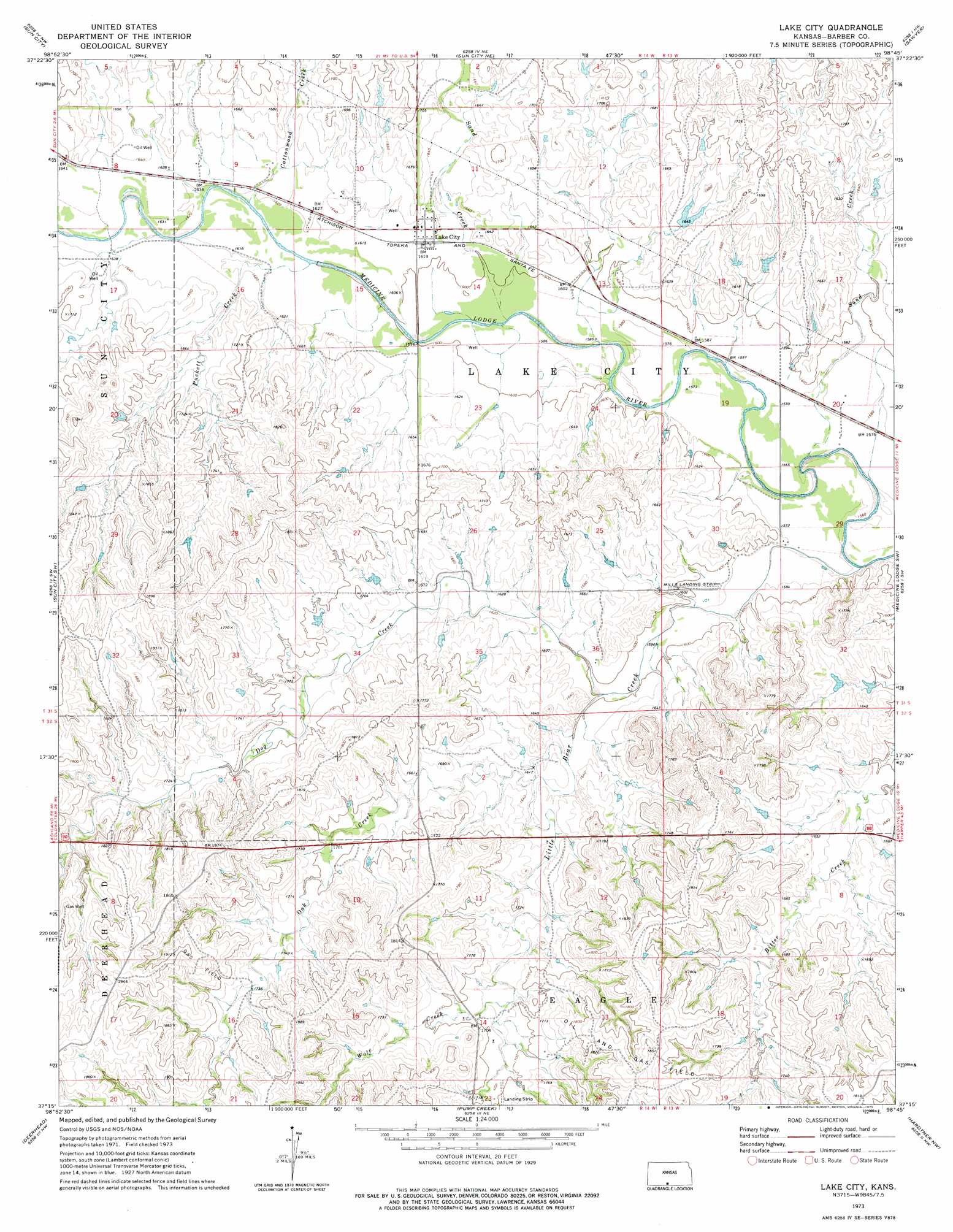
USGS Topo Quad 37098c7 - 1:24,000 scale
| Topo Map Name: | Lake City |
| USGS Topo Quad ID: | 37098c7 |
| Print Size: | ca. 21 1/4" wide x 27" high |
| Southeast Coordinates: | 37.25° N latitude / 98.75° W longitude |
| Map Center Coordinates: | 37.3125° N latitude / 98.8125° W longitude |
| U.S. State: | KS |
| Filename: | o37098c7.jpg |
| Download Map JPG Image: | Lake City topo map 1:24,000 scale |
| Map Type: | Topographic |
| Topo Series: | 7.5´ |
| Map Scale: | 1:24,000 |
| Source of Map Images: | United States Geological Survey (USGS) |
| Alternate Map Versions: |
Lake City KS 1973, updated 1975 Download PDF Buy paper map Lake City KS 2009 Download PDF Buy paper map Lake City KS 2012 Download PDF Buy paper map Lake City KS 2015 Download PDF Buy paper map |
1:24,000 Topo Quads surrounding Lake City
Haviland |
Croft |
Coats |
Pratt Sw |
Pratt Se |
Belvidere |
Sun City |
Sun City Ne |
Sawyer |
Isabel |
Wilmore Se |
Sun City Sw |
Lake City |
Medicine Lodge Sw |
Medicine Lodge |
Indian Creek |
Deerhead |
Pump Creek |
Hardtner Nw |
Gerlane |
Fancy Canyon |
Aetna |
Hackberry Creek |
Hardtner |
Stubbs |
> Back to 37098a1 at 1:100,000 scale
> Back to 37098a1 at 1:250,000 scale
> Back to U.S. Topo Maps home
Lake City topo map: Gazetteer
Lake City: Airports
Mills Landing Strip elevation 487m 1597′Lake City: Populated Places
Lake City elevation 491m 1610′Lake City: Streams
Cottonwood Creek elevation 493m 1617′Dog Creek elevation 486m 1594′
Little Bear Creek elevation 474m 1555′
Oak Creek elevation 493m 1617′
Puckett Creek elevation 488m 1601′
Sand Creek elevation 475m 1558′
Sand Creek elevation 485m 1591′
Lake City digital topo map on disk
Buy this Lake City topo map showing relief, roads, GPS coordinates and other geographical features, as a high-resolution digital map file on DVD: