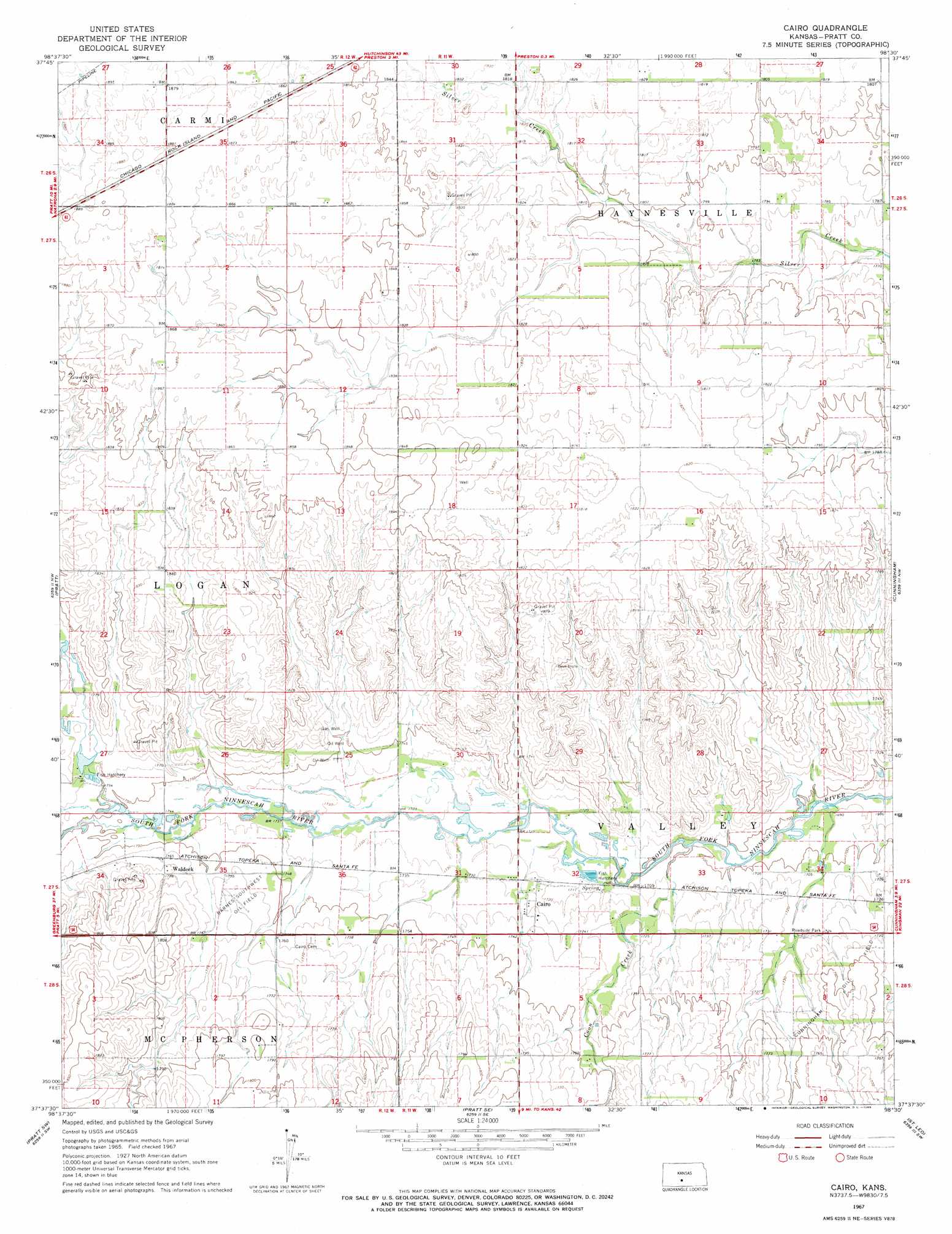
Cairo Topo Map Kansas
To zoom in, hover over the map of Cairo
USGS Topo Quad 37098f5 - 1:24,000 scale
| Topo Map Name: | Cairo |
| USGS Topo Quad ID: | 37098f5 |
| Print Size: | ca. 21 1/4" wide x 27" high |
| Southeast Coordinates: | 37.625° N latitude / 98.5° W longitude |
| Map Center Coordinates: | 37.6875° N latitude / 98.5625° W longitude |
| U.S. State: | KS |
| Filename: | o37098f5.jpg |
| Download Map JPG Image: | Cairo topo map 1:24,000 scale |
| Map Type: | Topographic |
| Topo Series: | 7.5´ |
| Map Scale: | 1:24,000 |
| Source of Map Images: | United States Geological Survey (USGS) |
| Alternate Map Versions: |
Cairo KS 1967, updated 1969 Download PDF Buy paper map Cairo KS 2009 Download PDF Buy paper map Cairo KS 2012 Download PDF Buy paper map Cairo KS 2015 Download PDF Buy paper map |
1:24,000 Topo Quads surrounding Cairo
Saint John South |
Stafford Nw |
Stafford |
Sylvia |
Plevna |
Byers |
Stafford Sw |
Preston |
Turon |
Langdon |
Coats Ne |
Pratt |
Cairo |
Cunningham |
Penalosa |
Coats |
Pratt Sw |
Pratt Se |
Saint Leo |
Willowdale |
Sun City Ne |
Sawyer |
Isabel |
Nashville |
Zenda |
> Back to 37098e1 at 1:100,000 scale
> Back to 37098a1 at 1:250,000 scale
> Back to U.S. Topo Maps home
Cairo topo map: Gazetteer
Cairo: Oilfields
Barnes Southwest Oil Field elevation 538m 1765′Cairo: Populated Places
Cairo elevation 525m 1722′Waldeck elevation 539m 1768′
Cairo: Streams
Coon Creek elevation 518m 1699′Cairo digital topo map on disk
Buy this Cairo topo map showing relief, roads, GPS coordinates and other geographical features, as a high-resolution digital map file on DVD: