Pretty Prairie Topo Map Kansas
To zoom in, hover over the map of Pretty Prairie
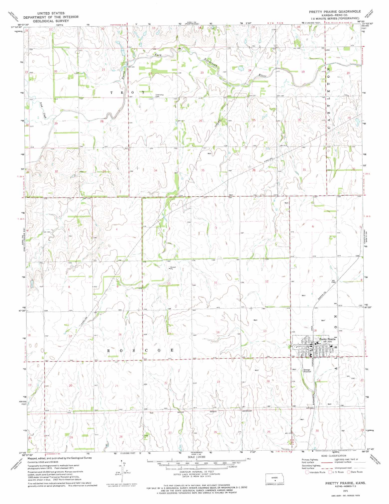
USGS Topo Quad 37098g1 - 1:24,000 scale
| Topo Map Name: | Pretty Prairie |
| USGS Topo Quad ID: | 37098g1 |
| Print Size: | ca. 21 1/4" wide x 27" high |
| Southeast Coordinates: | 37.75° N latitude / 98° W longitude |
| Map Center Coordinates: | 37.8125° N latitude / 98.0625° W longitude |
| U.S. State: | KS |
| Filename: | o37098g1.jpg |
| Download Map JPG Image: | Pretty Prairie topo map 1:24,000 scale |
| Map Type: | Topographic |
| Topo Series: | 7.5´ |
| Map Scale: | 1:24,000 |
| Source of Map Images: | United States Geological Survey (USGS) |
| Alternate Map Versions: |
Pretty Prairie KS 1971, updated 1974 Download PDF Buy paper map Pretty Prairie KS 2009 Download PDF Buy paper map Pretty Prairie KS 2012 Download PDF Buy paper map Pretty Prairie KS 2015 Download PDF Buy paper map |
1:24,000 Topo Quads surrounding Pretty Prairie
Alden Se |
Sterling Sw |
Yaggy |
Hutchinson |
Hutchinson Se |
Plevna |
Arlington |
Partridge |
Elmer |
Haven |
Langdon |
Pretty Prairie Sw |
Pretty Prairie |
Castleton |
Haven Se |
Penalosa |
Kingman Nw |
Kingman |
Waterloo |
Cheney |
Willowdale |
Cleveland |
Almeda |
Murdock |
Cheney Se |
> Back to 37098e1 at 1:100,000 scale
> Back to 37098a1 at 1:250,000 scale
> Back to U.S. Topo Maps home
Pretty Prairie topo map: Gazetteer
Pretty Prairie: Populated Places
Pretty Prairie elevation 479m 1571′Pretty Prairie: Streams
Irish Creek elevation 459m 1505′Pretty Prairie digital topo map on disk
Buy this Pretty Prairie topo map showing relief, roads, GPS coordinates and other geographical features, as a high-resolution digital map file on DVD: