Ashland Topo Map Kansas
To zoom in, hover over the map of Ashland
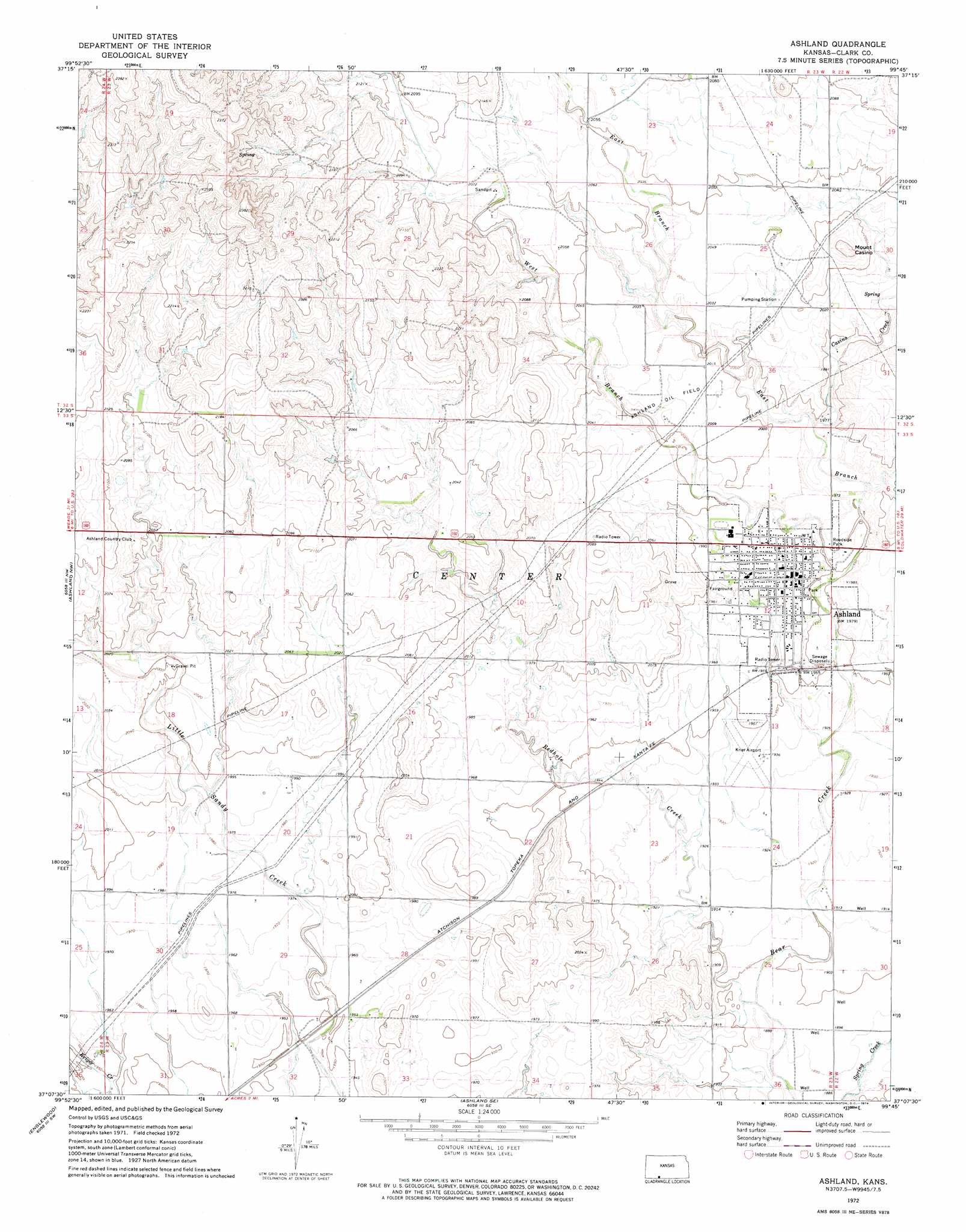
USGS Topo Quad 37099b7 - 1:24,000 scale
| Topo Map Name: | Ashland |
| USGS Topo Quad ID: | 37099b7 |
| Print Size: | ca. 21 1/4" wide x 27" high |
| Southeast Coordinates: | 37.125° N latitude / 99.75° W longitude |
| Map Center Coordinates: | 37.1875° N latitude / 99.8125° W longitude |
| U.S. State: | KS |
| Filename: | o37099b7.jpg |
| Download Map JPG Image: | Ashland topo map 1:24,000 scale |
| Map Type: | Topographic |
| Topo Series: | 7.5´ |
| Map Scale: | 1:24,000 |
| Source of Map Images: | United States Geological Survey (USGS) |
| Alternate Map Versions: |
Ashland KS 1972, updated 1974 Download PDF Buy paper map Ashland KS 2009 Download PDF Buy paper map Ashland KS 2012 Download PDF Buy paper map Ashland KS 2015 Download PDF Buy paper map |
1:24,000 Topo Quads surrounding Ashland
Minneola |
Bloom |
Simmons Creek |
Mount Jesus Nw |
Turkey Creek |
Fowler Se |
Bloom Sw |
Bloom Se |
Mount Jesus |
Lexington |
Proffitt Lake |
Ashland Nw |
Ashland |
Sitka |
Sugarloaf |
Mount Helen |
Englewood |
Ashland Se |
Sitka Sw |
Trout Creek |
Gate Ne |
Rosston Nw |
Rosston Ne |
Buffalo Nw |
Buffalo Ne |
> Back to 37099a1 at 1:100,000 scale
> Back to 37098a1 at 1:250,000 scale
> Back to U.S. Topo Maps home
Ashland topo map: Gazetteer
Ashland: Airports
Harold Krier Field elevation 595m 1952′Ashland: Oilfields
Ashland Oil Field elevation 616m 2020′Ashland: Populated Places
Ashland elevation 602m 1975′Ashland: Streams
Casino Creek elevation 601m 1971′East Branch Bear Creek elevation 591m 1938′
Redhole Creek elevation 576m 1889′
West Branch Bear Creek elevation 591m 1938′
Ashland: Summits
Mount Casino elevation 647m 2122′Ashland digital topo map on disk
Buy this Ashland topo map showing relief, roads, GPS coordinates and other geographical features, as a high-resolution digital map file on DVD: