Greensburg Topo Map Kansas
To zoom in, hover over the map of Greensburg
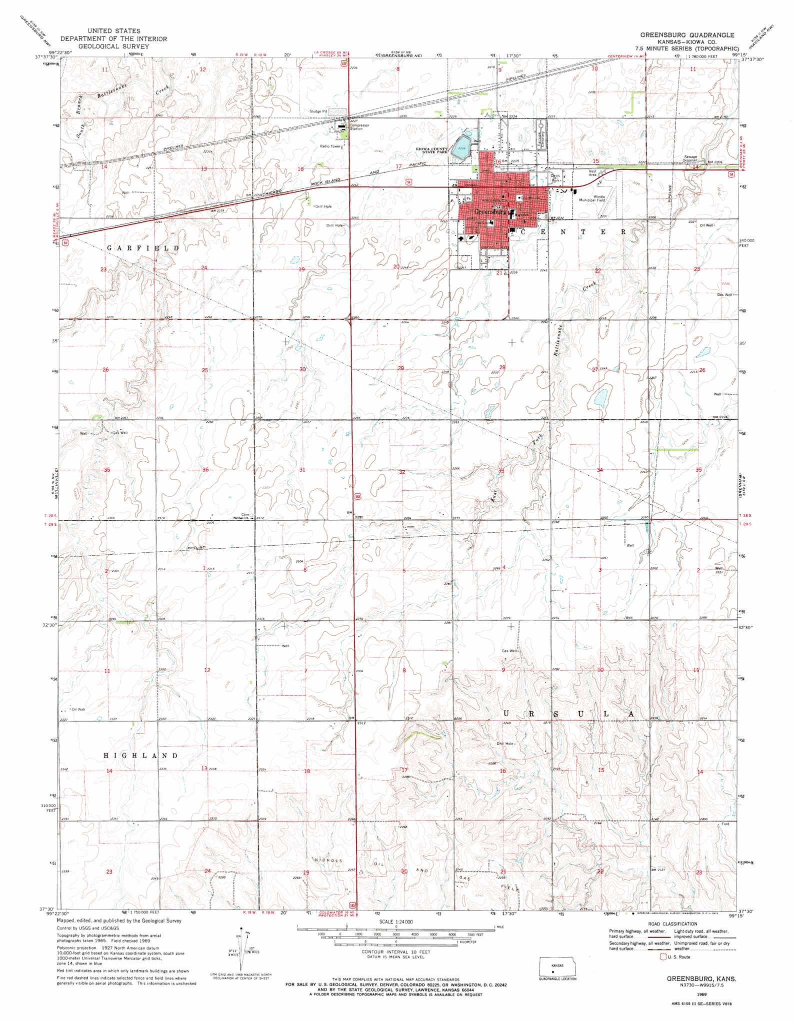
USGS Topo Quad 37099e3 - 1:24,000 scale
| Topo Map Name: | Greensburg |
| USGS Topo Quad ID: | 37099e3 |
| Print Size: | ca. 21 1/4" wide x 27" high |
| Southeast Coordinates: | 37.5° N latitude / 99.25° W longitude |
| Map Center Coordinates: | 37.5625° N latitude / 99.3125° W longitude |
| U.S. State: | KS |
| Filename: | o37099e3.jpg |
| Download Map JPG Image: | Greensburg topo map 1:24,000 scale |
| Map Type: | Topographic |
| Topo Series: | 7.5´ |
| Map Scale: | 1:24,000 |
| Source of Map Images: | United States Geological Survey (USGS) |
| Alternate Map Versions: |
Greensburg KS 1969, updated 1971 Download PDF Buy paper map Greensburg KS 2009 Download PDF Buy paper map Greensburg KS 2012 Download PDF Buy paper map Greensburg KS 2015 Download PDF Buy paper map |
1:24,000 Topo Quads surrounding Greensburg
Offerle Se |
Kinsley Sw |
Centerview |
Fellsburg |
Trousdale |
Bucklin Ne |
Greensburg Nw |
Greensburg Ne |
Haviland Nw |
Haviland Ne |
Bucklin Se |
Mullinville |
Greensburg |
Brenham |
Haviland |
Turkey Creek |
East Kiowa Creek North |
Coldwater Ne |
Iron Mountain |
Belvidere |
Lexington |
East Kiowa Creek South |
Coldwater |
Wilmore |
Wilmore Se |
> Back to 37099e1 at 1:100,000 scale
> Back to 37098a1 at 1:250,000 scale
> Back to U.S. Topo Maps home
Greensburg topo map: Gazetteer
Greensburg: Airports
Paul Windle Municipal Field elevation 680m 2230′Greensburg: Dams
Kiowa County State Lake Dam elevation 679m 2227′Greensburg: Oilfields
Nichols Oil and Gas Field elevation 688m 2257′Greensburg: Parks
Cradle Park elevation 680m 2230′Kiowa County State Park elevation 679m 2227′
Greensburg: Populated Places
Greensburg elevation 681m 2234′Greensburg: Post Offices
Greensburg Post Office elevation 680m 2230′Greensburg: Reservoirs
Kiowa County State Lake elevation 679m 2227′Greensburg digital topo map on disk
Buy this Greensburg topo map showing relief, roads, GPS coordinates and other geographical features, as a high-resolution digital map file on DVD: