Bucklin Topo Map Kansas
To zoom in, hover over the map of Bucklin
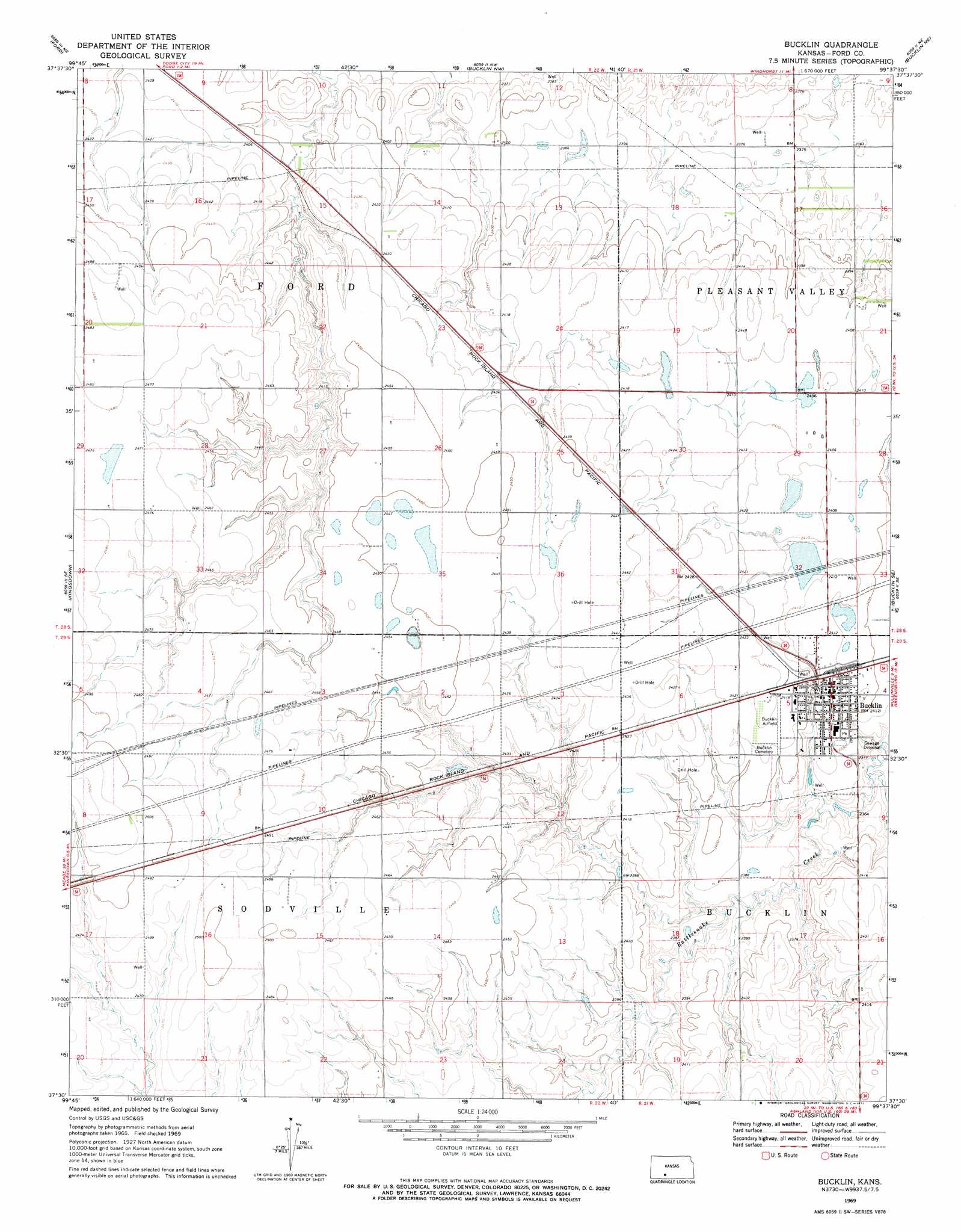
USGS Topo Quad 37099e6 - 1:24,000 scale
| Topo Map Name: | Bucklin |
| USGS Topo Quad ID: | 37099e6 |
| Print Size: | ca. 21 1/4" wide x 27" high |
| Southeast Coordinates: | 37.5° N latitude / 99.625° W longitude |
| Map Center Coordinates: | 37.5625° N latitude / 99.6875° W longitude |
| U.S. State: | KS |
| Filename: | o37099e6.jpg |
| Download Map JPG Image: | Bucklin topo map 1:24,000 scale |
| Map Type: | Topographic |
| Topo Series: | 7.5´ |
| Map Scale: | 1:24,000 |
| Source of Map Images: | United States Geological Survey (USGS) |
| Alternate Map Versions: |
Bucklin KS 1969, updated 1971 Download PDF Buy paper map Bucklin KS 2009 Download PDF Buy paper map Bucklin KS 2012 Download PDF Buy paper map Bucklin KS 2015 Download PDF Buy paper map |
1:24,000 Topo Quads surrounding Bucklin
Wright |
Spearville |
Bellefont |
Offerle Se |
Kinsley Sw |
Fort Dodge |
Ford |
Bucklin Nw |
Bucklin Ne |
Greensburg Nw |
Fort Dodge Sw |
Kingsdown |
Bucklin |
Bucklin Se |
Mullinville |
Bloom |
Simmons Creek |
Mount Jesus Nw |
Turkey Creek |
East Kiowa Creek North |
Bloom Sw |
Bloom Se |
Mount Jesus |
Lexington |
East Kiowa Creek South |
> Back to 37099e1 at 1:100,000 scale
> Back to 37098a1 at 1:250,000 scale
> Back to U.S. Topo Maps home
Bucklin topo map: Gazetteer
Bucklin: Airports
Bucklin Airfield elevation 737m 2417′Bucklin: Populated Places
Bucklin elevation 733m 2404′Bucklin digital topo map on disk
Buy this Bucklin topo map showing relief, roads, GPS coordinates and other geographical features, as a high-resolution digital map file on DVD: