Satanta Topo Map Kansas
To zoom in, hover over the map of Satanta
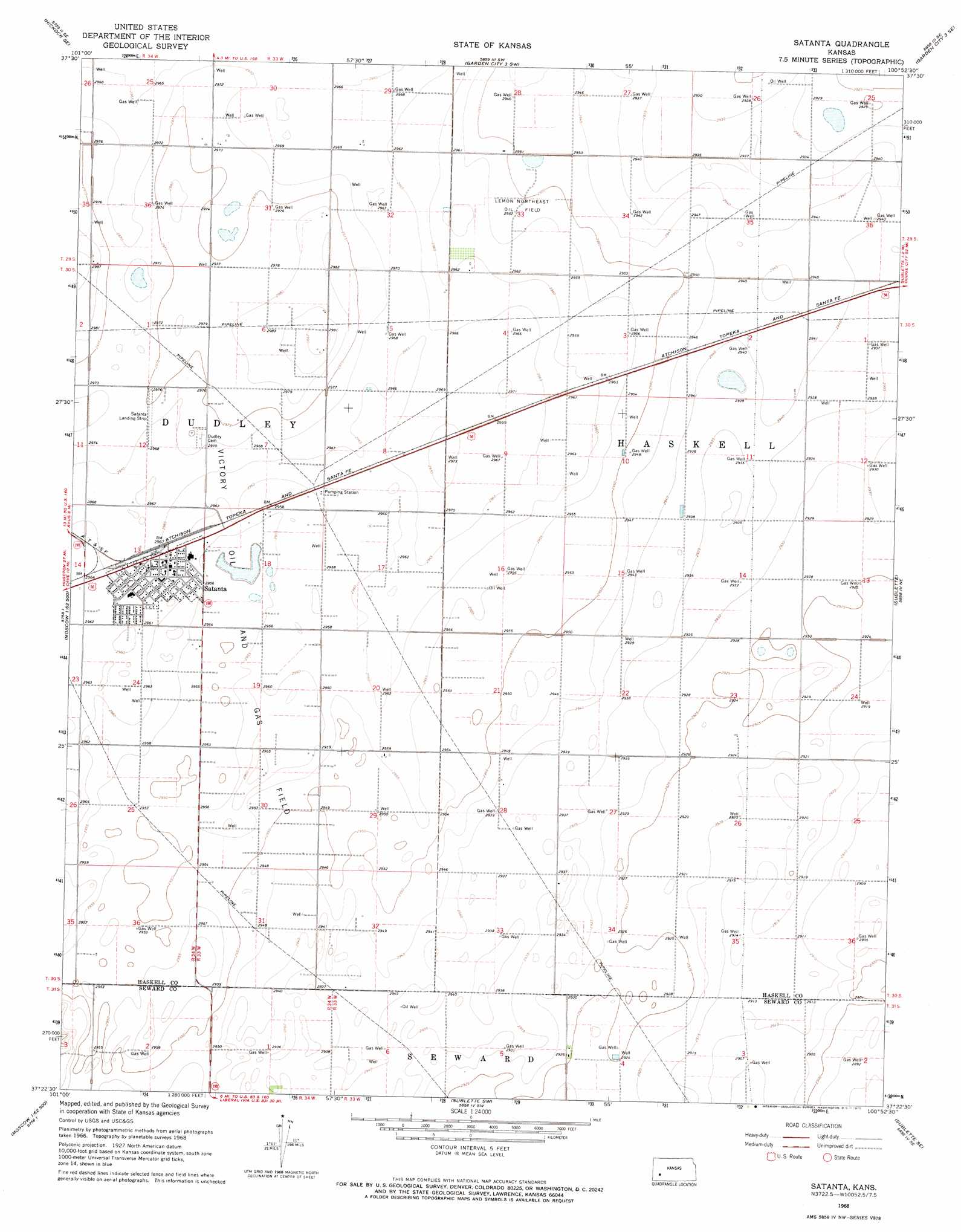
USGS Topo Quad 37100d8 - 1:24,000 scale
| Topo Map Name: | Satanta |
| USGS Topo Quad ID: | 37100d8 |
| Print Size: | ca. 21 1/4" wide x 27" high |
| Southeast Coordinates: | 37.375° N latitude / 100.875° W longitude |
| Map Center Coordinates: | 37.4375° N latitude / 100.9375° W longitude |
| U.S. State: | KS |
| Filename: | o37100d8.jpg |
| Download Map JPG Image: | Satanta topo map 1:24,000 scale |
| Map Type: | Topographic |
| Topo Series: | 7.5´ |
| Map Scale: | 1:24,000 |
| Source of Map Images: | United States Geological Survey (USGS) |
| Alternate Map Versions: |
Satanta KS 1968, updated 1970 Download PDF Buy paper map Satanta KS 2010 Download PDF Buy paper map Satanta KS 2012 Download PDF Buy paper map Satanta KS 2016 Download PDF Buy paper map |
1:24,000 Topo Quads surrounding Satanta
Hickok Nw |
Hickok Ne |
Garden City 3 Nw |
Garden City 3 Ne |
Copeland Nw |
Hickok |
Hickok Se |
Garden City 3 Sw |
Garden City 3 Se |
Copeland |
Moscow Nw |
Ryus |
Satanta |
Sublette |
Plains Nw |
Moscow |
Moscow Se |
Sublette Sw |
Sublette Se |
Plains Sw |
Woods Nw |
Woods |
Liberal Nw |
Liberal Ne |
Kismet |
> Back to 37100a1 at 1:100,000 scale
> Back to 37100a1 at 1:250,000 scale
> Back to U.S. Topo Maps home
Satanta topo map: Gazetteer
Satanta: Oilfields
Lemon Northeast Oil Field elevation 900m 2952′Victory Oil and Gas Field elevation 899m 2949′
Satanta: Populated Places
Satanta elevation 899m 2949′Satanta digital topo map on disk
Buy this Satanta topo map showing relief, roads, GPS coordinates and other geographical features, as a high-resolution digital map file on DVD: