Rolla Topo Map Kansas
To zoom in, hover over the map of Rolla
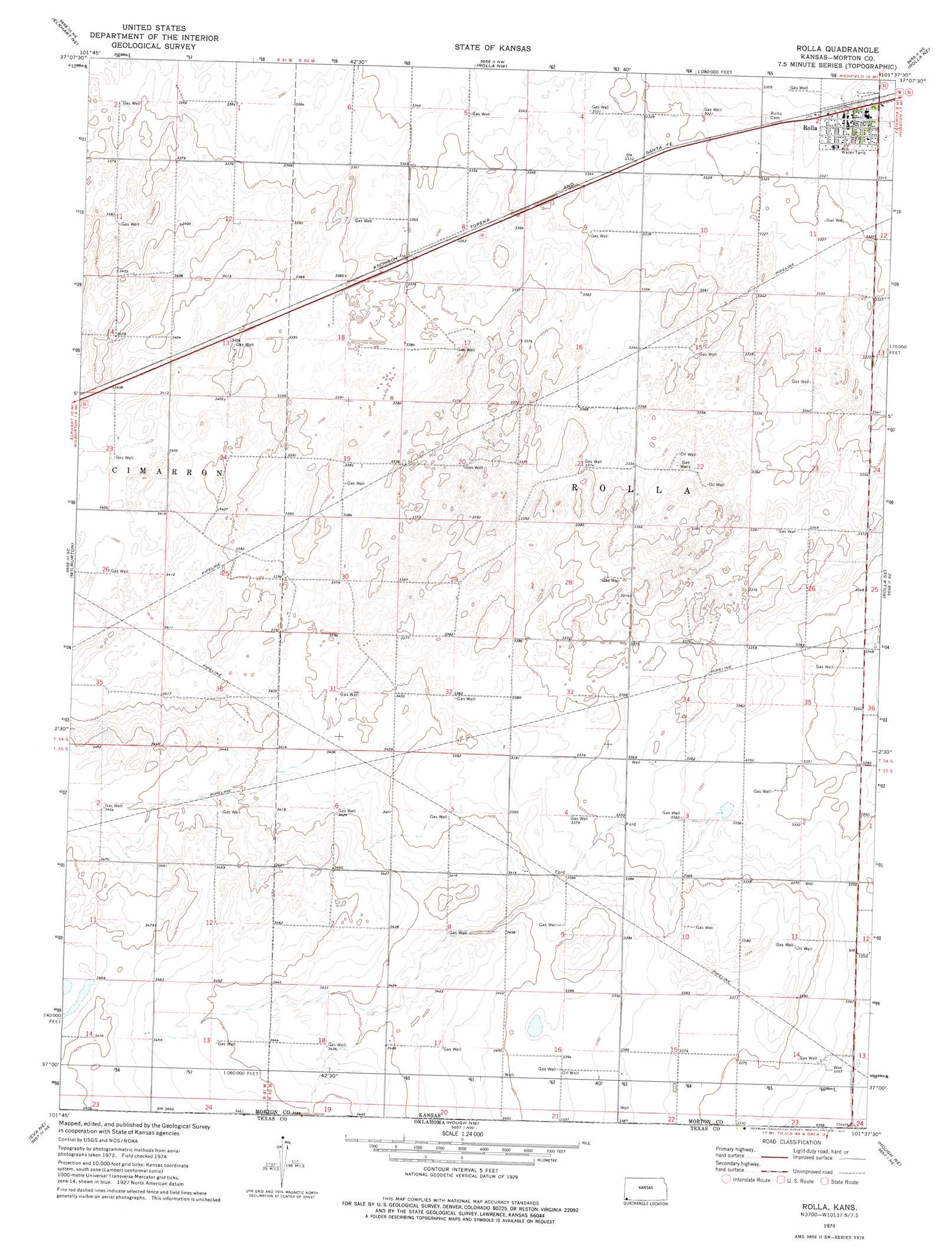
USGS Topo Quad 37101a6 - 1:24,000 scale
| Topo Map Name: | Rolla |
| USGS Topo Quad ID: | 37101a6 |
| Print Size: | ca. 21 1/4" wide x 27" high |
| Southeast Coordinates: | 37° N latitude / 101.625° W longitude |
| Map Center Coordinates: | 37.0625° N latitude / 101.6875° W longitude |
| U.S. State: | KS |
| Filename: | o37101a6.jpg |
| Download Map JPG Image: | Rolla topo map 1:24,000 scale |
| Map Type: | Topographic |
| Topo Series: | 7.5´ |
| Map Scale: | 1:24,000 |
| Source of Map Images: | United States Geological Survey (USGS) |
| Alternate Map Versions: |
Rolla KS 1974, updated 1976 Download PDF Buy paper map Rolla KS 2011 Download PDF Buy paper map Rolla KS 2012 Download PDF Buy paper map Rolla KS 2016 Download PDF Buy paper map |
| FStopo: | US Forest Service topo Rolla is available: Download FStopo PDF Download FStopo TIF |
1:24,000 Topo Quads surrounding Rolla
Richfield Sw |
Richfield |
Shore Airport Sw |
Shore Airport Se |
Wagon Bed Spring Sw |
Elkhart Nw |
Elkhart Ne |
Rolla Nw |
Rolla Ne |
Feterita |
Elkhart North |
Wilburton |
Rolla |
Rolla Se |
Hugoton Sw |
Elkhart South |
Eva Ne |
Hough Nw |
Hough Ne |
Straight |
Eva |
Eva Se |
Hough Sw |
Hough |
Straight Sw |
> Back to 37101a1 at 1:100,000 scale
> Back to 37100a1 at 1:250,000 scale
> Back to U.S. Topo Maps home
Rolla topo map: Gazetteer
Rolla: Flats
Highway Pasture elevation 1029m 3375′Pasture Number Thirty elevation 1045m 3428′
Pasture Number Thirtyone elevation 1052m 3451′
Pasture Number Twentyeight elevation 1020m 3346′
Pasture Number Twentynine elevation 1035m 3395′
South East Wilberton Pasture elevation 1030m 3379′
Tucker Pasture elevation 1038m 3405′
Watson Pasture elevation 1027m 3369′
Rolla: Populated Places
Rolla elevation 1012m 3320′Rolla digital topo map on disk
Buy this Rolla topo map showing relief, roads, GPS coordinates and other geographical features, as a high-resolution digital map file on DVD: