Richfield Topo Map Kansas
To zoom in, hover over the map of Richfield
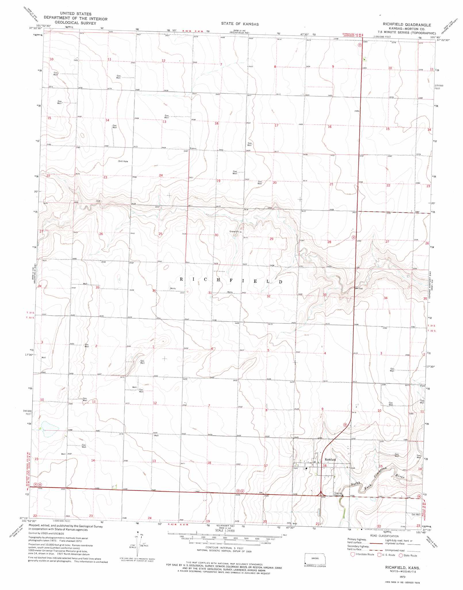
USGS Topo Quad 37101c7 - 1:24,000 scale
| Topo Map Name: | Richfield |
| USGS Topo Quad ID: | 37101c7 |
| Print Size: | ca. 21 1/4" wide x 27" high |
| Southeast Coordinates: | 37.25° N latitude / 101.75° W longitude |
| Map Center Coordinates: | 37.3125° N latitude / 101.8125° W longitude |
| U.S. State: | KS |
| Filename: | o37101c7.jpg |
| Download Map JPG Image: | Richfield topo map 1:24,000 scale |
| Map Type: | Topographic |
| Topo Series: | 7.5´ |
| Map Scale: | 1:24,000 |
| Source of Map Images: | United States Geological Survey (USGS) |
| Alternate Map Versions: |
Richfield KS 1973, updated 1975 Download PDF Buy paper map Richfield KS 2011 Download PDF Buy paper map Richfield KS 2012 Download PDF Buy paper map Richfield KS 2015 Download PDF Buy paper map |
| FStopo: | US Forest Service topo Richfield is available: Download FStopo PDF Download FStopo TIF |
1:24,000 Topo Quads surrounding Richfield
Lycan Se |
Manter |
Johnson West |
Johnson East |
Big Bow |
Saunders |
Richfield Nw |
Richfield Ne |
Shore Airport |
Shore Airport Ne |
Stonington Se |
Richfield Sw |
Richfield |
Shore Airport Sw |
Shore Airport Se |
Midway Ne |
Elkhart Nw |
Elkhart Ne |
Rolla Nw |
Rolla Ne |
Midway Se |
Elkhart North |
Wilburton |
Rolla |
Rolla Se |
> Back to 37101a1 at 1:100,000 scale
> Back to 37100a1 at 1:250,000 scale
> Back to U.S. Topo Maps home
Richfield topo map: Gazetteer
Richfield: Flats
New Pasture Number Thirteen elevation 1064m 3490′Richfield: Populated Places
Richfield elevation 1033m 3389′Richfield digital topo map on disk
Buy this Richfield topo map showing relief, roads, GPS coordinates and other geographical features, as a high-resolution digital map file on DVD: