Midway Sw Topo Map Colorado
To zoom in, hover over the map of Midway Sw
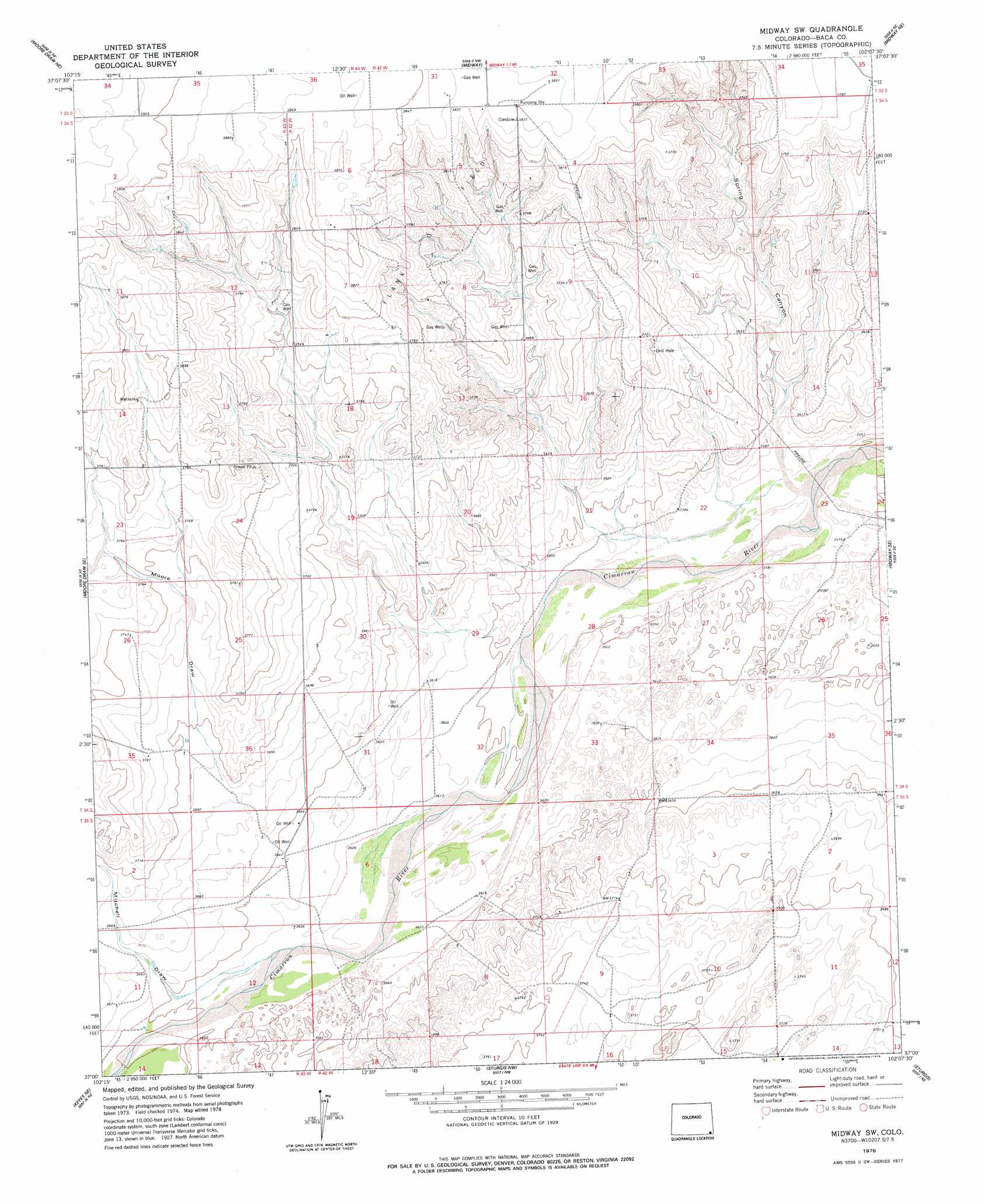
USGS Topo Quad 37102a2 - 1:24,000 scale
| Topo Map Name: | Midway Sw |
| USGS Topo Quad ID: | 37102a2 |
| Print Size: | ca. 21 1/4" wide x 27" high |
| Southeast Coordinates: | 37° N latitude / 102.125° W longitude |
| Map Center Coordinates: | 37.0625° N latitude / 102.1875° W longitude |
| U.S. State: | CO |
| Filename: | o37102a2.jpg |
| Download Map JPG Image: | Midway Sw topo map 1:24,000 scale |
| Map Type: | Topographic |
| Topo Series: | 7.5´ |
| Map Scale: | 1:24,000 |
| Source of Map Images: | United States Geological Survey (USGS) |
| Alternate Map Versions: |
Midway SW CO 1978, updated 1978 Download PDF Buy paper map Midway SW CO 2010 Download PDF Buy paper map Midway SW CO 2013 Download PDF Buy paper map Midway SW CO 2016 Download PDF Buy paper map |
1:24,000 Topo Quads surrounding Midway Sw
Vilas South |
Walsh Se |
Stonington |
Stonington Se |
Richfield Sw |
Moore Draw Nw |
Moore Draw Ne |
Midway |
Midway Ne |
Elkhart Nw |
Moore Draw Sw |
Moore Draw Se |
Midway Sw |
Midway Se |
Elkhart North |
Keyes Nw |
Keyes Ne |
Sturgis Nw |
Sturgis |
Elkhart South |
Keyes Sw |
Keyes West |
Keyes East |
Hopkins |
Eva |
> Back to 37102a1 at 1:100,000 scale
> Back to 37102a1 at 1:250,000 scale
> Back to U.S. Topo Maps home
Midway Sw topo map: Gazetteer
Midway Sw: Oilfields
Flank Oil Field elevation 1144m 3753′Midway Sw: Valleys
Mitchell Draw elevation 1111m 3645′Moore Draw elevation 1123m 3684′
Spring Canyon elevation 1088m 3569′
Midway Sw digital topo map on disk
Buy this Midway Sw topo map showing relief, roads, GPS coordinates and other geographical features, as a high-resolution digital map file on DVD: