Big Hole Canyon Topo Map Colorado
To zoom in, hover over the map of Big Hole Canyon
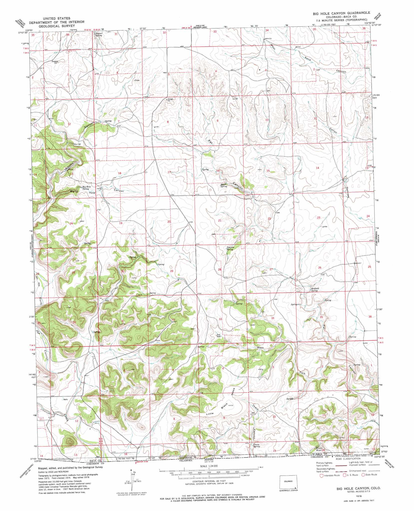
USGS Topo Quad 37102a8 - 1:24,000 scale
| Topo Map Name: | Big Hole Canyon |
| USGS Topo Quad ID: | 37102a8 |
| Print Size: | ca. 21 1/4" wide x 27" high |
| Southeast Coordinates: | 37° N latitude / 102.875° W longitude |
| Map Center Coordinates: | 37.0625° N latitude / 102.9375° W longitude |
| U.S. State: | CO |
| Filename: | o37102a8.jpg |
| Download Map JPG Image: | Big Hole Canyon topo map 1:24,000 scale |
| Map Type: | Topographic |
| Topo Series: | 7.5´ |
| Map Scale: | 1:24,000 |
| Source of Map Images: | United States Geological Survey (USGS) |
| Alternate Map Versions: |
Big Hole Canyon CO 1978, updated 1979 Download PDF Buy paper map Big Hole Canyon CO 1996, updated 2000 Download PDF Buy paper map Big Hole Canyon CO 2011 Download PDF Buy paper map Big Hole Canyon CO 2013 Download PDF Buy paper map Big Hole Canyon CO 2016 Download PDF Buy paper map |
| FStopo: | US Forest Service topo Big Hole Canyon is available: Download FStopo PDF Download FStopo TIF |
1:24,000 Topo Quads surrounding Big Hole Canyon
Andrix |
Utleyville |
Lone Rock |
Pritchett |
Springfield Sw |
Pintada Creek |
Carrizo Mountain |
Reader Lake |
Edler |
Campo Nw |
Furnish Canyon West |
Furnish Canyon East |
Big Hole Canyon |
Tubs Springs |
Campo Sw |
Wedding Cake Butte |
Goodson School |
Kenton |
Kenton Ne |
Autograph Cliff Nw |
Atencio |
Greendailey Canyon |
Kenton Sw |
Kenton Se |
Autograph Cliff |
> Back to 37102a1 at 1:100,000 scale
> Back to 37102a1 at 1:250,000 scale
> Back to U.S. Topo Maps home
Big Hole Canyon topo map: Gazetteer
Big Hole Canyon: Springs
Big Hole Spring elevation 1420m 4658′Hatfield Spring elevation 1375m 4511′
Major Spring elevation 1421m 4662′
Regnar Spring elevation 1461m 4793′
Tharp Spring elevation 1386m 4547′
Trujilla Spring elevation 1416m 4645′
Woods Water elevation 1370m 4494′
Big Hole Canyon: Summits
Little Black Mesa elevation 1441m 4727′Big Hole Canyon: Valleys
Big Hole Canyon elevation 1384m 4540′Furnish Canyon elevation 1336m 4383′
West Fork Pat Canyon elevation 1341m 4399′
Big Hole Canyon digital topo map on disk
Buy this Big Hole Canyon topo map showing relief, roads, GPS coordinates and other geographical features, as a high-resolution digital map file on DVD: