Pintada Creek Topo Map Colorado
To zoom in, hover over the map of Pintada Creek
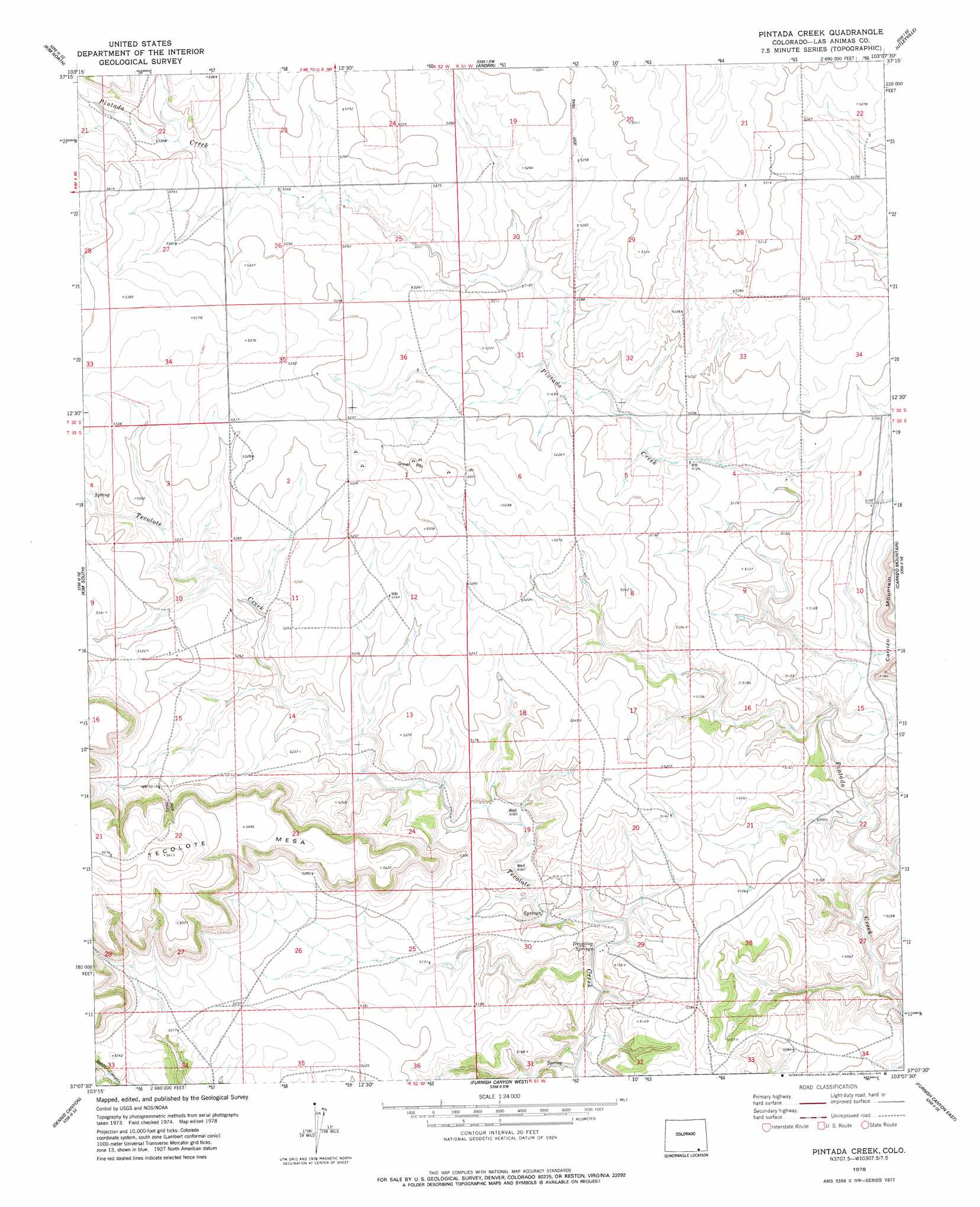
USGS Topo Quad 37103b2 - 1:24,000 scale
| Topo Map Name: | Pintada Creek |
| USGS Topo Quad ID: | 37103b2 |
| Print Size: | ca. 21 1/4" wide x 27" high |
| Southeast Coordinates: | 37.125° N latitude / 103.125° W longitude |
| Map Center Coordinates: | 37.1875° N latitude / 103.1875° W longitude |
| U.S. State: | CO |
| Filename: | o37103b2.jpg |
| Download Map JPG Image: | Pintada Creek topo map 1:24,000 scale |
| Map Type: | Topographic |
| Topo Series: | 7.5´ |
| Map Scale: | 1:24,000 |
| Source of Map Images: | United States Geological Survey (USGS) |
| Alternate Map Versions: |
Pintada Creek CO 1978, updated 1978 Download PDF Buy paper map Pintada Creek CO 1996, updated 2000 Download PDF Buy paper map Pintada Creek CO 2011 Download PDF Buy paper map Pintada Creek CO 2013 Download PDF Buy paper map Pintada Creek CO 2016 Download PDF Buy paper map |
| FStopo: | US Forest Service topo Pintada Creek is available: Download FStopo PDF Download FStopo TIF |
1:24,000 Topo Quads surrounding Pintada Creek
Icehouse Canyon |
Robbers Roost Canyon |
Buck Canyon |
Table Mesa |
Pritchett Nw |
Cherry Canyon |
Kim North |
Andrix |
Utleyville |
Lone Rock |
Dalerose Mesa |
Kim South |
Pintada Creek |
Carrizo Mountain |
Reader Lake |
Jesus Canyon |
Dennis Canyon |
Furnish Canyon West |
Furnish Canyon East |
Big Hole Canyon |
Travesser Park |
Tub Spring |
Wedding Cake Butte |
Goodson School |
Kenton |
> Back to 37103a1 at 1:100,000 scale
> Back to 37102a1 at 1:250,000 scale
> Back to U.S. Topo Maps home
Pintada Creek digital topo map on disk
Buy this Pintada Creek topo map showing relief, roads, GPS coordinates and other geographical features, as a high-resolution digital map file on DVD: