Robbers Roost Canyon Topo Map Colorado
To zoom in, hover over the map of Robbers Roost Canyon
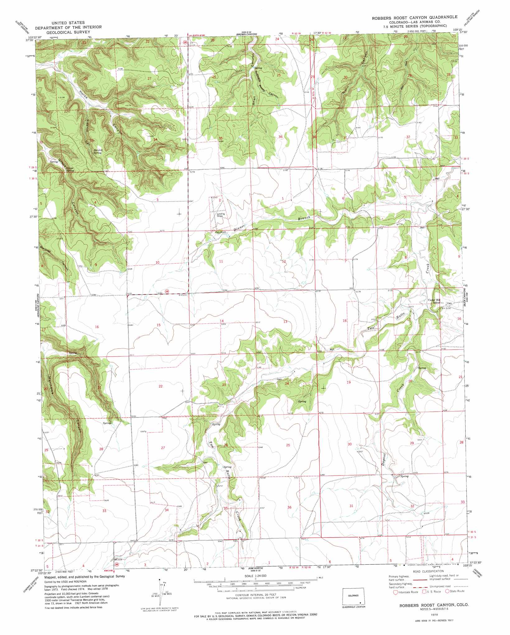
USGS Topo Quad 37103d3 - 1:24,000 scale
| Topo Map Name: | Robbers Roost Canyon |
| USGS Topo Quad ID: | 37103d3 |
| Print Size: | ca. 21 1/4" wide x 27" high |
| Southeast Coordinates: | 37.375° N latitude / 103.25° W longitude |
| Map Center Coordinates: | 37.4375° N latitude / 103.3125° W longitude |
| U.S. State: | CO |
| Filename: | o37103d3.jpg |
| Download Map JPG Image: | Robbers Roost Canyon topo map 1:24,000 scale |
| Map Type: | Topographic |
| Topo Series: | 7.5´ |
| Map Scale: | 1:24,000 |
| Source of Map Images: | United States Geological Survey (USGS) |
| Alternate Map Versions: |
Robbers Roost Canyon CO 2010 Download PDF Buy paper map Robbers Roost Canyon CO 2013 Download PDF Buy paper map Robbers Roost Canyon CO 2016 Download PDF Buy paper map |
1:24,000 Topo Quads surrounding Robbers Roost Canyon
Riley Canyon |
Corbin Canyon |
Rock Canyon |
Ninaview |
Clay Ranch |
Beaty Canyon |
Lost Canyon |
Brown Canyon |
Plug Hat Ranch |
Walker Canyon |
Plum Canyon |
Icehouse Canyon |
Robbers Roost Canyon |
Buck Canyon |
Table Mesa |
Villegreen |
Cherry Canyon |
Kim North |
Andrix |
Utleyville |
Tobe |
Dalerose Mesa |
Kim South |
Pintada Creek |
Carrizo Mountain |
> Back to 37103a1 at 1:100,000 scale
> Back to 37102a1 at 1:250,000 scale
> Back to U.S. Topo Maps home
Robbers Roost Canyon topo map: Gazetteer
Robbers Roost Canyon: Springs
Grape Spring elevation 1501m 4924′Sidehill Spring elevation 1546m 5072′
Robbers Roost Canyon: Streams
Dinner Branch elevation 1530m 5019′Dugout Creek elevation 1541m 5055′
Robbers Roost Canyon: Valleys
East Maverick Canyon elevation 1561m 5121′Robbers Roost Canyon elevation 1530m 5019′
Sidehill Canyon elevation 1481m 4858′
Robbers Roost Canyon digital topo map on disk
Buy this Robbers Roost Canyon topo map showing relief, roads, GPS coordinates and other geographical features, as a high-resolution digital map file on DVD: