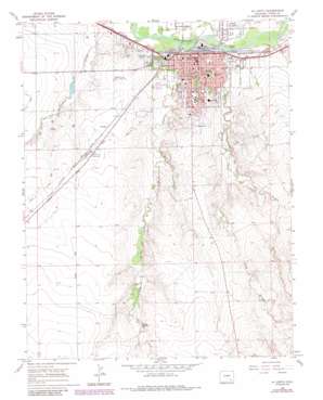
La Junta Topo Map Colorado
To zoom in, hover over the map of La Junta
USGS Topo Quad 37103h5 - 1:24,000 scale
| Topo Map Name: | La Junta |
| USGS Topo Quad ID: | 37103h5 |
| Print Size: | ca. 21 1/4" wide x 27" high |
| Southeast Coordinates: | 37.875° N latitude / 103.5° W longitude |
| Map Center Coordinates: | 37.9375° N latitude / 103.5625° W longitude |
| U.S. State: | CO |
| Filename: | o37103h5.jpg |
| Download Map JPG Image: | La Junta topo map 1:24,000 scale |
| Map Type: | Topographic |
| Topo Series: | 7.5´ |
| Map Scale: | 1:24,000 |
| Source of Map Images: | United States Geological Survey (USGS) |
| Alternate Map Versions: |
La Junta CO 1966, updated 1969 Download PDF Buy paper map La Junta CO 1966, updated 1970 Download PDF Buy paper map La Junta CO 1966, updated 1970 Download PDF Buy paper map La Junta CO 1966, updated 1985 Download PDF Buy paper map La Junta CO 1966, updated 1985 Download PDF Buy paper map La Junta CO 1996, updated 2000 Download PDF Buy paper map La Junta CO 2011 Download PDF Buy paper map La Junta CO 2013 Download PDF Buy paper map La Junta CO 2016 Download PDF Buy paper map |
| FStopo: | US Forest Service topo La Junta is available: Download FStopo PDF Download FStopo TIF |
1:24,000 Topo Quads surrounding La Junta
> Back to 37103e1 at 1:100,000 scale
> Back to 37102a1 at 1:250,000 scale
> Back to U.S. Topo Maps home
La Junta topo map: Gazetteer
La Junta: Airports
Arkansas Valley Regional Medical Center Heliport elevation 1273m 4176′La Junta: Cliffs
Dixie Bluffs elevation 1312m 4304′La Junta: Parks
Blaine Park elevation 1253m 4110′Potter Park elevation 1247m 4091′
Rattler Football Field elevation 1263m 4143′
Tippy Martinez Softball Field elevation 1268m 4160′
La Junta: Populated Places
La Junta elevation 1243m 4078′La Junta Gardens elevation 1239m 4064′
North La Junta elevation 1235m 4051′
Ormega elevation 1285m 4215′
La Junta: Post Offices
La Junta Post Office elevation 1242m 4074′La Junta: Streams
Anderson Arroyo elevation 1237m 4058′East Fork King Arroyo elevation 1265m 4150′
King Arroyo elevation 1234m 4048′
La Junta digital topo map on disk
Buy this La Junta topo map showing relief, roads, GPS coordinates and other geographical features, as a high-resolution digital map file on DVD:


