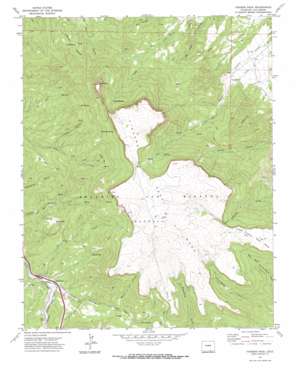
Fishers Peak Topo Map Colorado
To zoom in, hover over the map of Fishers Peak
USGS Topo Quad 37104a4 - 1:24,000 scale
| Topo Map Name: | Fishers Peak |
| USGS Topo Quad ID: | 37104a4 |
| Print Size: | ca. 21 1/4" wide x 27" high |
| Southeast Coordinates: | 37° N latitude / 104.375° W longitude |
| Map Center Coordinates: | 37.0625° N latitude / 104.4375° W longitude |
| U.S. State: | CO |
| Filename: | o37104a4.jpg |
| Download Map JPG Image: | Fishers Peak topo map 1:24,000 scale |
| Map Type: | Topographic |
| Topo Series: | 7.5´ |
| Map Scale: | 1:24,000 |
| Source of Map Images: | United States Geological Survey (USGS) |
| Alternate Map Versions: |
Fishers Peak CO 1971, updated 1974 Download PDF Buy paper map Fishers Peak CO 2010 Download PDF Buy paper map Fishers Peak CO 2013 Download PDF Buy paper map Fishers Peak CO 2016 Download PDF Buy paper map |
1:24,000 Topo Quads surrounding Fishers Peak
> Back to 37104a1 at 1:100,000 scale
> Back to 37104a1 at 1:250,000 scale
> Back to U.S. Topo Maps home
Fishers Peak topo map: Gazetteer
Fishers Peak: Dams
Lake Dorothy Dam elevation 2402m 7880′Fishers Peak: Flats
Big Flat elevation 2207m 7240′Marion Flat elevation 2510m 8234′
Fishers Peak: Mines
Grey Creek Mine elevation 2176m 7139′Fishers Peak: Populated Places
San Miguel elevation 2088m 6850′Fishers Peak: Reservoirs
Bell Tank elevation 2308m 7572′Lake Dorothy Reservoir elevation 2402m 7880′
Fishers Peak: Springs
Bell Spring elevation 2445m 8021′Cassidays Spring elevation 2597m 8520′
First Spring elevation 2260m 7414′
Pearl Spring elevation 2427m 7962′
Sager Spring elevation 2416m 7926′
Second Spring elevation 2653m 8704′
Fishers Peak: Streams
Brush Creek elevation 2367m 7765′Joe Creek elevation 2186m 7171′
McBride Creek elevation 2203m 7227′
Fishers Peak: Summits
Baldy elevation 2452m 8044′Fishers Peak elevation 2920m 9580′
Fishers Peak Mesa elevation 2887m 9471′
Little Fishers Peak Mesa elevation 2747m 9012′
Fishers Peak: Valleys
Coblett Canyon elevation 2215m 7267′Fishers Peak digital topo map on disk
Buy this Fishers Peak topo map showing relief, roads, GPS coordinates and other geographical features, as a high-resolution digital map file on DVD:


