Trinchera Cave Topo Map Colorado
To zoom in, hover over the map of Trinchera Cave
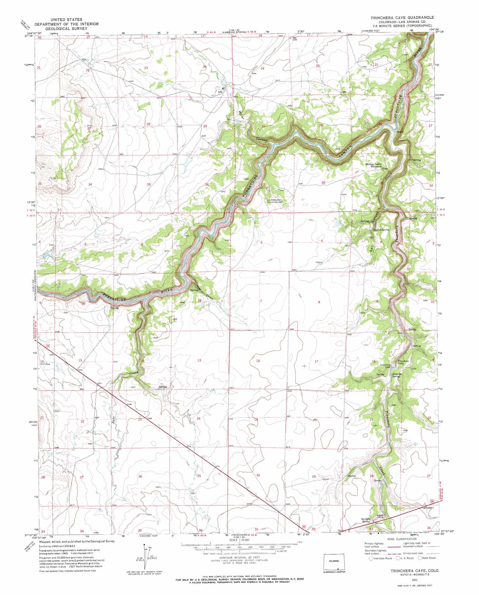
USGS Topo Quad 37104b1 - 1:24,000 scale
| Topo Map Name: | Trinchera Cave |
| USGS Topo Quad ID: | 37104b1 |
| Print Size: | ca. 21 1/4" wide x 27" high |
| Southeast Coordinates: | 37.125° N latitude / 104° W longitude |
| Map Center Coordinates: | 37.1875° N latitude / 104.0625° W longitude |
| U.S. State: | CO |
| Filename: | o37104b1.jpg |
| Download Map JPG Image: | Trinchera Cave topo map 1:24,000 scale |
| Map Type: | Topographic |
| Topo Series: | 7.5´ |
| Map Scale: | 1:24,000 |
| Source of Map Images: | United States Geological Survey (USGS) |
| Alternate Map Versions: |
Trinchera Cave CO 1971, updated 1973 Download PDF Buy paper map Trinchera Cave CO 1971, updated 1973 Download PDF Buy paper map Purgatoire Canyon CO 2010 Download PDF Buy paper map Purgatoire Canyon CO 2013 Download PDF Buy paper map Purgatoire Canyon CO 2016 Download PDF Buy paper map |
1:24,000 Topo Quads surrounding Trinchera Cave
Seven Lakes Reservoir |
Tyrone |
Brown Sheep Camp |
Rock Crossing |
Doss Canyon North |
Earl |
Model |
Lambing Spring |
Painted Canyon |
Doss Canyon South |
Mooney Hills |
Patterson Crossing |
Trinchera Cave |
Trementina Canyon |
Box Ranch |
Barela |
Abeyta |
Trinchera |
Branson |
Branson Se |
Yankee |
Dale Mountain |
Trinchera Pass |
Alps Mesa |
Emery Peak |
> Back to 37104a1 at 1:100,000 scale
> Back to 37104a1 at 1:250,000 scale
> Back to U.S. Topo Maps home
Trinchera Cave topo map: Gazetteer
Trinchera Cave: Falls
Trinchera Falls elevation 1652m 5419′Trinchera Cave: Springs
Eastside Spring elevation 1663m 5456′Million Dollar Water Hole elevation 1678m 5505′
Rail O Spring elevation 1629m 5344′
Surratt Spring elevation 1708m 5603′
Trinchera Cave: Streams
Salt Creek elevation 1608m 5275′Trinchera Creek elevation 1560m 5118′
Trinchera Cave: Valleys
Miller Canyon elevation 1582m 5190′Perea Canyon elevation 1598m 5242′
Rail Canyon elevation 1584m 5196′
Trinchera Cave digital topo map on disk
Buy this Trinchera Cave topo map showing relief, roads, GPS coordinates and other geographical features, as a high-resolution digital map file on DVD: