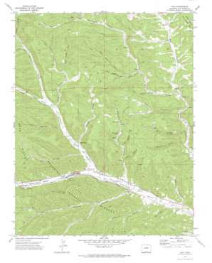
Vigil Topo Map Colorado
To zoom in, hover over the map of Vigil
USGS Topo Quad 37104b8 - 1:24,000 scale
| Topo Map Name: | Vigil |
| USGS Topo Quad ID: | 37104b8 |
| Print Size: | ca. 21 1/4" wide x 27" high |
| Southeast Coordinates: | 37.125° N latitude / 104.875° W longitude |
| Map Center Coordinates: | 37.1875° N latitude / 104.9375° W longitude |
| U.S. State: | CO |
| Filename: | o37104b8.jpg |
| Download Map JPG Image: | Vigil topo map 1:24,000 scale |
| Map Type: | Topographic |
| Topo Series: | 7.5´ |
| Map Scale: | 1:24,000 |
| Source of Map Images: | United States Geological Survey (USGS) |
| Alternate Map Versions: |
Vigil CO 1971, updated 1974 Download PDF Buy paper map Vigil CO 2010 Download PDF Buy paper map Vigil CO 2013 Download PDF Buy paper map Vigil CO 2016 Download PDF Buy paper map |
1:24,000 Topo Quads surrounding Vigil
> Back to 37104a1 at 1:100,000 scale
> Back to 37104a1 at 1:250,000 scale
> Back to U.S. Topo Maps home
Vigil topo map: Gazetteer
Vigil: Mines
Allen Mine elevation 2555m 8382′Allen Mine elevation 2278m 7473′
Vigil: Populated Places
Parras Plaza elevation 2282m 7486′Vigil elevation 2245m 7365′
Zamara elevation 2189m 7181′
Vigil: Ranges
Pete Hills elevation 2540m 8333′Vigil: Streams
Coal Creek elevation 2418m 7933′Guajatoyah Creek elevation 2340m 7677′
Middle Fork Purgatoire River elevation 2218m 7276′
North Fork Purgatoire River elevation 2218m 7276′
Vigil: Valleys
Apache Canyon elevation 2183m 7162′Ciruela Canyon elevation 2178m 7145′
Cove Canyon elevation 2222m 7290′
Dude Canyon elevation 2316m 7598′
Hicks Canyon elevation 2448m 8031′
Left Fork Apache Canyon elevation 2245m 7365′
Left Hand Fork Dude Canyon elevation 2336m 7664′
Logging Canyon elevation 2326m 7631′
North Canyon elevation 2290m 7513′
Pando Canyon elevation 2311m 7582′
Parras Canyon elevation 2273m 7457′
Pete Canyon elevation 2263m 7424′
Pratt Canyon elevation 2192m 7191′
Right Hand Fork Dude Canyon elevation 2336m 7664′
Right Hand Fork Logging Canyon elevation 2387m 7831′
San Pablo Canyon elevation 2248m 7375′
Santistevan Canyon elevation 2199m 7214′
Sawmill Canyon elevation 2183m 7162′
Snake Canyon elevation 2263m 7424′
Stonewall Valley elevation 2237m 7339′
Vigil digital topo map on disk
Buy this Vigil topo map showing relief, roads, GPS coordinates and other geographical features, as a high-resolution digital map file on DVD:


