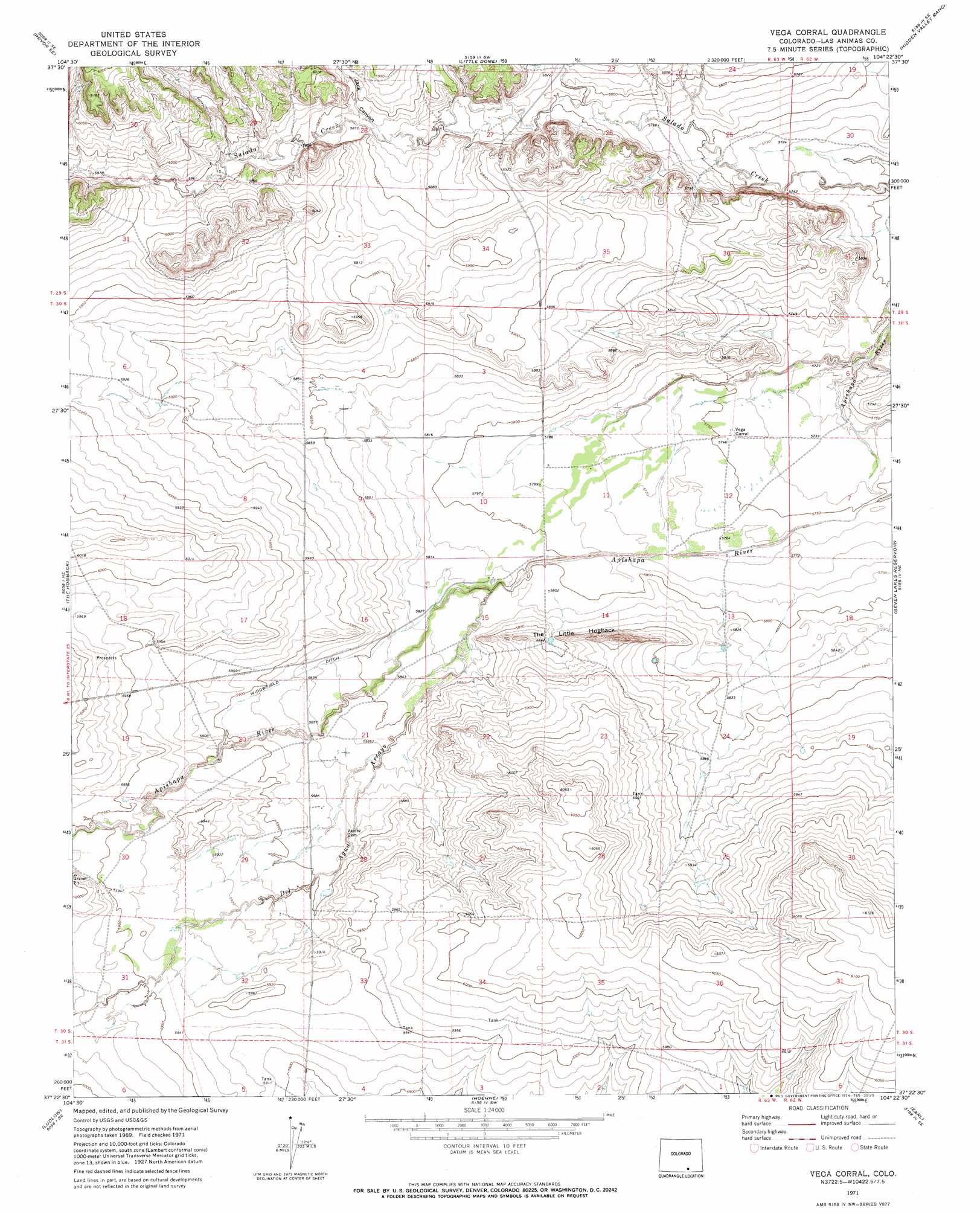
Vega Corral Topo Map Colorado
To zoom in, hover over the map of Vega Corral
USGS Topo Quad 37104d4 - 1:24,000 scale
| Topo Map Name: | Vega Corral |
| USGS Topo Quad ID: | 37104d4 |
| Print Size: | ca. 21 1/4" wide x 27" high |
| Southeast Coordinates: | 37.375° N latitude / 104.375° W longitude |
| Map Center Coordinates: | 37.4375° N latitude / 104.4375° W longitude |
| U.S. State: | CO |
| Filename: | o37104d4.jpg |
| Download Map JPG Image: | Vega Corral topo map 1:24,000 scale |
| Map Type: | Topographic |
| Topo Series: | 7.5´ |
| Map Scale: | 1:24,000 |
| Source of Map Images: | United States Geological Survey (USGS) |
| Alternate Map Versions: |
Vega Corral CO 1971, updated 1974 Download PDF Buy paper map Vega Corral CO 2010 Download PDF Buy paper map Vega Corral CO 2013 Download PDF Buy paper map Vega Corral CO 2016 Download PDF Buy paper map |
1:24,000 Topo Quads surrounding Vega Corral
Maria Reservoir |
Cucharas Reservoir |
South Rattlesnake Butte |
Jones Lake Spring |
Sun Valley Ranch |
Pryor |
Pryor Se |
Little Dome |
Hidden Valley Ranch |
Bates Lake |
Aguilar |
The Hogback |
Vega Corral |
Seven Lakes Reservoir |
Tyrone |
Delagua |
Ludlow |
Hoehne |
Earl |
Model |
Madrid |
Trinidad West |
Trinidad East |
Mooney Hills |
Patterson Crossing |
> Back to 37104a1 at 1:100,000 scale
> Back to 37104a1 at 1:250,000 scale
> Back to U.S. Topo Maps home
Vega Corral topo map: Gazetteer
Vega Corral: Canals
Windowfield Ditch elevation 1794m 5885′Vega Corral: Ridges
The Little Hogback elevation 1782m 5846′Vega Corral: Streams
Del Aqua Arroyo elevation 1772m 5813′Vega Corral: Valleys
Jack Canyon elevation 1790m 5872′Vega Corral digital topo map on disk
Buy this Vega Corral topo map showing relief, roads, GPS coordinates and other geographical features, as a high-resolution digital map file on DVD: