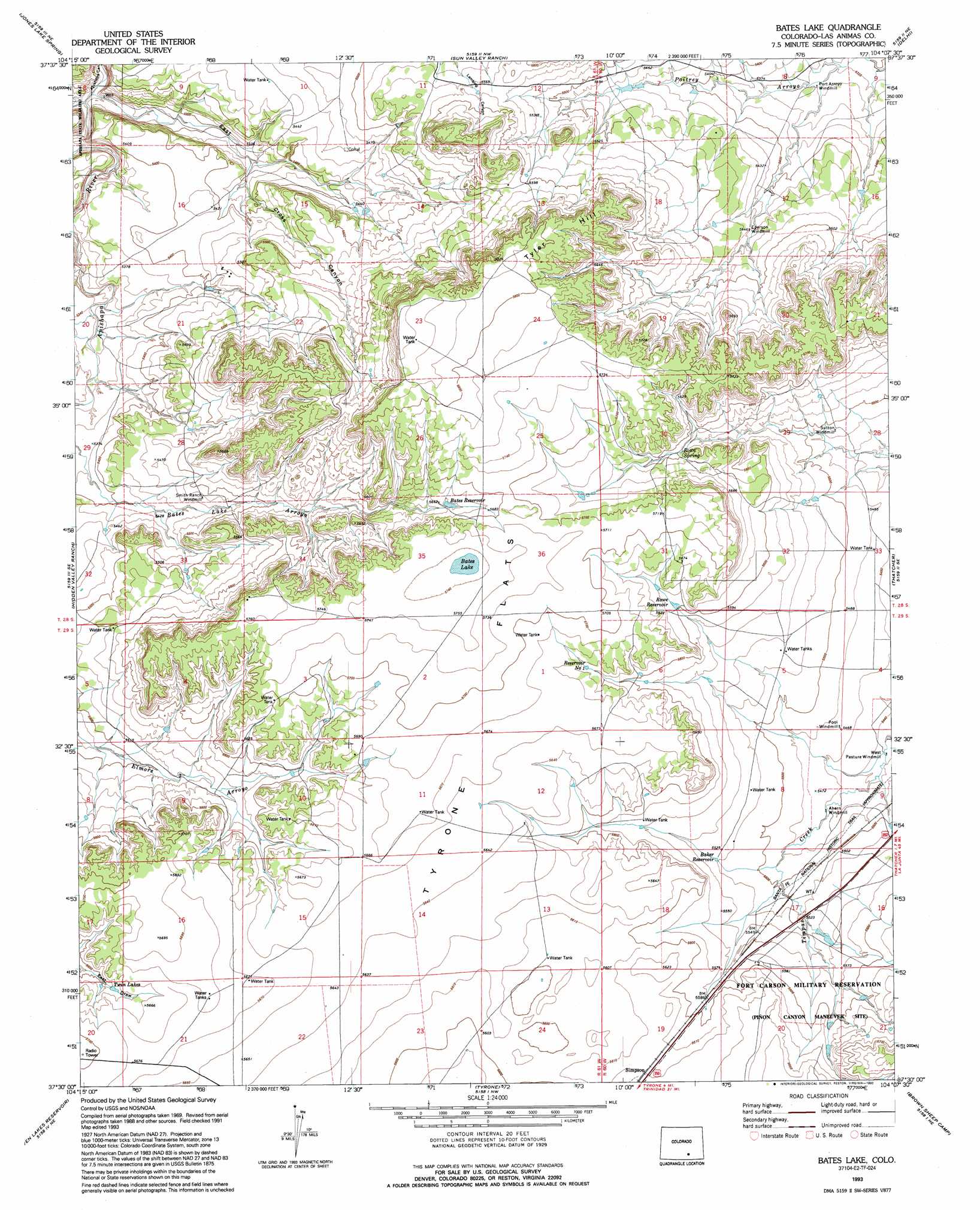
Bates Lake Topo Map Colorado
To zoom in, hover over the map of Bates Lake
USGS Topo Quad 37104e2 - 1:24,000 scale
| Topo Map Name: | Bates Lake |
| USGS Topo Quad ID: | 37104e2 |
| Print Size: | ca. 21 1/4" wide x 27" high |
| Southeast Coordinates: | 37.5° N latitude / 104.125° W longitude |
| Map Center Coordinates: | 37.5625° N latitude / 104.1875° W longitude |
| U.S. State: | CO |
| Filename: | o37104e2.jpg |
| Download Map JPG Image: | Bates Lake topo map 1:24,000 scale |
| Map Type: | Topographic |
| Topo Series: | 7.5´ |
| Map Scale: | 1:24,000 |
| Source of Map Images: | United States Geological Survey (USGS) |
| Alternate Map Versions: |
Bates Lake CO 1971, updated 1974 Download PDF Buy paper map Bates Lake CO 1971, updated 1974 Download PDF Buy paper map Bates Lake CO 1993, updated 1993 Download PDF Buy paper map Bates Lake CO 2010 Download PDF Buy paper map Bates Lake CO 2013 Download PDF Buy paper map Bates Lake CO 2016 Download PDF Buy paper map |
1:24,000 Topo Quads surrounding Bates Lake
North Rattlesnake Butte |
Myers Canyon |
Sanford Hills |
Snowden Lake |
Timpas Sw |
South Rattlesnake Butte |
Jones Lake Spring |
Sun Valley Ranch |
Delhi |
Bloom |
Little Dome |
Hidden Valley Ranch |
Bates Lake |
Thatcher |
Lockwood Arroyo |
Vega Corral |
Seven Lakes Reservoir |
Tyrone |
Brown Sheep Camp |
Rock Crossing |
Hoehne |
Earl |
Model |
Lambing Spring |
Painted Canyon |
> Back to 37104e1 at 1:100,000 scale
> Back to 37104a1 at 1:250,000 scale
> Back to U.S. Topo Maps home
Bates Lake topo map: Gazetteer
Bates Lake: Flats
Tyrone Flats elevation 1721m 5646′Bates Lake: Lakes
Bates Lake elevation 1750m 5741′Twin Lakes elevation 1715m 5626′
Bates Lake: Reservoirs
Baker Reservoir elevation 1684m 5524′Bates Reservoir elevation 1726m 5662′
Rowe Reservoir elevation 1707m 5600′
Bates Lake: Springs
Rowe Spring elevation 1702m 5583′Bates Lake: Summits
Tyler Hill elevation 1767m 5797′Bates Lake: Valleys
East Cross Canyon elevation 1595m 5232′West Cross Canyon elevation 1597m 5239′
Bates Lake digital topo map on disk
Buy this Bates Lake topo map showing relief, roads, GPS coordinates and other geographical features, as a high-resolution digital map file on DVD: