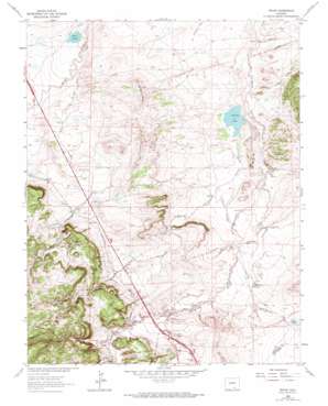
Pryor Topo Map Colorado
To zoom in, hover over the map of Pryor
USGS Topo Quad 37104e6 - 1:24,000 scale
| Topo Map Name: | Pryor |
| USGS Topo Quad ID: | 37104e6 |
| Print Size: | ca. 21 1/4" wide x 27" high |
| Southeast Coordinates: | 37.5° N latitude / 104.625° W longitude |
| Map Center Coordinates: | 37.5625° N latitude / 104.6875° W longitude |
| U.S. State: | CO |
| Filename: | o37104e6.jpg |
| Download Map JPG Image: | Pryor topo map 1:24,000 scale |
| Map Type: | Topographic |
| Topo Series: | 7.5´ |
| Map Scale: | 1:24,000 |
| Source of Map Images: | United States Geological Survey (USGS) |
| Alternate Map Versions: |
Pryor CO 1963, updated 1966 Download PDF Buy paper map Pryor CO 1963, updated 1966 Download PDF Buy paper map Pryor CO 1963, updated 1974 Download PDF Buy paper map Pryor CO 2010 Download PDF Buy paper map Pryor CO 2013 Download PDF Buy paper map Pryor CO 2016 Download PDF Buy paper map |
1:24,000 Topo Quads surrounding Pryor
> Back to 37104e1 at 1:100,000 scale
> Back to 37104a1 at 1:250,000 scale
> Back to U.S. Topo Maps home
Pryor topo map: Gazetteer
Pryor: Dams
Antonio Valdez Dam elevation 1851m 6072′Chapman Reservoir Dam elevation 1869m 6131′
Levy Dam elevation 1876m 6154′
Pryor: Lakes
Stanley Lake elevation 1908m 6259′Pryor: Mines
Blue Blaze Mine elevation 1979m 6492′Caprock Mine elevation 1995m 6545′
Hezron Mines elevation 2032m 6666′
Lester Mine elevation 1994m 6541′
Midway Mine elevation 1982m 6502′
New Pryor Mine elevation 2005m 6578′
Old Rouse Mine elevation 1995m 6545′
Primrose Mine elevation 1922m 6305′
Pryor Mine elevation 2009m 6591′
Rugby Mine elevation 1951m 6400′
Viking Mine elevation 1984m 6509′
Pryor: Populated Places
Monson elevation 1952m 6404′Pryor elevation 1957m 6420′
Pryor: Reservoirs
Farr Lake elevation 1869m 6131′Farr Lake elevation 1863m 6112′
Levy Reservoir elevation 1876m 6154′
Saliba Lake elevation 1852m 6076′
Pryor: Slopes
Saliba Mesa elevation 1980m 6496′Pryor: Streams
Mayne Arroyo elevation 1866m 6122′Pryor: Summits
Bunker Hill elevation 1973m 6473′Tombstone Hill elevation 1902m 6240′
Pryor: Valleys
Black Hawk Canyon elevation 1959m 6427′Hezron Gulch elevation 1854m 6082′
Pryor Canyon elevation 1964m 6443′
Pryor digital topo map on disk
Buy this Pryor topo map showing relief, roads, GPS coordinates and other geographical features, as a high-resolution digital map file on DVD:


