Cucharas Reservoir Topo Map Colorado
To zoom in, hover over the map of Cucharas Reservoir
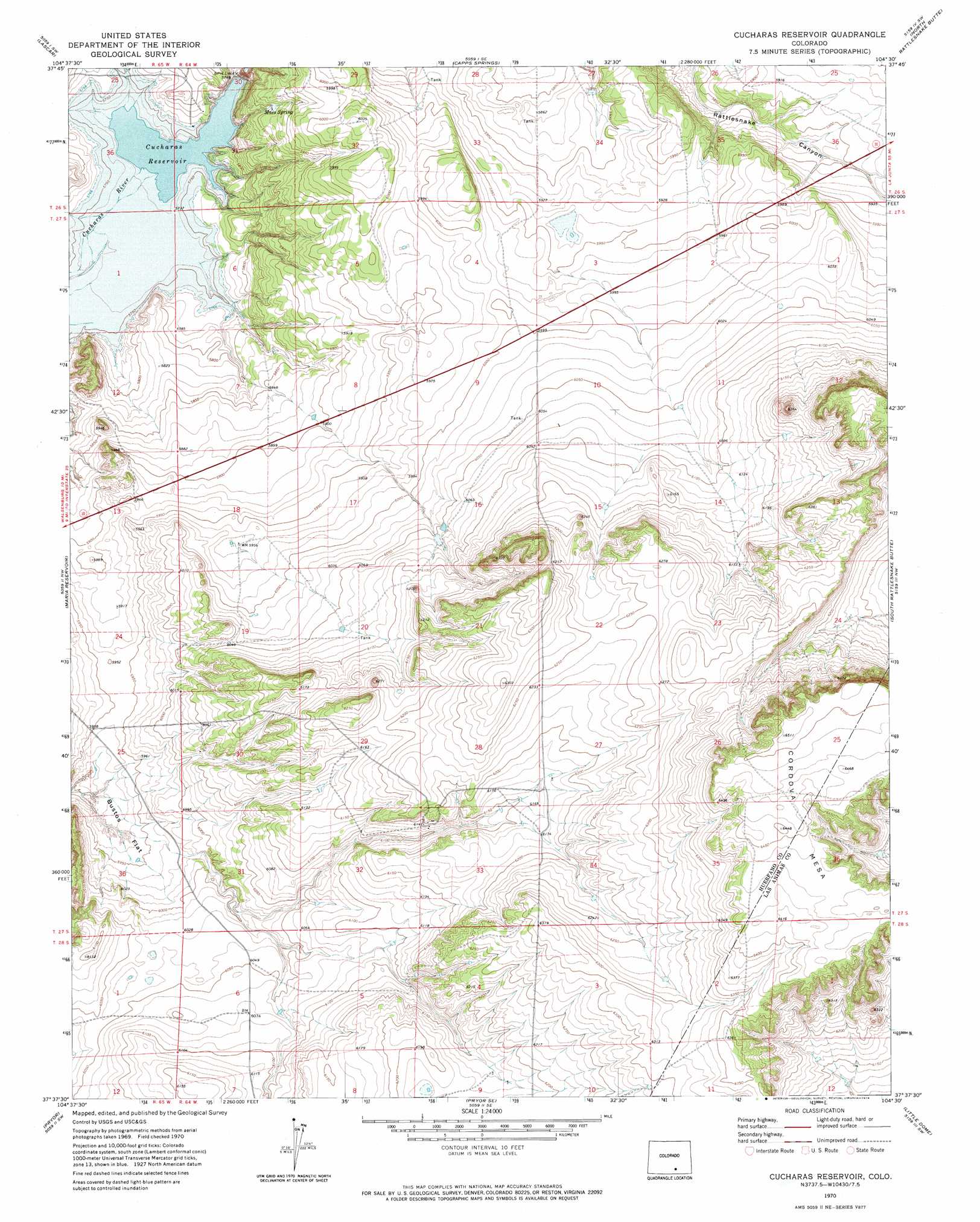
USGS Topo Quad 37104f5 - 1:24,000 scale
| Topo Map Name: | Cucharas Reservoir |
| USGS Topo Quad ID: | 37104f5 |
| Print Size: | ca. 21 1/4" wide x 27" high |
| Southeast Coordinates: | 37.625° N latitude / 104.5° W longitude |
| Map Center Coordinates: | 37.6875° N latitude / 104.5625° W longitude |
| U.S. State: | CO |
| Filename: | o37104f5.jpg |
| Download Map JPG Image: | Cucharas Reservoir topo map 1:24,000 scale |
| Map Type: | Topographic |
| Topo Series: | 7.5´ |
| Map Scale: | 1:24,000 |
| Source of Map Images: | United States Geological Survey (USGS) |
| Alternate Map Versions: |
Cucharas Reservoir CO 1970, updated 1974 Download PDF Buy paper map Cucharas Reservoir CO 2010 Download PDF Buy paper map Cucharas Reservoir CO 2013 Download PDF Buy paper map Cucharas Reservoir CO 2016 Download PDF Buy paper map |
1:24,000 Topo Quads surrounding Cucharas Reservoir
Colorado City |
Graneros Flats |
Cedarwood |
Hog Ranch Canyon |
Red Top Ranch |
Huerfano Butte |
Lascar |
Capps Springs |
North Rattlesnake Butte |
Myers Canyon |
Walsenburg North |
Maria Reservoir |
Cucharas Reservoir |
South Rattlesnake Butte |
Jones Lake Spring |
Walsenburg South |
Pryor |
Pryor Se |
Little Dome |
Hidden Valley Ranch |
Santa Clara |
Aguilar |
The Hogback |
Vega Corral |
Seven Lakes Reservoir |
> Back to 37104e1 at 1:100,000 scale
> Back to 37104a1 at 1:250,000 scale
> Back to U.S. Topo Maps home
Cucharas Reservoir topo map: Gazetteer
Cucharas Reservoir: Dams
Cucharas Number 5 Dam elevation 1782m 5846′Cucharas Reservoir: Flats
Bustos Flat elevation 1809m 5935′Cucharas Reservoir: Reservoirs
Cucharas Reservoir elevation 1758m 5767′Cucharas Valley Reservoir Number 5 elevation 1782m 5846′
Cucharas Reservoir: Springs
Maes Spring elevation 1793m 5882′Cucharas Reservoir: Summits
Cordova Mesa elevation 1986m 6515′Cucharas Reservoir digital topo map on disk
Buy this Cucharas Reservoir topo map showing relief, roads, GPS coordinates and other geographical features, as a high-resolution digital map file on DVD: