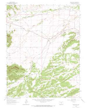
Black Hills Topo Map Colorado
To zoom in, hover over the map of Black Hills
USGS Topo Quad 37104f8 - 1:24,000 scale
| Topo Map Name: | Black Hills |
| USGS Topo Quad ID: | 37104f8 |
| Print Size: | ca. 21 1/4" wide x 27" high |
| Southeast Coordinates: | 37.625° N latitude / 104.875° W longitude |
| Map Center Coordinates: | 37.6875° N latitude / 104.9375° W longitude |
| U.S. State: | CO |
| Filename: | o37104f8.jpg |
| Download Map JPG Image: | Black Hills topo map 1:24,000 scale |
| Map Type: | Topographic |
| Topo Series: | 7.5´ |
| Map Scale: | 1:24,000 |
| Source of Map Images: | United States Geological Survey (USGS) |
| Alternate Map Versions: |
Black Hills CO 1963, updated 1966 Download PDF Buy paper map Black Hills CO 2010 Download PDF Buy paper map Black Hills CO 2013 Download PDF Buy paper map Black Hills CO 2016 Download PDF Buy paper map |
1:24,000 Topo Quads surrounding Black Hills
> Back to 37104e1 at 1:100,000 scale
> Back to 37104a1 at 1:250,000 scale
> Back to U.S. Topo Maps home
Black Hills topo map: Gazetteer
Black Hills: Canals
Dan Mahan Ditch elevation 1866m 6122′Martin Ditch Number 2 elevation 1944m 6377′
Pino Ditch elevation 1902m 6240′
Black Hills: Gaps
Bells Gap elevation 1933m 6341′Black Hills: Mines
Alamo Mine Number 1 elevation 2056m 6745′Barbour Mine elevation 2055m 6742′
Big Four Mine elevation 1988m 6522′
Butte Valley Mine elevation 2055m 6742′
Calumet Number One Mine elevation 1928m 6325′
Kebler Mine elevation 1977m 6486′
Kebler Number Two Mine elevation 1977m 6486′
Larrimore Mine elevation 1937m 6354′
Major Mine elevation 1932m 6338′
Shamrock Mine elevation 1947m 6387′
Sunnyside Mine elevation 1921m 6302′
Turner Mine elevation 1894m 6213′
Turner Mine elevation 1929m 6328′
Black Hills: Populated Places
Alamo elevation 2082m 6830′Delcarbon elevation 1933m 6341′
Strong elevation 1949m 6394′
Tioga elevation 1996m 6548′
Black Hills: Streams
Ojo de Alamo Arroyo elevation 1842m 6043′Black Hills: Summits
Black Hills elevation 2284m 7493′Black Hills: Valleys
Pole Canyon elevation 1866m 6122′Black Hills digital topo map on disk
Buy this Black Hills topo map showing relief, roads, GPS coordinates and other geographical features, as a high-resolution digital map file on DVD:


