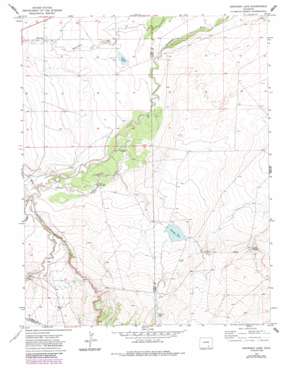
Snowden Lake Topo Map Colorado
To zoom in, hover over the map of Snowden Lake
USGS Topo Quad 37104g1 - 1:24,000 scale
| Topo Map Name: | Snowden Lake |
| USGS Topo Quad ID: | 37104g1 |
| Print Size: | ca. 21 1/4" wide x 27" high |
| Southeast Coordinates: | 37.75° N latitude / 104° W longitude |
| Map Center Coordinates: | 37.8125° N latitude / 104.0625° W longitude |
| U.S. State: | CO |
| Filename: | o37104g1.jpg |
| Download Map JPG Image: | Snowden Lake topo map 1:24,000 scale |
| Map Type: | Topographic |
| Topo Series: | 7.5´ |
| Map Scale: | 1:24,000 |
| Source of Map Images: | United States Geological Survey (USGS) |
| Alternate Map Versions: |
Snowden Lake CO 1970, updated 1974 Download PDF Buy paper map Snowden Lake CO 1970, updated 1974 Download PDF Buy paper map Snowden Lake CO 1970, updated 1985 Download PDF Buy paper map Snowden Lake CO 1970, updated 1985 Download PDF Buy paper map Snowden Lake CO 1996, updated 2000 Download PDF Buy paper map Snowden Lake CO 2011 Download PDF Buy paper map Snowden Lake CO 2013 Download PDF Buy paper map Snowden Lake CO 2016 Download PDF Buy paper map |
| FStopo: | US Forest Service topo Snowden Lake is available: Download FStopo PDF Download FStopo TIF |
1:24,000 Topo Quads surrounding Snowden Lake
> Back to 37104e1 at 1:100,000 scale
> Back to 37104a1 at 1:250,000 scale
> Back to U.S. Topo Maps home
Snowden Lake topo map: Gazetteer
Snowden Lake: Channels
Old Channel Apishapa River elevation 1431m 4694′Snowden Lake: Populated Places
Rock Crossing elevation 1460m 4790′Whiterock elevation 1437m 4714′
Snowden Lake: Reservoirs
Hixon Reservoir elevation 1512m 4960′La Pear Pond elevation 1416m 4645′
Snowden Lake elevation 1467m 4812′
Snowden Lake: Springs
Kitch Spring elevation 1443m 4734′Snowden Lake: Streams
Buffalo Arroyo elevation 1439m 4721′Twomile Arroyo elevation 1436m 4711′
Snowden Lake: Wells
North Hixon Well elevation 1435m 4708′Snowden Lake digital topo map on disk
Buy this Snowden Lake topo map showing relief, roads, GPS coordinates and other geographical features, as a high-resolution digital map file on DVD:


