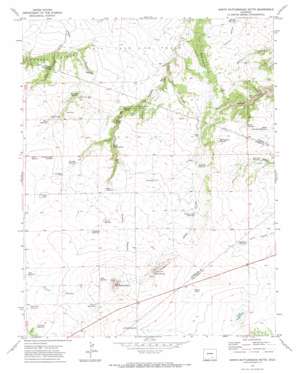
North Rattlesnake Butte Topo Map Colorado
To zoom in, hover over the map of North Rattlesnake Butte
USGS Topo Quad 37104g4 - 1:24,000 scale
| Topo Map Name: | North Rattlesnake Butte |
| USGS Topo Quad ID: | 37104g4 |
| Print Size: | ca. 21 1/4" wide x 27" high |
| Southeast Coordinates: | 37.75° N latitude / 104.375° W longitude |
| Map Center Coordinates: | 37.8125° N latitude / 104.4375° W longitude |
| U.S. State: | CO |
| Filename: | o37104g4.jpg |
| Download Map JPG Image: | North Rattlesnake Butte topo map 1:24,000 scale |
| Map Type: | Topographic |
| Topo Series: | 7.5´ |
| Map Scale: | 1:24,000 |
| Source of Map Images: | United States Geological Survey (USGS) |
| Alternate Map Versions: |
North Rattlesnake Butte CO 1971, updated 1974 Download PDF Buy paper map North Rattlesnake Butte CO 2010 Download PDF Buy paper map North Rattlesnake Butte CO 2013 Download PDF Buy paper map North Rattlesnake Butte CO 2016 Download PDF Buy paper map |
1:24,000 Topo Quads surrounding North Rattlesnake Butte
> Back to 37104e1 at 1:100,000 scale
> Back to 37104a1 at 1:250,000 scale
> Back to U.S. Topo Maps home
North Rattlesnake Butte topo map: Gazetteer
North Rattlesnake Butte: Lakes
Church Lakes elevation 1842m 6043′Deus Lake elevation 1830m 6003′
South Canyon Lake elevation 1809m 5935′
North Rattlesnake Butte: Reservoirs
Baxter Reservoir elevation 1790m 5872′Bogue Reservoir elevation 1812m 5944′
Butte Reservoir elevation 1901m 6236′
Doyle Arroyo Reservoir elevation 1805m 5921′
Gold Mine Reservoir elevation 1849m 6066′
Hans Reservoir elevation 1802m 5912′
Lambert Reservoir elevation 1863m 6112′
Lone Jack Reservoir elevation 1770m 5807′
Machatten Reservoir elevation 1760m 5774′
North Lone Jack Reservoir elevation 1775m 5823′
Overshaun Reservoir elevation 1840m 6036′
Overton Reservoir elevation 1830m 6003′
Peterson Reservoir elevation 1734m 5688′
Pierce Reservoir elevation 1885m 6184′
Price Reservoir elevation 1833m 6013′
Reynolds Reservoir elevation 1770m 5807′
Ronfeldt Reservoir elevation 1802m 5912′
Six Thousand Reservoir elevation 1796m 5892′
Southeast Reservoir elevation 1817m 5961′
Teeple Reservoir elevation 1836m 6023′
Tickle Tank elevation 1750m 5741′
United States Government Reservoir elevation 1829m 6000′
North Rattlesnake Butte: Ridges
Hogback elevation 1891m 6204′The Beardsley elevation 1740m 5708′
North Rattlesnake Butte: Springs
Bobins Pocket Spring elevation 1717m 5633′Dime Spring elevation 1691m 5547′
Duran Spring elevation 1858m 6095′
Pacheco Spring elevation 1725m 5659′
Upper Woodey Spring elevation 1778m 5833′
Woodey Spring elevation 1748m 5734′
North Rattlesnake Butte: Summits
North Rattlesnake Butte elevation 1957m 6420′North Rattlesnake Butte: Valleys
East Turkey Canyon elevation 1701m 5580′Tinaja Canyon elevation 1682m 5518′
North Rattlesnake Butte: Wells
Becker Well elevation 1785m 5856′Center Well elevation 1803m 5915′
Machatten Well elevation 1755m 5757′
Oxbow Well elevation 1744m 5721′
Teeple Well elevation 1818m 5964′
West Well elevation 1787m 5862′
North Rattlesnake Butte digital topo map on disk
Buy this North Rattlesnake Butte topo map showing relief, roads, GPS coordinates and other geographical features, as a high-resolution digital map file on DVD:


