Red Top Ranch Topo Map Colorado
To zoom in, hover over the map of Red Top Ranch
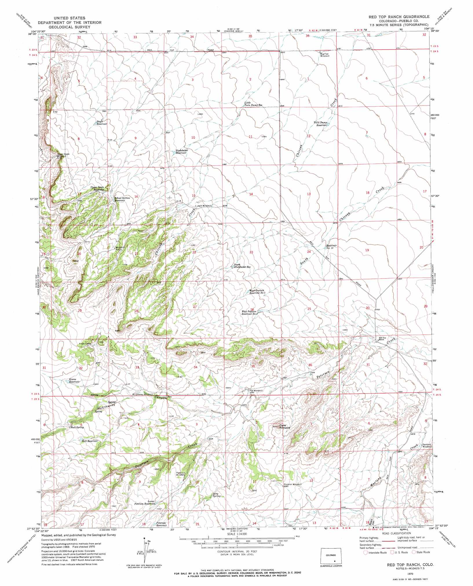
USGS Topo Quad 37104h3 - 1:24,000 scale
| Topo Map Name: | Red Top Ranch |
| USGS Topo Quad ID: | 37104h3 |
| Print Size: | ca. 21 1/4" wide x 27" high |
| Southeast Coordinates: | 37.875° N latitude / 104.25° W longitude |
| Map Center Coordinates: | 37.9375° N latitude / 104.3125° W longitude |
| U.S. State: | CO |
| Filename: | o37104h3.jpg |
| Download Map JPG Image: | Red Top Ranch topo map 1:24,000 scale |
| Map Type: | Topographic |
| Topo Series: | 7.5´ |
| Map Scale: | 1:24,000 |
| Source of Map Images: | United States Geological Survey (USGS) |
| Alternate Map Versions: |
Red Top Ranch CO 1970, updated 1973 Download PDF Buy paper map Red Top Ranch CO 2010 Download PDF Buy paper map Red Top Ranch CO 2013 Download PDF Buy paper map Red Top Ranch CO 2016 Download PDF Buy paper map |
1:24,000 Topo Quads surrounding Red Top Ranch
Southeast Pueblo |
Vineland |
Avondale |
Nepesta |
Fowler |
Goat Butte |
Doyle Bridge |
Chicos Well |
Flying A Ranch |
Hardesty Reservoir |
Cedarwood |
Hog Ranch Canyon |
Red Top Ranch |
Yellowbank Creek |
Apishapa Bridge |
Capps Springs |
North Rattlesnake Butte |
Myers Canyon |
Sanford Hills |
Snowden Lake |
Cucharas Reservoir |
South Rattlesnake Butte |
Jones Lake Spring |
Sun Valley Ranch |
Delhi |
> Back to 37104e1 at 1:100,000 scale
> Back to 37104a1 at 1:250,000 scale
> Back to U.S. Topo Maps home
Red Top Ranch topo map: Gazetteer
Red Top Ranch: Reservoirs
Doyle Reservoir elevation 1561m 5121′Kierce Reservoir elevation 1605m 5265′
Little Twin Dump Reservoir elevation 1492m 4895′
Lower Peterson Reservoir elevation 1614m 5295′
Peck Reservoir elevation 1625m 5331′
Peterson Reservoir elevation 1625m 5331′
School Section Reservoir elevation 1579m 5180′
South Studebaker Reservoir elevation 1554m 5098′
Studebaker Reservoir elevation 1532m 5026′
Twin Dump Reservoir elevation 1473m 4832′
Upper Doyle Reservoir elevation 1580m 5183′
West Pasture Reservoir Number 1 elevation 1556m 5104′
West Pasture Reservoir Number 2 elevation 1554m 5098′
Red Top Ranch: Springs
Airy Spring elevation 1569m 5147′Peck Spring elevation 1623m 5324′
Red Top Ranch: Streams
Plum Creek elevation 1500m 4921′Red Top Ranch: Summits
Cone Pinnacle elevation 1590m 5216′Red Top Ranch: Valleys
McElhaney Canyon elevation 1512m 4960′Myers Canyon elevation 1500m 4921′
Red Top Ranch digital topo map on disk
Buy this Red Top Ranch topo map showing relief, roads, GPS coordinates and other geographical features, as a high-resolution digital map file on DVD: