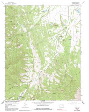
Cuchara Topo Map Colorado
To zoom in, hover over the map of Cuchara
USGS Topo Quad 37105d1 - 1:24,000 scale
| Topo Map Name: | Cuchara |
| USGS Topo Quad ID: | 37105d1 |
| Print Size: | ca. 21 1/4" wide x 27" high |
| Southeast Coordinates: | 37.375° N latitude / 105° W longitude |
| Map Center Coordinates: | 37.4375° N latitude / 105.0625° W longitude |
| U.S. State: | CO |
| Filename: | o37105d1.jpg |
| Download Map JPG Image: | Cuchara topo map 1:24,000 scale |
| Map Type: | Topographic |
| Topo Series: | 7.5´ |
| Map Scale: | 1:24,000 |
| Source of Map Images: | United States Geological Survey (USGS) |
| Alternate Map Versions: |
Cuchara CO 1963, updated 1966 Download PDF Buy paper map Cuchara CO 1963, updated 1966 Download PDF Buy paper map Cuchara CO 1963, updated 1972 Download PDF Buy paper map Cuchara CO 1963, updated 1991 Download PDF Buy paper map Cuchara CO 1967, updated 1986 Download PDF Buy paper map Cuchara CO 1967, updated 1986 Download PDF Buy paper map Cuchara CO 1994, updated 2001 Download PDF Buy paper map Cuchara CO 2011 Download PDF Buy paper map Cuchara CO 2013 Download PDF Buy paper map Cuchara CO 2016 Download PDF Buy paper map |
| FStopo: | US Forest Service topo Cuchara is available: Download FStopo PDF Download FStopo TIF |
1:24,000 Topo Quads surrounding Cuchara
> Back to 37105a1 at 1:100,000 scale
> Back to 37104a1 at 1:250,000 scale
> Back to U.S. Topo Maps home
Cuchara topo map: Gazetteer
Cuchara: Canals
Butte Ditch elevation 2253m 7391′Echo Ditch elevation 2425m 7956′
Spanish Peaks Ditch elevation 2234m 7329′
Cuchara: Dams
Fielden Dam elevation 2319m 7608′H R Carson Number 1 Dam elevation 2244m 7362′
H R Carson Number 2 Dam elevation 2238m 7342′
La Veta Lake North Dam elevation 2218m 7276′
La Veta Lake South Dam elevation 2218m 7276′
Cuchara: Lakes
Mexican Lake elevation 2283m 7490′Mountain Lake elevation 2555m 8382′
Rock Lake elevation 2371m 7778′
Cuchara: Mines
Linscott Mine elevation 2528m 8293′Spanish Peaks Mine elevation 2834m 9297′
Wonder Mine elevation 2379m 7805′
Cuchara: Pillars
Profile Rock elevation 2354m 7723′Sawtooth Rock elevation 2779m 9117′
Cuchara: Populated Places
Cuchara elevation 2581m 8467′Cuchara: Post Offices
Cuchara Camps Post Office (historical) elevation 2581m 8467′Cuchara: Reservoirs
Butte Reservoir elevation 2237m 7339′Fielden Reservoir elevation 2319m 7608′
H R Carson Reservoir elevation 2240m 7349′
H R Carson Reservoir Number 1 elevation 2244m 7362′
H R Carson Reservoir Number 2 elevation 2238m 7342′
Hayes Reservoir elevation 2193m 7194′
HR Carson Reservoir elevation 2241m 7352′
La Veta Lake North Reservoir elevation 2218m 7276′
La Veta Town Reservoir elevation 2218m 7276′
Marker Lake elevation 2221m 7286′
McDonald Reservoir elevation 2341m 7680′
Town Lakes elevation 2220m 7283′
Cuchara: Ridges
Devils Stairsteps elevation 2494m 8182′Echo Ridge elevation 2650m 8694′
Piney Ridge elevation 2577m 8454′
Cuchara: Springs
Sulphur Springs elevation 2425m 7956′Cuchara: Streams
Bend Creek elevation 2536m 8320′Big Branch elevation 2482m 8143′
Big Branch Cucharas Creek elevation 2485m 8152′
Bonnett Creek elevation 2558m 8392′
Chaparral Creek elevation 2427m 7962′
Dodgeton Creek elevation 2600m 8530′
Echo Creek elevation 2266m 7434′
Little Echo Creek elevation 2546m 8353′
Price Creek elevation 2464m 8083′
Rilling Creek elevation 2252m 7388′
White Creek elevation 2458m 8064′
Cuchara: Summits
Goemmer Butte elevation 2419m 7936′Kruger Mountain elevation 2874m 9429′
North White Peak elevation 3072m 10078′
Cuchara: Trails
Black Hills Trail elevation 2798m 9179′Cuchara: Valleys
Barnes Canyon elevation 2395m 7857′Coleman Canyon elevation 2405m 7890′
Copper King Canyon elevation 2354m 7723′
Cottonwood Canyon elevation 2493m 8179′
Dry Gulch elevation 2622m 8602′
Echo Canyon elevation 2301m 7549′
Hope Gulch elevation 2482m 8143′
Huestes Canyon elevation 2337m 7667′
Magpie Canyon elevation 2358m 7736′
Price Canyon elevation 2476m 8123′
Rilling Canyon elevation 2267m 7437′
Tracy Canyon elevation 2489m 8166′
Vories Canyon elevation 2440m 8005′
Wade Canyon elevation 2365m 7759′
Cuchara digital topo map on disk
Buy this Cuchara topo map showing relief, roads, GPS coordinates and other geographical features, as a high-resolution digital map file on DVD:


