Fort Garland Topo Map Colorado
To zoom in, hover over the map of Fort Garland
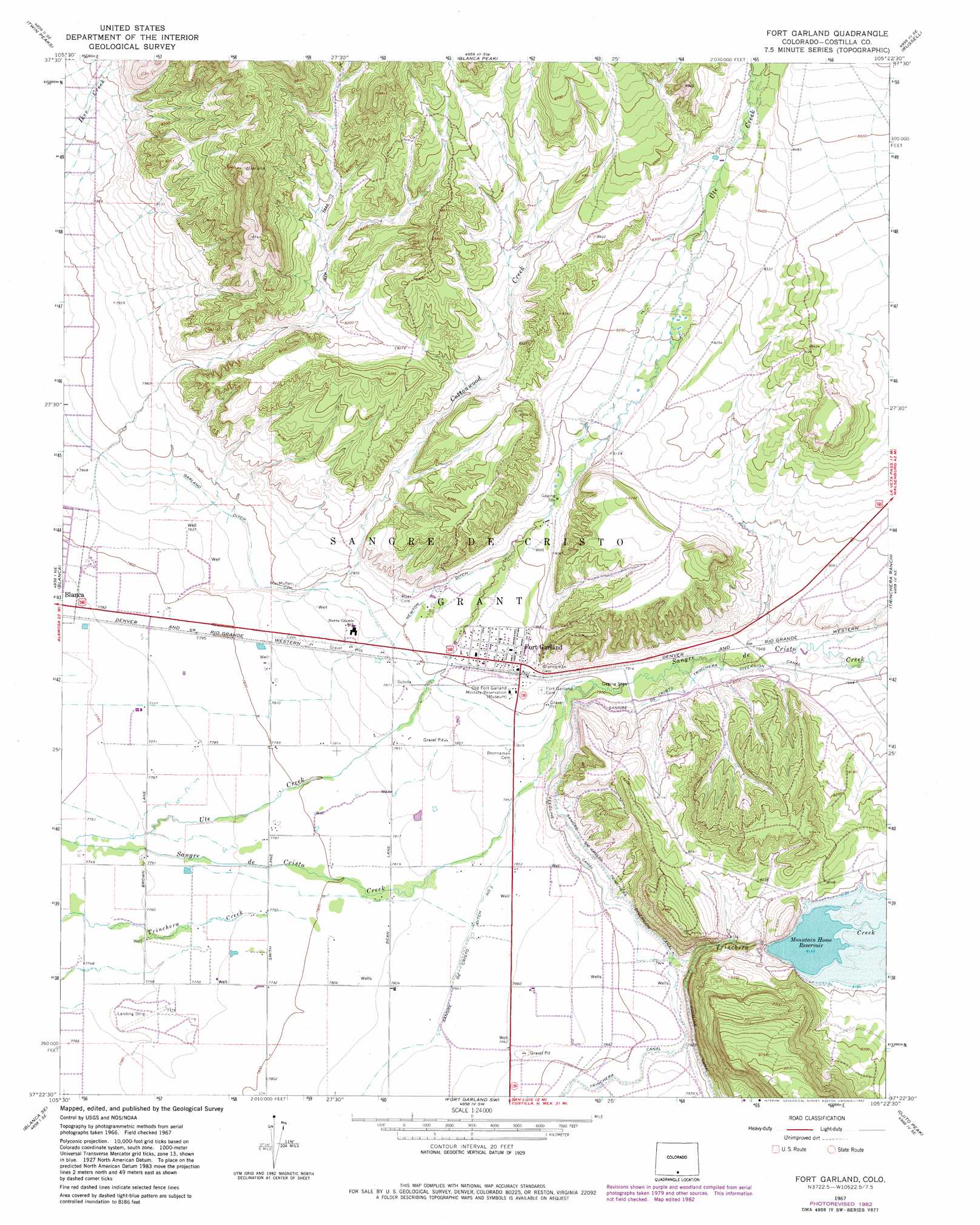
USGS Topo Quad 37105d4 - 1:24,000 scale
| Topo Map Name: | Fort Garland |
| USGS Topo Quad ID: | 37105d4 |
| Print Size: | ca. 21 1/4" wide x 27" high |
| Southeast Coordinates: | 37.375° N latitude / 105.375° W longitude |
| Map Center Coordinates: | 37.4375° N latitude / 105.4375° W longitude |
| U.S. State: | CO |
| Filename: | o37105d4.jpg |
| Download Map JPG Image: | Fort Garland topo map 1:24,000 scale |
| Map Type: | Topographic |
| Topo Series: | 7.5´ |
| Map Scale: | 1:24,000 |
| Source of Map Images: | United States Geological Survey (USGS) |
| Alternate Map Versions: |
Fort Garland CO 1967, updated 1971 Download PDF Buy paper map Fort Garland CO 1967, updated 1971 Download PDF Buy paper map Fort Garland CO 1967, updated 1982 Download PDF Buy paper map Fort Garland CO 2010 Download PDF Buy paper map Fort Garland CO 2013 Download PDF Buy paper map Fort Garland CO 2016 Download PDF Buy paper map |
1:24,000 Topo Quads surrounding Fort Garland
Medano Ranch |
Zapata Ranch |
Mosca Pass |
Red Wing |
Little Sheep Mountain |
Dry Lakes |
Twin Peaks |
Blanca Peak |
Russell |
La Veta Pass |
Baldy |
Blanca |
Fort Garland |
Trinchera Ranch |
Mccarty Park |
Lasauses |
Blanca Se |
Fort Garland Sw |
Ojito Peak |
Trinchera Peak |
Mesito Reservoir |
San Acacio |
San Luis |
Taylor Ranch |
El Valle Creek |
> Back to 37105a1 at 1:100,000 scale
> Back to 37104a1 at 1:250,000 scale
> Back to U.S. Topo Maps home
Fort Garland topo map: Gazetteer
Fort Garland: Airports
Skinkle Landing Strip elevation 2369m 7772′Fort Garland: Canals
Feedline Canal elevation 2408m 7900′Garland Ditch elevation 2402m 7880′
Newton Ditch elevation 2426m 7959′
Sangre de Cristo Ditch Number 3 elevation 2391m 7844′
Sangre De Cristo-Trinchera Diversion Canal elevation 2419m 7936′
Fort Garland: Dams
Mountain Home Dam elevation 2500m 8202′Fort Garland: Populated Places
Fort Garland elevation 2419m 7936′Fort Garland: Reservoirs
Mountain Home Reservoir elevation 2500m 8202′Fort Garland: Streams
Cottonwood Creek elevation 2389m 7837′Ute Creek elevation 2362m 7749′
Fort Garland digital topo map on disk
Buy this Fort Garland topo map showing relief, roads, GPS coordinates and other geographical features, as a high-resolution digital map file on DVD: