Baldy Topo Map Colorado
To zoom in, hover over the map of Baldy
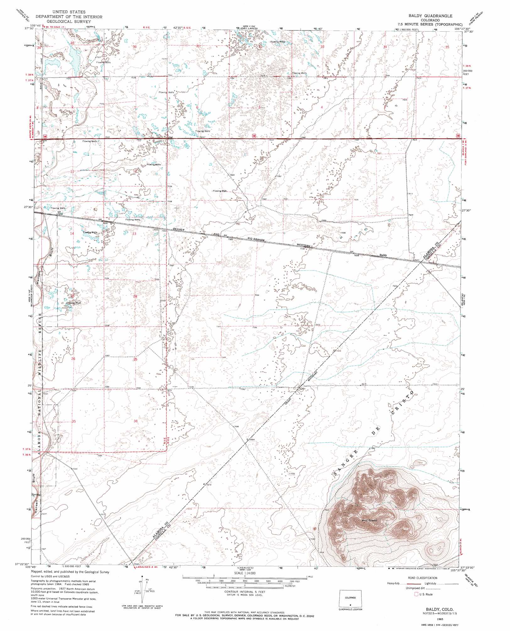
USGS Topo Quad 37105d6 - 1:24,000 scale
| Topo Map Name: | Baldy |
| USGS Topo Quad ID: | 37105d6 |
| Print Size: | ca. 21 1/4" wide x 27" high |
| Southeast Coordinates: | 37.375° N latitude / 105.625° W longitude |
| Map Center Coordinates: | 37.4375° N latitude / 105.6875° W longitude |
| U.S. State: | CO |
| Filename: | o37105d6.jpg |
| Download Map JPG Image: | Baldy topo map 1:24,000 scale |
| Map Type: | Topographic |
| Topo Series: | 7.5´ |
| Map Scale: | 1:24,000 |
| Source of Map Images: | United States Geological Survey (USGS) |
| Alternate Map Versions: |
Baldy CO 1965, updated 1968 Download PDF Buy paper map Baldy CO 1965, updated 1987 Download PDF Buy paper map Baldy CO 2010 Download PDF Buy paper map Baldy CO 2013 Download PDF Buy paper map Baldy CO 2016 Download PDF Buy paper map |
1:24,000 Topo Quads surrounding Baldy
Hooper West |
Hooper East |
Medano Ranch |
Zapata Ranch |
Mosca Pass |
Mount Pleasant School |
Hooper Se |
Dry Lakes |
Twin Peaks |
Blanca Peak |
Alamosa West |
Alamosa East |
Baldy |
Blanca |
Fort Garland |
La Jara |
Pikes Stockade |
Lasauses |
Blanca Se |
Fort Garland Sw |
Manassa |
Manassa Ne |
Mesito Reservoir |
San Acacio |
San Luis |
> Back to 37105a1 at 1:100,000 scale
> Back to 37104a1 at 1:250,000 scale
> Back to U.S. Topo Maps home
Baldy digital topo map on disk
Buy this Baldy topo map showing relief, roads, GPS coordinates and other geographical features, as a high-resolution digital map file on DVD: