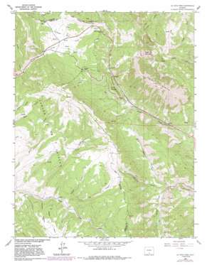
La Veta Pass Topo Map Colorado
To zoom in, hover over the map of La Veta Pass
USGS Topo Quad 37105e2 - 1:24,000 scale
| Topo Map Name: | La Veta Pass |
| USGS Topo Quad ID: | 37105e2 |
| Print Size: | ca. 21 1/4" wide x 27" high |
| Southeast Coordinates: | 37.5° N latitude / 105.125° W longitude |
| Map Center Coordinates: | 37.5625° N latitude / 105.1875° W longitude |
| U.S. State: | CO |
| Filename: | o37105e2.jpg |
| Download Map JPG Image: | La Veta Pass topo map 1:24,000 scale |
| Map Type: | Topographic |
| Topo Series: | 7.5´ |
| Map Scale: | 1:24,000 |
| Source of Map Images: | United States Geological Survey (USGS) |
| Alternate Map Versions: |
La Veta Pass CO 1963, updated 1966 Download PDF Buy paper map La Veta Pass CO 1963, updated 1966 Download PDF Buy paper map La Veta Pass CO 1963, updated 1971 Download PDF Buy paper map La Veta Pass CO 1963, updated 1971 Download PDF Buy paper map La Veta Pass CO 1963, updated 1982 Download PDF Buy paper map La Veta Pass CO 1963, updated 1991 Download PDF Buy paper map La Veta Pass CO 2010 Download PDF Buy paper map La Veta Pass CO 2013 Download PDF Buy paper map La Veta Pass CO 2016 Download PDF Buy paper map |
1:24,000 Topo Quads surrounding La Veta Pass
> Back to 37105e1 at 1:100,000 scale
> Back to 37104a1 at 1:250,000 scale
> Back to U.S. Topo Maps home
La Veta Pass topo map: Gazetteer
La Veta Pass: Cliffs
Windy Point elevation 2728m 8950′La Veta Pass: Dams
Yellowstone Dam elevation 2704m 8871′La Veta Pass: Flats
McDowell Park elevation 2777m 9110′La Veta Pass: Gaps
North La Veta Pass elevation 2873m 9425′Pass Creek Pass elevation 2859m 9379′
Sangre de Cristo Pass elevation 2886m 9468′
La Veta Pass: Mines
McGuire Mine elevation 2499m 8198′Muleshoe Mine elevation 2997m 9832′
La Veta Pass: Populated Places
Codo elevation 2583m 8474′La Veta Pass elevation 2862m 9389′
Muleshoe elevation 2680m 8792′
La Veta Pass: Reservoirs
Yellowstone Reservoir elevation 2704m 8871′La Veta Pass: Streams
Idlewild Creek elevation 2438m 7998′North Middle Creek elevation 2424m 7952′
South Middle Creek elevation 2437m 7995′
Vega Creek elevation 2612m 8569′
La Veta Pass: Summits
Dump Mountain elevation 2795m 9169′Mount Mestas elevation 3524m 11561′
Rough Mountain elevation 3395m 11138′
Wagon Mesa elevation 2761m 9058′
La Veta Pass: Valleys
Chimney Canyon elevation 2621m 8599′Mexican Canyon elevation 2681m 8795′
Stearns Gulch elevation 2708m 8884′
Toll Canyon elevation 2657m 8717′
La Veta Pass digital topo map on disk
Buy this La Veta Pass topo map showing relief, roads, GPS coordinates and other geographical features, as a high-resolution digital map file on DVD:


