Little Sheep Mountain Topo Map Colorado
To zoom in, hover over the map of Little Sheep Mountain
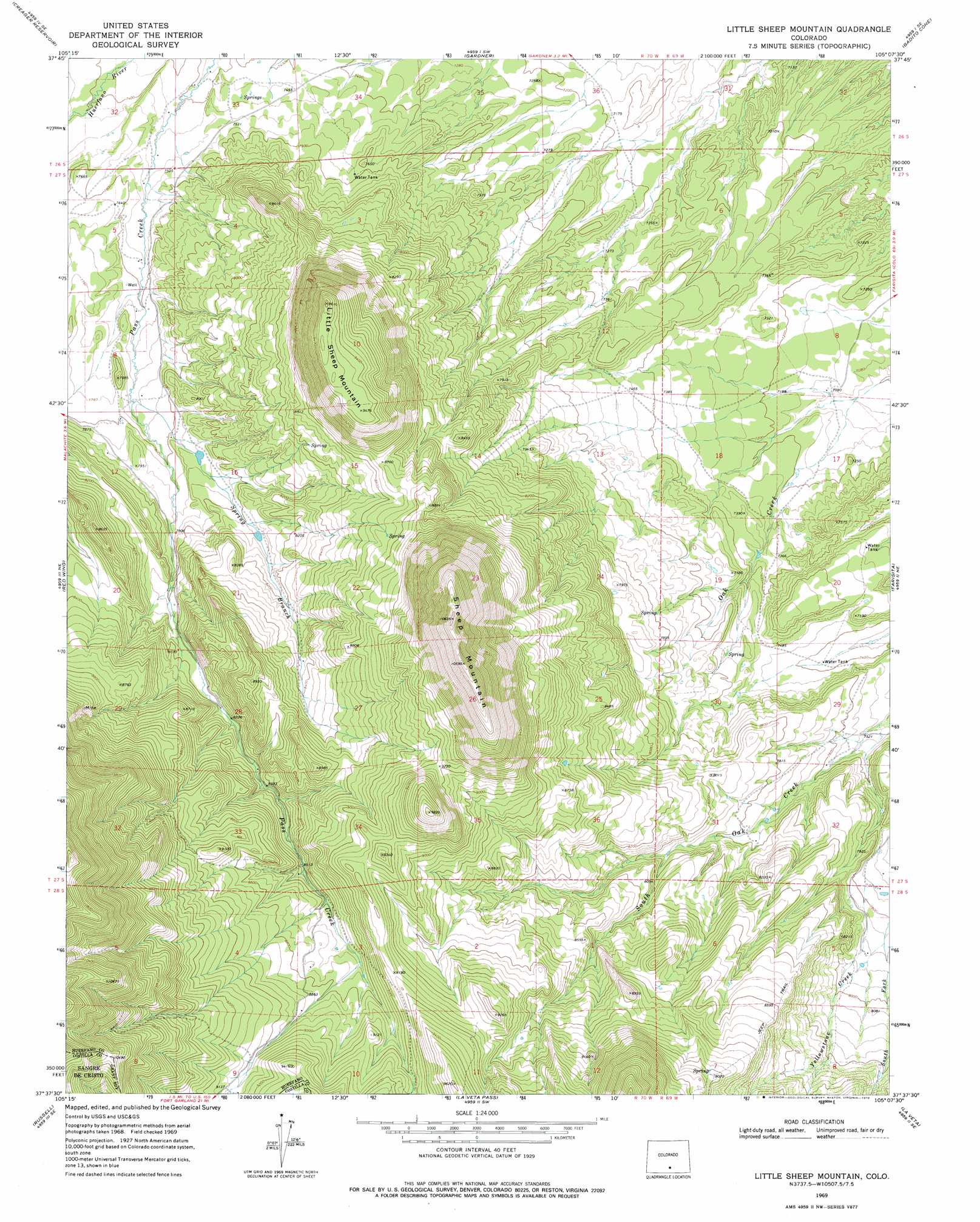
USGS Topo Quad 37105f2 - 1:24,000 scale
| Topo Map Name: | Little Sheep Mountain |
| USGS Topo Quad ID: | 37105f2 |
| Print Size: | ca. 21 1/4" wide x 27" high |
| Southeast Coordinates: | 37.625° N latitude / 105.125° W longitude |
| Map Center Coordinates: | 37.6875° N latitude / 105.1875° W longitude |
| U.S. State: | CO |
| Filename: | o37105f2.jpg |
| Download Map JPG Image: | Little Sheep Mountain topo map 1:24,000 scale |
| Map Type: | Topographic |
| Topo Series: | 7.5´ |
| Map Scale: | 1:24,000 |
| Source of Map Images: | United States Geological Survey (USGS) |
| Alternate Map Versions: |
Little Sheep Mountain CO 1969, updated 1973 Download PDF Buy paper map Little Sheep Mountain CO 1969, updated 1973 Download PDF Buy paper map Little Sheep Mountain CO 1969, updated 1978 Download PDF Buy paper map Little Sheep Mountain CO 2010 Download PDF Buy paper map Little Sheep Mountain CO 2013 Download PDF Buy paper map Little Sheep Mountain CO 2016 Download PDF Buy paper map |
1:24,000 Topo Quads surrounding Little Sheep Mountain
Beck Mountain |
Devils Gulch |
Bear Creek |
San Isabel |
Rye |
Medano Pass |
Creager Reservoir |
Gardner |
Badito Cone |
Hayden Butte |
Mosca Pass |
Red Wing |
Little Sheep Mountain |
Farisita |
Black Hills |
Blanca Peak |
Russell |
La Veta Pass |
La Veta |
Ritter Arroyo |
Fort Garland |
Trinchera Ranch |
Mccarty Park |
Cuchara |
Spanish Peaks |
> Back to 37105e1 at 1:100,000 scale
> Back to 37104a1 at 1:250,000 scale
> Back to U.S. Topo Maps home
Little Sheep Mountain topo map: Gazetteer
Little Sheep Mountain: Streams
South Fork Yellowstone Creek elevation 2394m 7854′Spring Branch elevation 2350m 7709′
Little Sheep Mountain: Summits
Little Sheep Mountain elevation 2931m 9616′Sheep Mountain elevation 3237m 10620′
Little Sheep Mountain digital topo map on disk
Buy this Little Sheep Mountain topo map showing relief, roads, GPS coordinates and other geographical features, as a high-resolution digital map file on DVD: