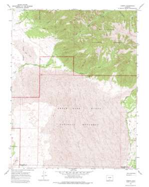
Liberty Topo Map Colorado
To zoom in, hover over the map of Liberty
USGS Topo Quad 37105g5 - 1:24,000 scale
| Topo Map Name: | Liberty |
| USGS Topo Quad ID: | 37105g5 |
| Print Size: | ca. 21 1/4" wide x 27" high |
| Southeast Coordinates: | 37.75° N latitude / 105.5° W longitude |
| Map Center Coordinates: | 37.8125° N latitude / 105.5625° W longitude |
| U.S. State: | CO |
| Filename: | o37105g5.jpg |
| Download Map JPG Image: | Liberty topo map 1:24,000 scale |
| Map Type: | Topographic |
| Topo Series: | 7.5´ |
| Map Scale: | 1:24,000 |
| Source of Map Images: | United States Geological Survey (USGS) |
| Alternate Map Versions: |
Liberty CO 1967, updated 1971 Download PDF Buy paper map Liberty CO 1967, updated 1971 Download PDF Buy paper map Liberty CO 1967, updated 1975 Download PDF Buy paper map Liberty CO 2001, updated 2005 Download PDF Buy paper map Liberty CO 2011 Download PDF Buy paper map Liberty CO 2013 Download PDF Buy paper map Liberty CO 2016 Download PDF Buy paper map |
| FStopo: | US Forest Service topo Liberty is available: Download FStopo PDF Download FStopo TIF |
1:24,000 Topo Quads surrounding Liberty
> Back to 37105e1 at 1:100,000 scale
> Back to 37104a1 at 1:250,000 scale
> Back to U.S. Topo Maps home
Liberty topo map: Gazetteer
Liberty: Parks
Great Sand Dunes National Park elevation 2590m 8497′Liberty: Populated Places
Duncan elevation 2472m 8110′Liberty elevation 2522m 8274′
Liberty: Streams
Castle Creek elevation 2520m 8267′Cold Creek elevation 2408m 7900′
Little Medano Creek elevation 2559m 8395′
Short Creek elevation 2414m 7919′
Liberty: Valleys
Cleveland Gulch elevation 2729m 8953′Horse Canyon elevation 2524m 8280′
Sawmill Canyon elevation 2497m 8192′
Liberty digital topo map on disk
Buy this Liberty topo map showing relief, roads, GPS coordinates and other geographical features, as a high-resolution digital map file on DVD:


