Deadman Camp Sw Topo Map Colorado
To zoom in, hover over the map of Deadman Camp Sw
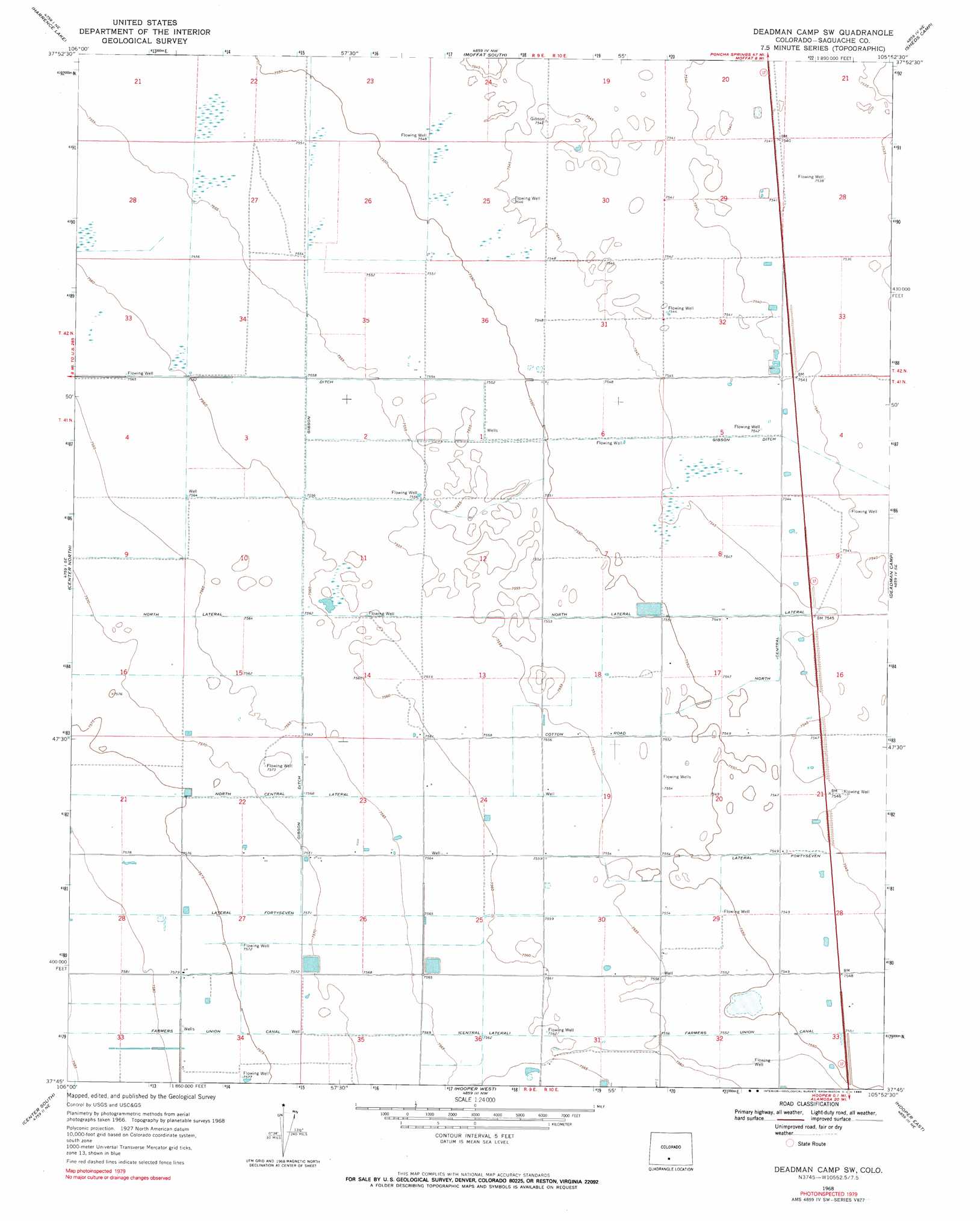
USGS Topo Quad 37105g8 - 1:24,000 scale
| Topo Map Name: | Deadman Camp Sw |
| USGS Topo Quad ID: | 37105g8 |
| Print Size: | ca. 21 1/4" wide x 27" high |
| Southeast Coordinates: | 37.75° N latitude / 105.875° W longitude |
| Map Center Coordinates: | 37.8125° N latitude / 105.9375° W longitude |
| U.S. State: | CO |
| Filename: | o37105g8.jpg |
| Download Map JPG Image: | Deadman Camp Sw topo map 1:24,000 scale |
| Map Type: | Topographic |
| Topo Series: | 7.5´ |
| Map Scale: | 1:24,000 |
| Source of Map Images: | United States Geological Survey (USGS) |
| Alternate Map Versions: |
Deadman Camp SW CO 1968, updated 1970 Download PDF Buy paper map Deadman Camp Sw CO 1968, updated 1990 Download PDF Buy paper map Deadman Camp SW CO 2010 Download PDF Buy paper map Deadman Camp SW CO 2013 Download PDF Buy paper map Deadman Camp SW CO 2016 Download PDF Buy paper map |
1:24,000 Topo Quads surrounding Deadman Camp Sw
Saguache |
Hickey Bridge |
Moffat North |
Mirage |
Rito Alto Peak |
Swede Corners |
Harrence Lake |
Moffat South |
Sheds Camp |
Crestone |
La Garita |
Center North |
Deadman Camp Sw |
Deadman Camp |
Sand Camp |
Sevenmile Plaza |
Center South |
Hooper West |
Hooper East |
Medano Ranch |
Monte Vista |
Homelake |
Mount Pleasant School |
Hooper Se |
Dry Lakes |
> Back to 37105e1 at 1:100,000 scale
> Back to 37104a1 at 1:250,000 scale
> Back to U.S. Topo Maps home
Deadman Camp Sw topo map: Gazetteer
Deadman Camp Sw: Canals
Gibson Ditch elevation 2299m 7542′Lateral Fortyseven elevation 2312m 7585′
North Central Lateral elevation 2309m 7575′
Deadman Camp Sw digital topo map on disk
Buy this Deadman Camp Sw topo map showing relief, roads, GPS coordinates and other geographical features, as a high-resolution digital map file on DVD: