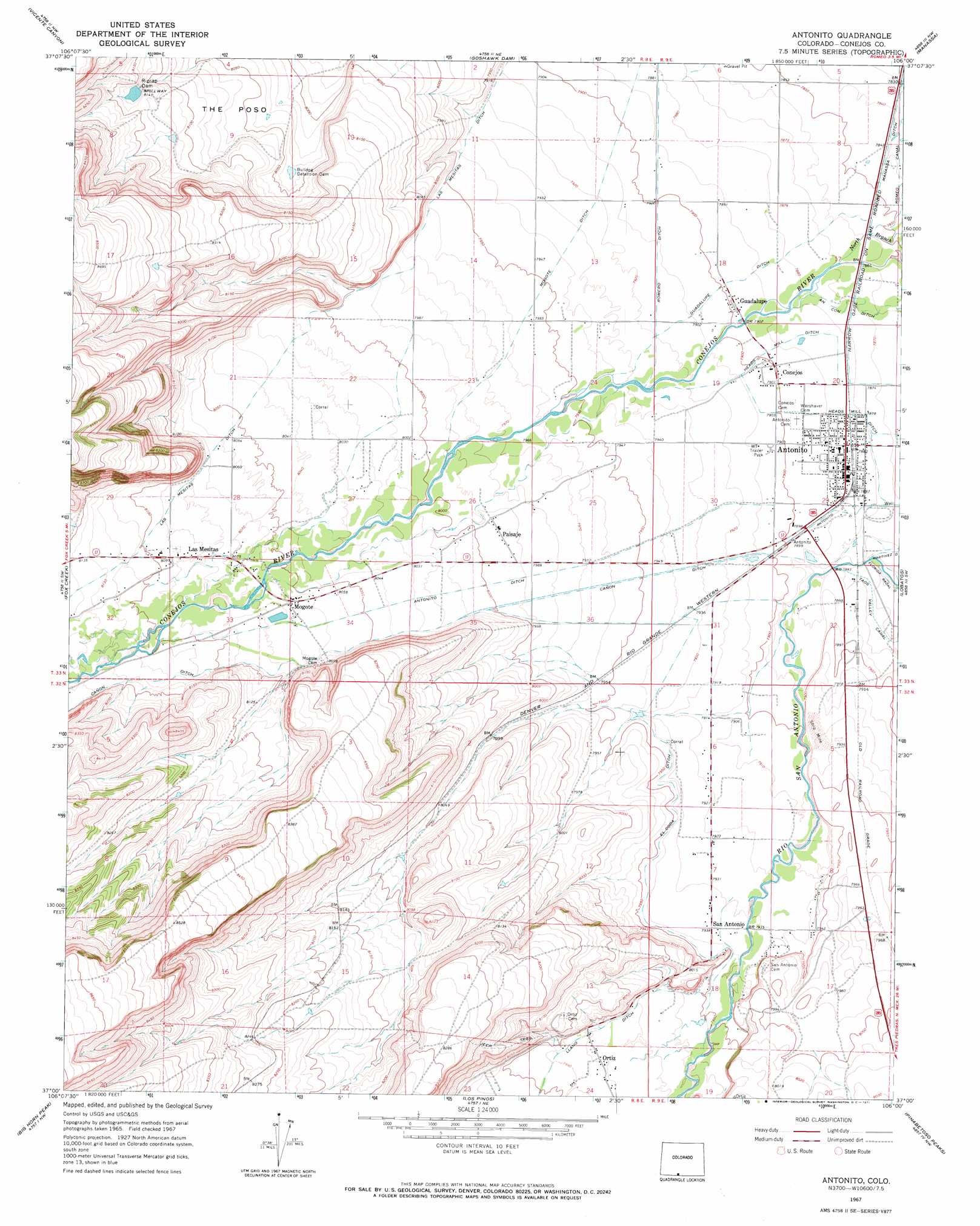
Antonito Topo Map Colorado
To zoom in, hover over the map of Antonito
USGS Topo Quad 37106a1 - 1:24,000 scale
| Topo Map Name: | Antonito |
| USGS Topo Quad ID: | 37106a1 |
| Print Size: | ca. 21 1/4" wide x 27" high |
| Southeast Coordinates: | 37° N latitude / 106° W longitude |
| Map Center Coordinates: | 37.0625° N latitude / 106.0625° W longitude |
| U.S. State: | CO |
| Filename: | o37106a1.jpg |
| Download Map JPG Image: | Antonito topo map 1:24,000 scale |
| Map Type: | Topographic |
| Topo Series: | 7.5´ |
| Map Scale: | 1:24,000 |
| Source of Map Images: | United States Geological Survey (USGS) |
| Alternate Map Versions: |
Antonito CO 1967, updated 1971 Download PDF Buy paper map Antonito CO 1967, updated 1971 Download PDF Buy paper map Antonito CO 2010 Download PDF Buy paper map Antonito CO 2013 Download PDF Buy paper map Antonito CO 2016 Download PDF Buy paper map |
1:24,000 Topo Quads surrounding Antonito
Terrace Reservoir |
Centro |
Capulin |
La Jara |
Pikes Stockade |
La Jara Canyon |
Vicente Canyon |
Goshawk Dam |
Manassa |
Manassa Ne |
Osier |
Fox Creek |
Antonito |
Lobatos |
Kiowa Hill |
Toltec Mesa |
Bighorn Peak |
Los Pinos |
Pinabetoso Peaks |
La Segita Peaks Ne |
Lagunitas Creek |
Broke Off Mountain |
San Antonio Mountain |
La Segita Peaks |
Cerro De La Olla |
> Back to 37106a1 at 1:100,000 scale
> Back to 37106a1 at 1:250,000 scale
> Back to U.S. Topo Maps home
Antonito topo map: Gazetteer
Antonito: Basins
The Poso elevation 2458m 8064′Antonito: Canals
Cañon Ditch elevation 2442m 8011′El Coda Ditch elevation 2421m 7942′
Guadalupe Ditch elevation 2406m 7893′
Las Mesitas Ditch elevation 2442m 8011′
Llano Ditch elevation 2434m 7985′
Mogote Ditch elevation 2423m 7949′
Antonito: Dams
Bulldog Detention Dam elevation 2449m 8034′Riprap Dam elevation 2477m 8126′
Antonito: Populated Places
Antonito elevation 2405m 7890′Conejos elevation 2409m 7903′
Guadalupe elevation 2409m 7903′
Las Mesitas elevation 2469m 8100′
Mogote elevation 2461m 8074′
Ortiz elevation 2434m 7985′
Paisaje elevation 2438m 7998′
San Antonio elevation 2420m 7939′
Antonito digital topo map on disk
Buy this Antonito topo map showing relief, roads, GPS coordinates and other geographical features, as a high-resolution digital map file on DVD: