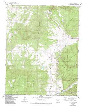
Edith Topo Map Colorado
To zoom in, hover over the map of Edith
USGS Topo Quad 37106a8 - 1:24,000 scale
| Topo Map Name: | Edith |
| USGS Topo Quad ID: | 37106a8 |
| Print Size: | ca. 21 1/4" wide x 27" high |
| Southeast Coordinates: | 37° N latitude / 106.875° W longitude |
| Map Center Coordinates: | 37.0625° N latitude / 106.9375° W longitude |
| U.S. States: | CO, NM |
| Filename: | o37106a8.jpg |
| Download Map JPG Image: | Edith topo map 1:24,000 scale |
| Map Type: | Topographic |
| Topo Series: | 7.5´ |
| Map Scale: | 1:24,000 |
| Source of Map Images: | United States Geological Survey (USGS) |
| Alternate Map Versions: |
Edith CO 1984, updated 1984 Download PDF Buy paper map Edith CO 2011 Download PDF Buy paper map Edith CO 2013 Download PDF Buy paper map Edith CO 2016 Download PDF Buy paper map |
| FStopo: | US Forest Service topo Edith is available: Download FStopo PDF Download FStopo TIF |
1:24,000 Topo Quads surrounding Edith
> Back to 37106a1 at 1:100,000 scale
> Back to 37106a1 at 1:250,000 scale
> Back to U.S. Topo Maps home
Edith topo map: Gazetteer
Edith: Flats
Coyote Park elevation 2270m 7447′Kenney Flats elevation 2339m 7673′
Edith: Populated Places
Edith elevation 2158m 7080′Edith: Springs
Felix Spring elevation 2544m 8346′Paul Spring elevation 2536m 8320′
Pescar Springs elevation 2378m 7801′
Edith: Streams
Boone Creek elevation 2269m 7444′Edith: Summits
Archuleta Mesa elevation 2809m 9215′Klutter Mountain elevation 2594m 8510′
Edith: Valleys
Abeyta Canyon elevation 2159m 7083′El Cañon de Pescar elevation 2222m 7290′
Edith digital topo map on disk
Buy this Edith topo map showing relief, roads, GPS coordinates and other geographical features, as a high-resolution digital map file on DVD:


