Vicente Canyon Topo Map Colorado
To zoom in, hover over the map of Vicente Canyon
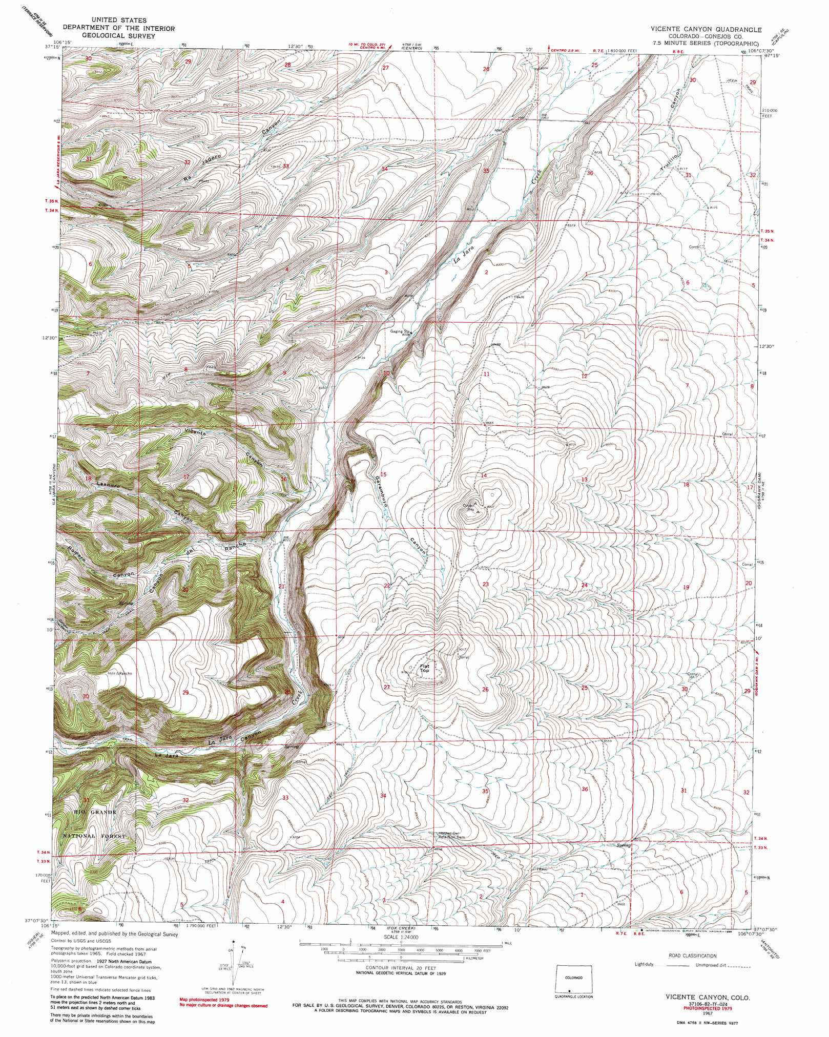
USGS Topo Quad 37106b2 - 1:24,000 scale
| Topo Map Name: | Vicente Canyon |
| USGS Topo Quad ID: | 37106b2 |
| Print Size: | ca. 21 1/4" wide x 27" high |
| Southeast Coordinates: | 37.125° N latitude / 106.125° W longitude |
| Map Center Coordinates: | 37.1875° N latitude / 106.1875° W longitude |
| U.S. State: | CO |
| Filename: | o37106b2.jpg |
| Download Map JPG Image: | Vicente Canyon topo map 1:24,000 scale |
| Map Type: | Topographic |
| Topo Series: | 7.5´ |
| Map Scale: | 1:24,000 |
| Source of Map Images: | United States Geological Survey (USGS) |
| Alternate Map Versions: |
Vicente Canyon CO 1967, updated 1971 Download PDF Buy paper map Vicente Canyon CO 1967, updated 1971 Download PDF Buy paper map Vicente Canyon CO 1967, updated 1986 Download PDF Buy paper map Vicente Canyon CO 2011 Download PDF Buy paper map Vicente Canyon CO 2013 Download PDF Buy paper map Vicente Canyon CO 2016 Download PDF Buy paper map |
| FStopo: | US Forest Service topo Vicente Canyon is available: Download FStopo PDF Download FStopo TIF |
1:24,000 Topo Quads surrounding Vicente Canyon
Jasper |
Greenie Mountain |
Fulcher Gulch |
Waverly |
Alamosa West |
Red Mountain |
Terrace Reservoir |
Centro |
Capulin |
La Jara |
Spectacle Lake |
La Jara Canyon |
Vicente Canyon |
Goshawk Dam |
Manassa |
Cumbres |
Osier |
Fox Creek |
Antonito |
Lobatos |
West Fork Rio Brazos |
Toltec Mesa |
Bighorn Peak |
Los Pinos |
Pinabetoso Peaks |
> Back to 37106a1 at 1:100,000 scale
> Back to 37106a1 at 1:250,000 scale
> Back to U.S. Topo Maps home
Vicente Canyon topo map: Gazetteer
Vicente Canyon: Dams
Horned Owl Retention Dam elevation 2690m 8825′Vicente Canyon: Summits
Flat Top elevation 2791m 9156′Vicente Canyon: Valleys
Canyon del Rancho elevation 2514m 8248′Garambuyo Gulch elevation 2485m 8152′
La Jara Canyon elevation 2424m 7952′
Leandro Canyon elevation 2554m 8379′
Romero Canyon elevation 2591m 8500′
Vicente Canyon elevation 2513m 8244′
Vicente Canyon digital topo map on disk
Buy this Vicente Canyon topo map showing relief, roads, GPS coordinates and other geographical features, as a high-resolution digital map file on DVD: