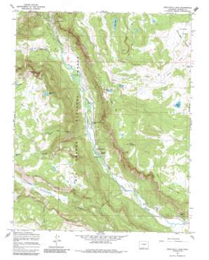
Spectacle Lake Topo Map Colorado
To zoom in, hover over the map of Spectacle Lake
USGS Topo Quad 37106b4 - 1:24,000 scale
| Topo Map Name: | Spectacle Lake |
| USGS Topo Quad ID: | 37106b4 |
| Print Size: | ca. 21 1/4" wide x 27" high |
| Southeast Coordinates: | 37.125° N latitude / 106.375° W longitude |
| Map Center Coordinates: | 37.1875° N latitude / 106.4375° W longitude |
| U.S. State: | CO |
| Filename: | o37106b4.jpg |
| Download Map JPG Image: | Spectacle Lake topo map 1:24,000 scale |
| Map Type: | Topographic |
| Topo Series: | 7.5´ |
| Map Scale: | 1:24,000 |
| Source of Map Images: | United States Geological Survey (USGS) |
| Alternate Map Versions: |
Spectacle Lake CO 1967, updated 1969 Download PDF Buy paper map Spectacle Lake CO 1967, updated 1969 Download PDF Buy paper map Spectacle Lake CO 1967, updated 1981 Download PDF Buy paper map Spectacle Lake CO 1967, updated 1986 Download PDF Buy paper map Spectacle Lake CO 1967, updated 1986 Download PDF Buy paper map Spectacle Lake CO 2001, updated 2005 Download PDF Buy paper map Spectacle Lake CO 2011 Download PDF Buy paper map Spectacle Lake CO 2013 Download PDF Buy paper map Spectacle Lake CO 2016 Download PDF Buy paper map |
| FStopo: | US Forest Service topo Spectacle Lake is available: Download FStopo PDF Download FStopo TIF |
1:24,000 Topo Quads surrounding Spectacle Lake
> Back to 37106a1 at 1:100,000 scale
> Back to 37106a1 at 1:250,000 scale
> Back to U.S. Topo Maps home
Spectacle Lake topo map: Gazetteer
Spectacle Lake: Flats
Chicago Bogs elevation 2987m 9799′Second Meadows elevation 3035m 9957′
Spectacle Lake: Lakes
Beaver Lake elevation 2994m 9822′Lily Lake elevation 3049m 10003′
Los Flores Lake elevation 3092m 10144′
Lost Lake elevation 3226m 10583′
Ruybalid Lake elevation 3408m 11181′
Spectacle Lake elevation 2677m 8782′
Spectacle Lake: Pillars
The Pinnacles elevation 2840m 9317′Spectacle Lake: Streams
North Fork Rough Creek elevation 2860m 9383′Rito Colorado elevation 3032m 9947′
Rough Creek elevation 2678m 8786′
South Fork Conejos River elevation 2725m 8940′
Spectacle Lake: Summits
Black Mountain elevation 3417m 11210′Spectacle Lake: Trails
Conejos Stock Driveway elevation 3351m 10994′Notch Trail elevation 2921m 9583′
Ruybalid Trail elevation 3351m 10994′
Spectacle Lake: Valleys
Roaring Gulch elevation 2774m 9101′Spectacle Lake digital topo map on disk
Buy this Spectacle Lake topo map showing relief, roads, GPS coordinates and other geographical features, as a high-resolution digital map file on DVD:


