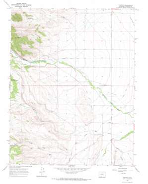
Centro Topo Map Colorado
To zoom in, hover over the map of Centro
USGS Topo Quad 37106c2 - 1:24,000 scale
| Topo Map Name: | Centro |
| USGS Topo Quad ID: | 37106c2 |
| Print Size: | ca. 21 1/4" wide x 27" high |
| Southeast Coordinates: | 37.25° N latitude / 106.125° W longitude |
| Map Center Coordinates: | 37.3125° N latitude / 106.1875° W longitude |
| U.S. State: | CO |
| Filename: | o37106c2.jpg |
| Download Map JPG Image: | Centro topo map 1:24,000 scale |
| Map Type: | Topographic |
| Topo Series: | 7.5´ |
| Map Scale: | 1:24,000 |
| Source of Map Images: | United States Geological Survey (USGS) |
| Alternate Map Versions: |
Centro CO 1967, updated 1970 Download PDF Buy paper map Centro CO 2010 Download PDF Buy paper map Centro CO 2013 Download PDF Buy paper map Centro CO 2016 Download PDF Buy paper map |
| FStopo: | US Forest Service topo Centro is available: Download FStopo PDF Download FStopo TIF |
1:24,000 Topo Quads surrounding Centro
> Back to 37106a1 at 1:100,000 scale
> Back to 37106a1 at 1:250,000 scale
> Back to U.S. Topo Maps home
Centro topo map: Gazetteer
Centro: Canals
Alamosa Creek Canal elevation 2557m 8389′Terrace Main Canal elevation 2459m 8067′
Valdez Ditch Number 5 elevation 2454m 8051′
Centro: Populated Places
Centro elevation 2406m 7893′Centro: Reservoirs
Chipmunk Reservoir elevation 2472m 8110′Dodo Reservoir elevation 2489m 8166′
Pine Squirrel Reservoir elevation 2538m 8326′
Whippoorwill Reservoir elevation 2543m 8343′
Wren Reservoir elevation 2491m 8172′
Centro: Streams
Hot Creek elevation 2394m 7854′Ojito Creek elevation 2482m 8143′
Poso Creek elevation 2408m 7900′
Centro: Summits
Chiquito Peak elevation 2932m 9619′Centro: Valleys
Ra Jadero Canyon elevation 2447m 8028′Trujillo Canyon elevation 2407m 7896′
Centro digital topo map on disk
Buy this Centro topo map showing relief, roads, GPS coordinates and other geographical features, as a high-resolution digital map file on DVD:


