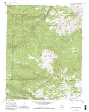
Greenie Mountain Topo Map Colorado
To zoom in, hover over the map of Greenie Mountain
USGS Topo Quad 37106d3 - 1:24,000 scale
| Topo Map Name: | Greenie Mountain |
| USGS Topo Quad ID: | 37106d3 |
| Print Size: | ca. 21 1/4" wide x 27" high |
| Southeast Coordinates: | 37.375° N latitude / 106.25° W longitude |
| Map Center Coordinates: | 37.4375° N latitude / 106.3125° W longitude |
| U.S. State: | CO |
| Filename: | o37106d3.jpg |
| Download Map JPG Image: | Greenie Mountain topo map 1:24,000 scale |
| Map Type: | Topographic |
| Topo Series: | 7.5´ |
| Map Scale: | 1:24,000 |
| Source of Map Images: | United States Geological Survey (USGS) |
| Alternate Map Versions: |
Greenie Mountain CO 1967, updated 1970 Download PDF Buy paper map Greenie Mountain CO 1967, updated 1970 Download PDF Buy paper map Greenie Mountain CO 1967, updated 1986 Download PDF Buy paper map Greenie Mountain CO 1967, updated 1986 Download PDF Buy paper map Greenie Mountain CO 2001, updated 2005 Download PDF Buy paper map Greenie Mountain CO 2011 Download PDF Buy paper map Greenie Mountain CO 2013 Download PDF Buy paper map Greenie Mountain CO 2016 Download PDF Buy paper map |
| FStopo: | US Forest Service topo Greenie Mountain is available: Download FStopo PDF Download FStopo TIF |
1:24,000 Topo Quads surrounding Greenie Mountain
> Back to 37106a1 at 1:100,000 scale
> Back to 37106a1 at 1:250,000 scale
> Back to U.S. Topo Maps home
Greenie Mountain topo map: Gazetteer
Greenie Mountain: Flats
Cat Creek Park elevation 2928m 9606′Horse Park elevation 3322m 10898′
Rock Creek Park elevation 2661m 8730′
Greenie Mountain: Ridges
Green Ridge elevation 3349m 10987′Greenie Mountain: Springs
Shillings Spring elevation 2684m 8805′Greenie Mountain: Streams
Deer Creek elevation 2588m 8490′North Fork Cat Creek elevation 2725m 8940′
North Fork Rock Creek elevation 2664m 8740′
South Fork Cat Creek elevation 2725m 8940′
South Fork Rock Creek elevation 2666m 8746′
Willow Creek elevation 2658m 8720′
Greenie Mountain: Summits
Bishop Rock elevation 2660m 8727′Greenie Mountain elevation 3389m 11118′
Lion Point elevation 3366m 11043′
Greenie Mountain: Trails
North Fork Dry Creek Trail elevation 2976m 9763′Greenie Mountain: Valleys
Burnt Gulch elevation 2515m 8251′Comstock Gulch elevation 2951m 9681′
Deer Gulch elevation 2840m 9317′
Negro Gulch elevation 2793m 9163′
Poison Gulch elevation 2598m 8523′
Pole Gulch elevation 2560m 8398′
Scherer Gulch elevation 2986m 9796′
Soldier Gulch elevation 2822m 9258′
Greenie Mountain digital topo map on disk
Buy this Greenie Mountain topo map showing relief, roads, GPS coordinates and other geographical features, as a high-resolution digital map file on DVD:


