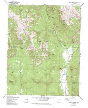
Saddle Mountain Topo Map Colorado
To zoom in, hover over the map of Saddle Mountain
USGS Topo Quad 37106d8 - 1:24,000 scale
| Topo Map Name: | Saddle Mountain |
| USGS Topo Quad ID: | 37106d8 |
| Print Size: | ca. 21 1/4" wide x 27" high |
| Southeast Coordinates: | 37.375° N latitude / 106.875° W longitude |
| Map Center Coordinates: | 37.4375° N latitude / 106.9375° W longitude |
| U.S. State: | CO |
| Filename: | o37106d8.jpg |
| Download Map JPG Image: | Saddle Mountain topo map 1:24,000 scale |
| Map Type: | Topographic |
| Topo Series: | 7.5´ |
| Map Scale: | 1:24,000 |
| Source of Map Images: | United States Geological Survey (USGS) |
| Alternate Map Versions: |
Saddle Mountain CO 2011 Download PDF Buy paper map Saddle Mountain CO 2013 Download PDF Buy paper map Saddle Mountain CO 2016 Download PDF Buy paper map |
| FStopo: | US Forest Service topo Saddle Mountain is available: Download FStopo PDF Download FStopo TIF |
1:24,000 Topo Quads surrounding Saddle Mountain
> Back to 37106a1 at 1:100,000 scale
> Back to 37106a1 at 1:250,000 scale
> Back to U.S. Topo Maps home
Saddle Mountain topo map: Gazetteer
Saddle Mountain: Basins
Mullins Hole elevation 2763m 9064′Saddle Mountain: Canals
Chapson Ditch elevation 2352m 7716′Snowball Ditch elevation 2507m 8225′
Saddle Mountain: Flats
Allen Park elevation 2566m 8418′Poison Park elevation 2646m 8681′
Sheep Park elevation 2897m 9504′
Saddle Mountain: Lakes
Borns Lake elevation 2551m 8369′Hatcher Lakes elevation 2492m 8175′
Rock Lakes elevation 3328m 10918′
Rod and Gun Club Lake elevation 2618m 8589′
Saddle Mountain: Mines
Blacks Mine elevation 2992m 9816′Saddle Mountain: Reservoirs
T Lazy T Reservoir elevation 2347m 7700′Saddle Mountain: Springs
Newton Spring elevation 2374m 7788′Saddle Mountain: Streams
Allen Creek elevation 2338m 7670′Beaver Creek elevation 2634m 8641′
Burro Creek elevation 2554m 8379′
Eagle Creek elevation 2800m 9186′
Fall Creek elevation 2391m 7844′
Himes Creek elevation 2361m 7746′
Omaha Creek elevation 2733m 8966′
Wolf Creek elevation 2373m 7785′
Saddle Mountain: Summits
Indian Head elevation 2809m 9215′Saddle Mountain elevation 3647m 11965′
Sheep Mountain elevation 3772m 12375′
Sliderock Mountain elevation 2705m 8874′
Saddle Mountain: Trails
Rainbow Trail elevation 2651m 8697′Saddle Mountain digital topo map on disk
Buy this Saddle Mountain topo map showing relief, roads, GPS coordinates and other geographical features, as a high-resolution digital map file on DVD:


