Homelake Topo Map Colorado
To zoom in, hover over the map of Homelake
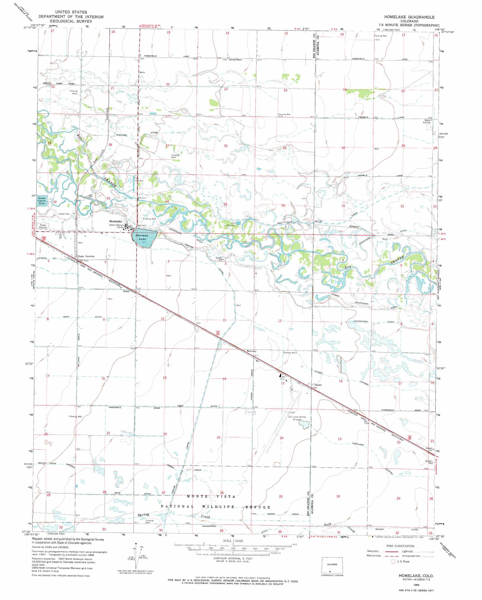
USGS Topo Quad 37106e1 - 1:24,000 scale
| Topo Map Name: | Homelake |
| USGS Topo Quad ID: | 37106e1 |
| Print Size: | ca. 21 1/4" wide x 27" high |
| Southeast Coordinates: | 37.5° N latitude / 106° W longitude |
| Map Center Coordinates: | 37.5625° N latitude / 106.0625° W longitude |
| U.S. State: | CO |
| Filename: | o37106e1.jpg |
| Download Map JPG Image: | Homelake topo map 1:24,000 scale |
| Map Type: | Topographic |
| Topo Series: | 7.5´ |
| Map Scale: | 1:24,000 |
| Source of Map Images: | United States Geological Survey (USGS) |
| Alternate Map Versions: |
Homelake CO 1966, updated 1968 Download PDF Buy paper map Homelake CO 2010 Download PDF Buy paper map Homelake CO 2013 Download PDF Buy paper map Homelake CO 2016 Download PDF Buy paper map |
1:24,000 Topo Quads surrounding Homelake
Twin Mountains Se |
La Garita |
Center North |
Deadman Camp Sw |
Deadman Camp |
Del Norte |
Sevenmile Plaza |
Center South |
Hooper West |
Hooper East |
Dog Mountain |
Monte Vista |
Homelake |
Mount Pleasant School |
Hooper Se |
Greenie Mountain |
Fulcher Gulch |
Waverly |
Alamosa West |
Alamosa East |
Terrace Reservoir |
Centro |
Capulin |
La Jara |
Pikes Stockade |
> Back to 37106e1 at 1:100,000 scale
> Back to 37106a1 at 1:250,000 scale
> Back to U.S. Topo Maps home
Homelake topo map: Gazetteer
Homelake: Airports
Monte Vista Municipal Airport elevation 2319m 7608′Homelake: Canals
Billings Ditch elevation 2325m 7627′Getz Ditch elevation 2322m 7618′
Leyden Lateral elevation 2317m 7601′
Lower Centennial Ditch elevation 2313m 7588′
McLean Drain elevation 2329m 7641′
Parma Drain elevation 2320m 7611′
San Luis Valley Canal elevation 2316m 7598′
Sanderson Ditch elevation 2317m 7601′
Homelake: Populated Places
Homelake elevation 2327m 7634′Parma elevation 2319m 7608′
Sugar Junction elevation 2330m 7644′
Zinzer elevation 2327m 7634′
Homelake: Reservoirs
Sherman Lake elevation 2325m 7627′Homelake: Streams
Spring Creek elevation 2315m 7595′Homelake digital topo map on disk
Buy this Homelake topo map showing relief, roads, GPS coordinates and other geographical features, as a high-resolution digital map file on DVD: