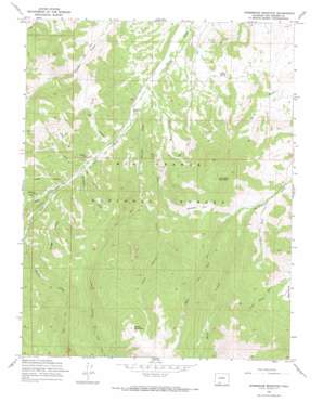
Horseshoe Mountain Topo Map Colorado
To zoom in, hover over the map of Horseshoe Mountain
USGS Topo Quad 37106e4 - 1:24,000 scale
| Topo Map Name: | Horseshoe Mountain |
| USGS Topo Quad ID: | 37106e4 |
| Print Size: | ca. 21 1/4" wide x 27" high |
| Southeast Coordinates: | 37.5° N latitude / 106.375° W longitude |
| Map Center Coordinates: | 37.5625° N latitude / 106.4375° W longitude |
| U.S. State: | CO |
| Filename: | o37106e4.jpg |
| Download Map JPG Image: | Horseshoe Mountain topo map 1:24,000 scale |
| Map Type: | Topographic |
| Topo Series: | 7.5´ |
| Map Scale: | 1:24,000 |
| Source of Map Images: | United States Geological Survey (USGS) |
| Alternate Map Versions: |
Horseshoe Mountain CO 1967, updated 1969 Download PDF Buy paper map Horseshoe Mountain CO 1967, updated 1969 Download PDF Buy paper map Horseshoe Mountain CO 2001, updated 2005 Download PDF Buy paper map Horseshoe Mountain CO 2011 Download PDF Buy paper map Horseshoe Mountain CO 2013 Download PDF Buy paper map Horseshoe Mountain CO 2016 Download PDF Buy paper map |
| FStopo: | US Forest Service topo Horseshoe Mountain is available: Download FStopo PDF Download FStopo TIF |
1:24,000 Topo Quads surrounding Horseshoe Mountain
> Back to 37106e1 at 1:100,000 scale
> Back to 37106a1 at 1:250,000 scale
> Back to U.S. Topo Maps home
Horseshoe Mountain topo map: Gazetteer
Horseshoe Mountain: Flats
Dry Lake Flats elevation 2897m 9504′Horseshoe Park elevation 3169m 10396′
Horseshoe Mountain: Springs
Cedar Spring elevation 2609m 8559′Horseshoe Mountain: Streams
Bennett Creek elevation 2586m 8484′Castle Rock Creek elevation 2701m 8861′
Cherry Creek elevation 2567m 8421′
East Fork Pinos Creek elevation 2676m 8779′
East Fork San Francisco Creek elevation 2825m 9268′
Little Bennett Creek elevation 2758m 9048′
Middle Fork San Francisco Creek elevation 2876m 9435′
Milk Creek elevation 2639m 8658′
West Fork Pinos Creek elevation 2676m 8779′
West Fork San Francisco Creek elevation 2876m 9435′
Horseshoe Mountain: Summits
Horseshoe Mountain elevation 3333m 10935′Poison Mountain elevation 3650m 11975′
Horseshoe Mountain: Valleys
Barriclause Canyon elevation 2678m 8786′Horse Canyon elevation 2679m 8789′
Log Canyon elevation 2659m 8723′
Lower Log Canyon elevation 2653m 8704′
Munger Canyon elevation 2704m 8871′
Pole Canyon elevation 2662m 8733′
Sunday Gulch elevation 2724m 8937′
Warr Canyon elevation 2623m 8605′
Horseshoe Mountain digital topo map on disk
Buy this Horseshoe Mountain topo map showing relief, roads, GPS coordinates and other geographical features, as a high-resolution digital map file on DVD:


