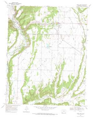
Loma Linda Topo Map Colorado
To zoom in, hover over the map of Loma Linda
USGS Topo Quad 37107b7 - 1:24,000 scale
| Topo Map Name: | Loma Linda |
| USGS Topo Quad ID: | 37107b7 |
| Print Size: | ca. 21 1/4" wide x 27" high |
| Southeast Coordinates: | 37.125° N latitude / 107.75° W longitude |
| Map Center Coordinates: | 37.1875° N latitude / 107.8125° W longitude |
| U.S. State: | CO |
| Filename: | o37107b7.jpg |
| Download Map JPG Image: | Loma Linda topo map 1:24,000 scale |
| Map Type: | Topographic |
| Topo Series: | 7.5´ |
| Map Scale: | 1:24,000 |
| Source of Map Images: | United States Geological Survey (USGS) |
| Alternate Map Versions: |
Loma Linda CO 1968, updated 1972 Download PDF Buy paper map Loma Linda CO 2010 Download PDF Buy paper map Loma Linda CO 2013 Download PDF Buy paper map Loma Linda CO 2016 Download PDF Buy paper map |
1:24,000 Topo Quads surrounding Loma Linda
> Back to 37107a1 at 1:100,000 scale
> Back to 37106a1 at 1:250,000 scale
> Back to U.S. Topo Maps home
Loma Linda topo map: Gazetteer
Loma Linda: Airports
Animas Air Park elevation 2028m 6653′Animas Air Park Heliport elevation 2025m 6643′
Durango-La Plata County Airport elevation 2028m 6653′
Loma Linda: Canals
Cedar Lateral elevation 2086m 6843′Coop Ditch elevation 2106m 6909′
Cottonwood Lateral elevation 2080m 6824′
East Mesa Ditch elevation 1919m 6295′
Florida Farmers Ditch elevation 2147m 7043′
McClure Murray Ditch elevation 2072m 6797′
Pine Lateral elevation 2092m 6863′
Loma Linda: Dams
Charles Lemon RR Dam elevation 2049m 6722′Pastorius Dam elevation 2092m 6863′
Short Dam elevation 1982m 6502′
Loma Linda: Mines
Gold Prince Mine elevation 1988m 6522′Loma Linda: Populated Places
Carbon Junction elevation 1954m 6410′Falfa elevation 2105m 6906′
Florida elevation 2051m 6729′
Grandview elevation 2068m 6784′
Griffth (historical) elevation 2104m 6902′
Loma Linda elevation 2117m 6945′
Piñon Acres elevation 2071m 6794′
Loma Linda: Reservoirs
Charles Lemon RR Reservoir elevation 2049m 6722′Pastorius Reservoir elevation 2092m 6863′
Short Reservoir elevation 1982m 6502′
Loma Linda: Streams
Dry Creek elevation 1913m 6276′Salt Creek elevation 1939m 6361′
Loma Linda: Summits
Sunnyside Mesa elevation 1911m 6269′Loma Linda: Valleys
Big Canyon elevation 1951m 6400′Carbon Junction Canyon elevation 1955m 6414′
Cottonwood Gulch elevation 1927m 6322′
Hereford Canyon elevation 1898m 6227′
Phillips Canyon elevation 1908m 6259′
Pine Gulch elevation 1939m 6361′
R E A Canyon elevation 1949m 6394′
Sale Barn Canyon elevation 1954m 6410′
Sutton Draw elevation 1957m 6420′
Teti Canyon elevation 1900m 6233′
West Fork Cottonwood Gulch elevation 2018m 6620′
Wilson Gulch elevation 1934m 6345′
Loma Linda digital topo map on disk
Buy this Loma Linda topo map showing relief, roads, GPS coordinates and other geographical features, as a high-resolution digital map file on DVD:


