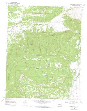
Basin Mountain Topo Map Colorado
To zoom in, hover over the map of Basin Mountain
USGS Topo Quad 37107b8 - 1:24,000 scale
| Topo Map Name: | Basin Mountain |
| USGS Topo Quad ID: | 37107b8 |
| Print Size: | ca. 21 1/4" wide x 27" high |
| Southeast Coordinates: | 37.125° N latitude / 107.875° W longitude |
| Map Center Coordinates: | 37.1875° N latitude / 107.9375° W longitude |
| U.S. State: | CO |
| Filename: | o37107b8.jpg |
| Download Map JPG Image: | Basin Mountain topo map 1:24,000 scale |
| Map Type: | Topographic |
| Topo Series: | 7.5´ |
| Map Scale: | 1:24,000 |
| Source of Map Images: | United States Geological Survey (USGS) |
| Alternate Map Versions: |
Basin Mountain CO 1968, updated 1972 Download PDF Buy paper map Basin Mountain CO 2010 Download PDF Buy paper map Basin Mountain CO 2013 Download PDF Buy paper map Basin Mountain CO 2016 Download PDF Buy paper map |
1:24,000 Topo Quads surrounding Basin Mountain
> Back to 37107a1 at 1:100,000 scale
> Back to 37106a1 at 1:250,000 scale
> Back to U.S. Topo Maps home
Basin Mountain topo map: Gazetteer
Basin Mountain: Airports
Mountain Bell-Durango Heliport elevation 1999m 6558′Basin Mountain: Basins
Ridges Basin elevation 2077m 6814′Basin Mountain: Bridges
Weaselskin Bridge elevation 1884m 6181′Basin Mountain: Gaps
East Gap elevation 2321m 7614′West Gap elevation 2343m 7687′
Basin Mountain: Mines
Peacock Mine elevation 2195m 7201′Porter Mine elevation 2199m 7214′
Basin Mountain: Populated Places
La Posta elevation 1881m 6171′Basin Mountain: Reservoirs
Goat Canyon Reservoir elevation 1988m 6522′Herrera Reservoir elevation 1992m 6535′
McCullogh Reservoir elevation 2176m 7139′
Montoya Reservoir elevation 2085m 6840′
Sullivan Reservoir elevation 2040m 6692′
Basin Mountain: Springs
Indian Spring elevation 1951m 6400′McCullogh Spring elevation 2092m 6863′
Basin Mountain: Streams
Basin Creek elevation 1901m 6236′Indian Creek elevation 1901m 6236′
Basin Mountain: Summits
Basin Mountain elevation 2506m 8221′Bridge Timber Mountain elevation 2515m 8251′
Basin Mountain: Valleys
Black Water Canyon elevation 2089m 6853′Box Canyon elevation 2136m 7007′
Cottonwood Canyon elevation 2065m 6774′
Goat Canyon elevation 1881m 6171′
McCullogh Canyon elevation 1970m 6463′
Mud Springs Canyon elevation 2078m 6817′
Sawmill Canyon elevation 1936m 6351′
Spring Gulch elevation 1883m 6177′
Basin Mountain digital topo map on disk
Buy this Basin Mountain topo map showing relief, roads, GPS coordinates and other geographical features, as a high-resolution digital map file on DVD:


